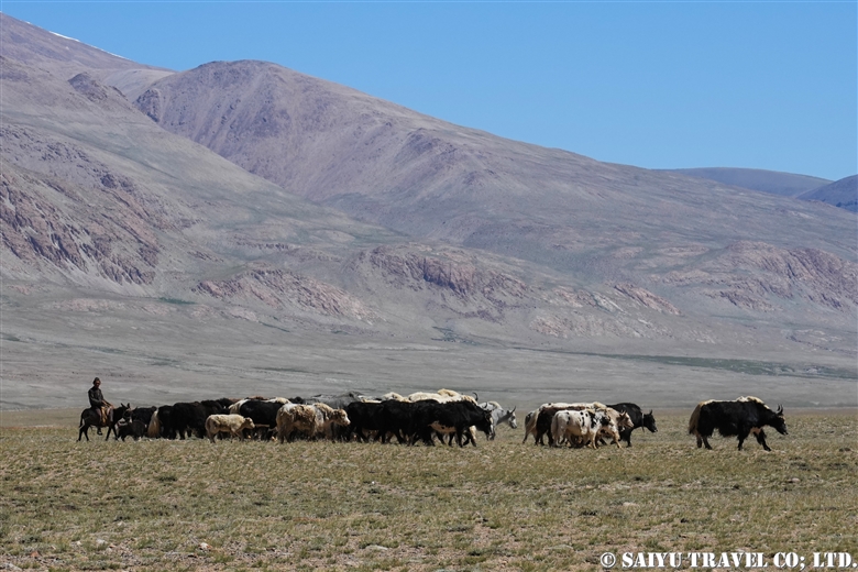

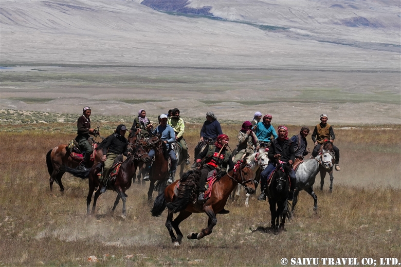
Buzkashi being held on the shores of Lake Chaqmaqtin, Wakhan corridor, in summer. It is practised among the Kyrgyz peoples of the Wakhan corridor at weddings as well as during Eid, the Islamic festival of sacrifice.
>Re-discovering Afghanistan: Wakhan Corridor, and the Kyrgyz in the Afghan Pamir
Buzkashi is the national sport of Afghanistan, in which two groups of horse riders compete for a goat. In Persian, it means exactly what it sounds like: goat = buz , pulling= kashi. I saw buz kashi on the last day of my three-days stay in a Kyrgyz camp. That was the day when the men I had seen in the camp mounted their horses and, suddenly for the first time, began to looked cool to me. To be honest, up until that point I had felt that while the women were working from the morning milking and making Qurut, the men weren’t doing much to help …
↑↑The Kyrgyz buzkashi being held amidst the spectacular scenery of the Wakhan corridor.
From 1996 to 2001, when the former Taliban (not the current Taliban regime) was in control, many entertainment activities were banned as ‘immoral’ and buzkashi was also banned. Buzkashi has since been revived and is now a major national event, with tournaments organised in each state. While in big cities buzkashi is sometimes held in stadiums in costumes with sponsors’ logos, in rural areas buzkashi is purely a traditional event for people to enjoy.

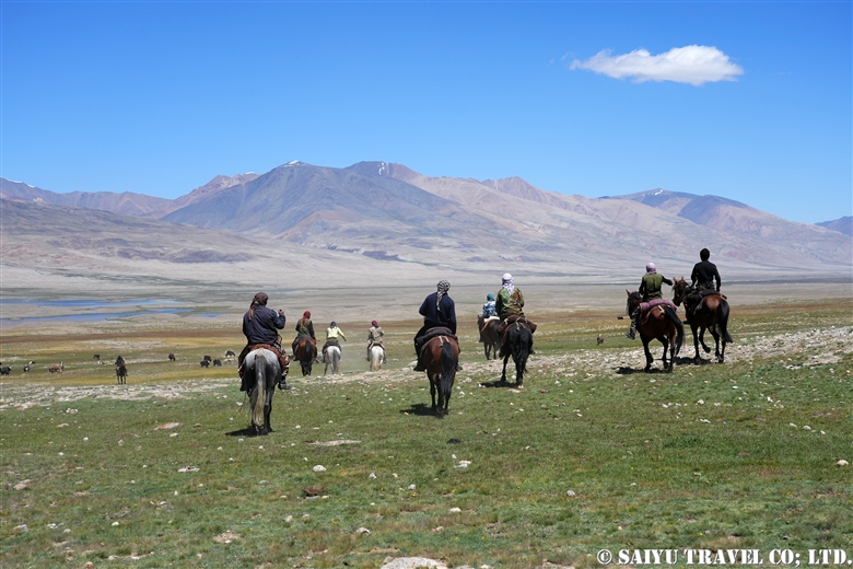
People heading to wedding .
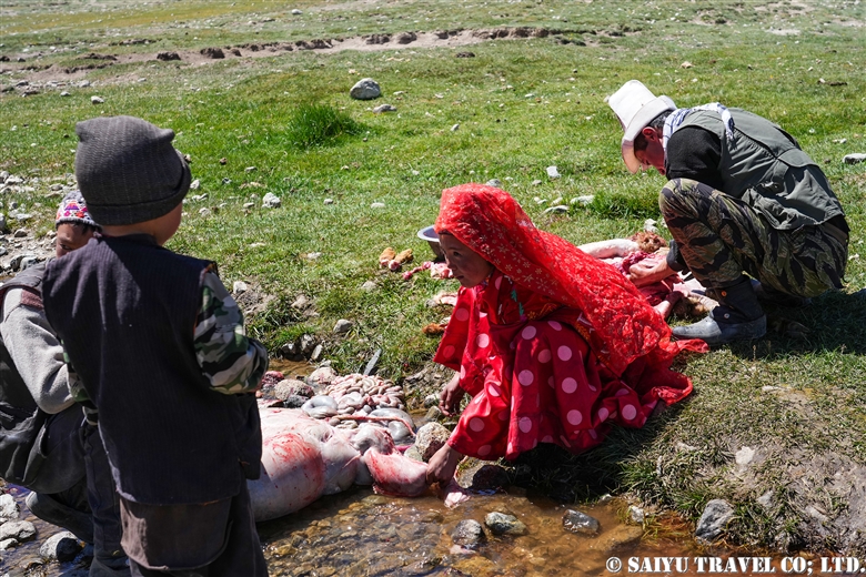
A sheep being dismembered for a wedding celebration meal.
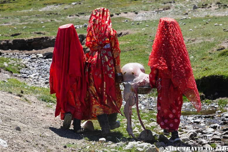
Kyrgyz girls carrying sheep meat.
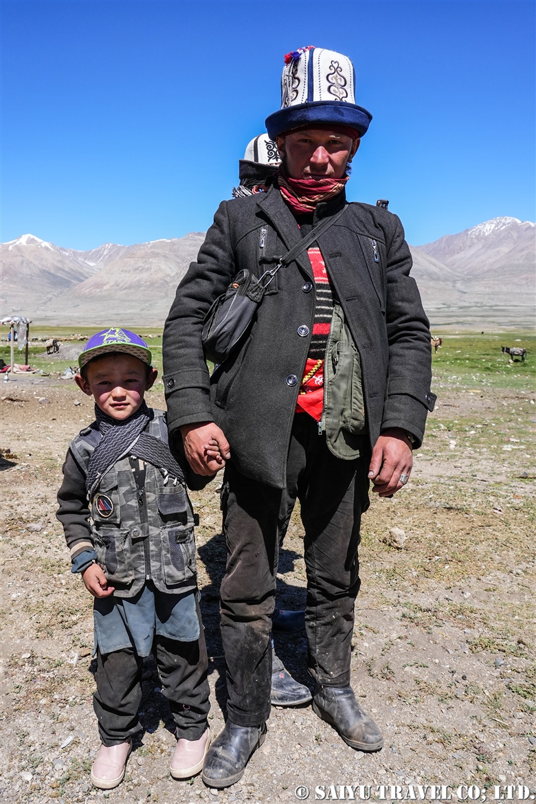
A man and his child who came to celebrate and participate in the buzkashi.
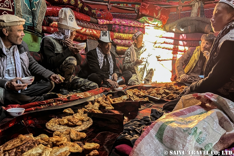
Everyone praying and offering food before the Buzkashi. Milk tea and fried bread were served.
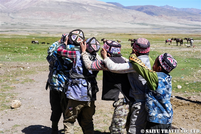
Children at play until the buzkashi starts.
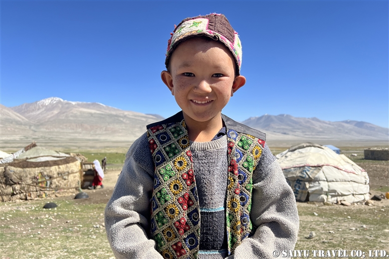
A Kyrgyz boy who wants to try buzkashi.
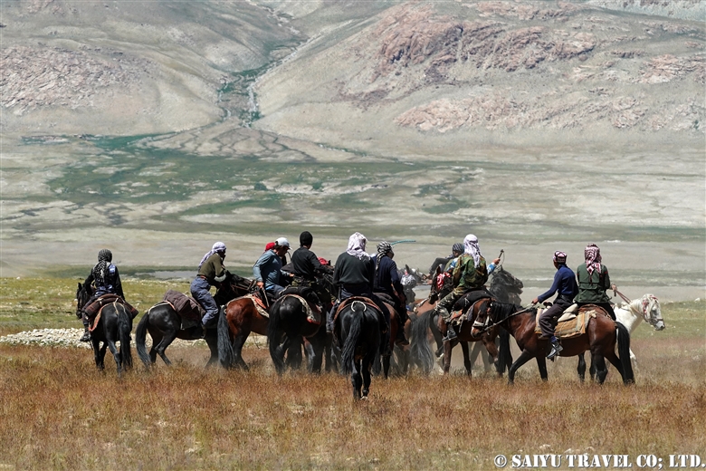
After prayers and food offerings, the buzkashi finally begins.
A goat with its head cut off. The goat used was not the one killed on the day, but a stuffed goat that was prepared in the village for buzkashi.
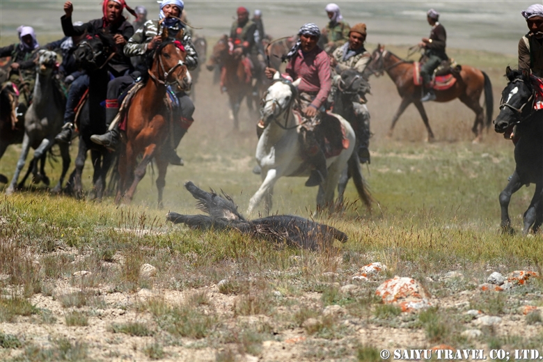
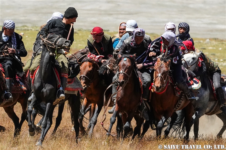
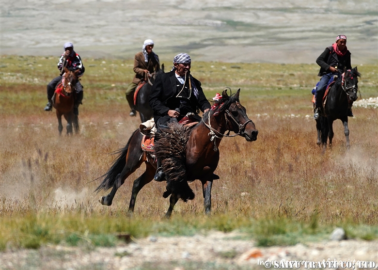
The goat is thrown down to the earth and the contest begins.
It requires strength and skill to pull this goat up from the ground with one hand and ride while holding it. During all this, the whip is held in the mouth.
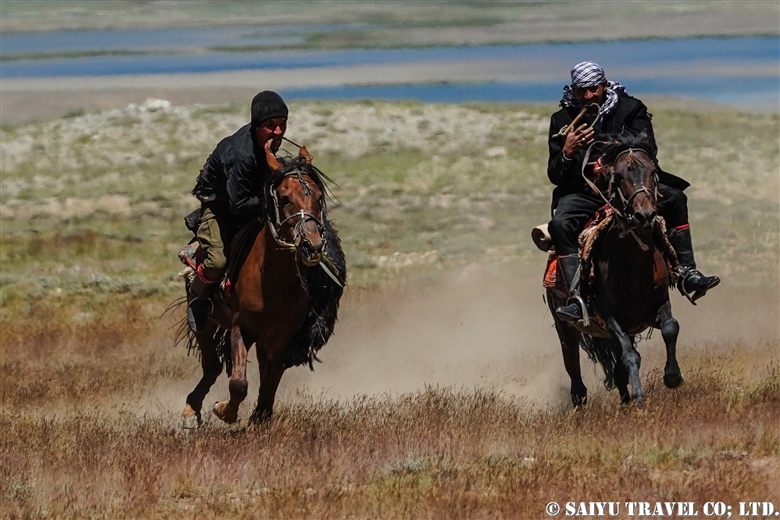
Competing for the goat.
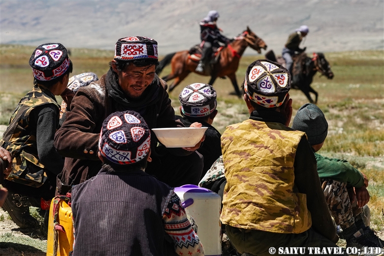
Family watching the game over a cup of tea.
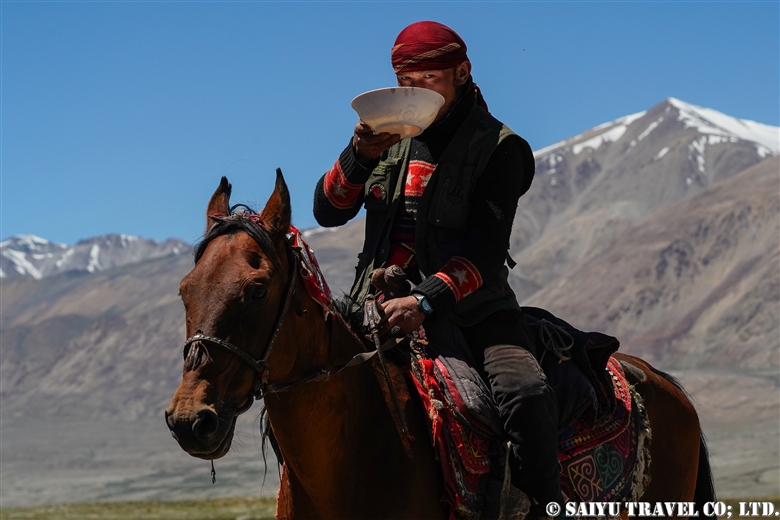
Participants also take a break, to have some milk tea.
After a break, they return to thebuzkashi.
Kyrgyz buzkashi, performed amidst the spectacular mountain scenery of the Wakhan corridor.
Image & Text : Mariko SAWADA
*Contact us, Indus Caravan for more information or to make arrangements for visiting Afghanistan, Wakhan Corridor.
*Please follow us on Youtube, Instagram & Facebook
Category : ◆Afghanistan > - Wakhan CorridorTag : Pamir , Kyrgyz , Indus Caravan , Ishkashim , Saiyu Travel , Sarhad-e-Wakhan , wakhi , Lake Chaqmaqtin , Little Pamir , Big Pamir , Afghanistan , Amu Darya , Wakhan , Afghanistan tour , Wkhan Corridor , buzkashi , Afghan Pamir