View of Nanga Parbat from Flight PK451!

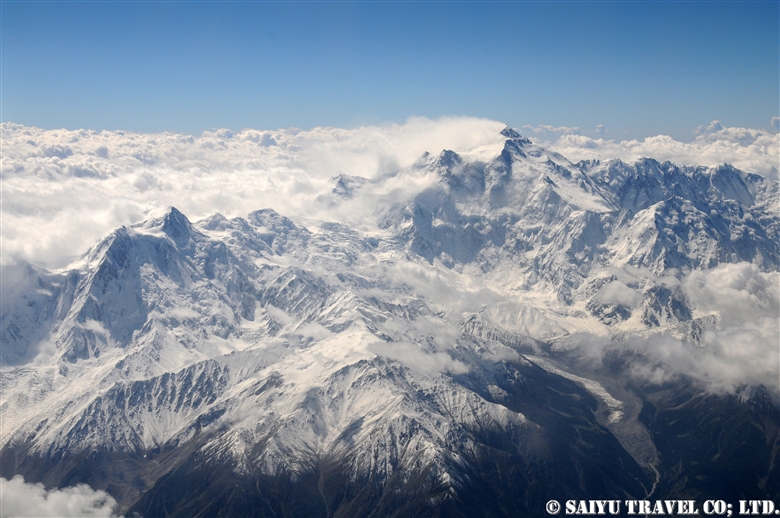
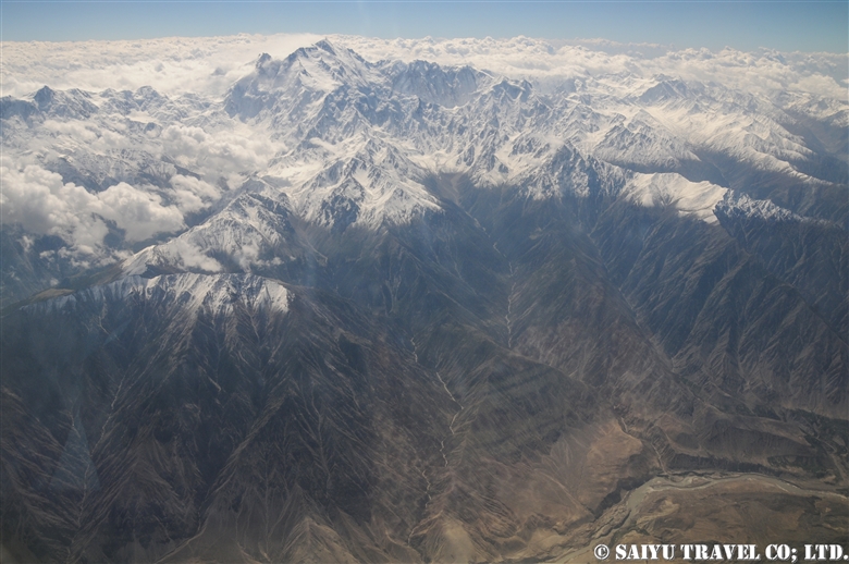
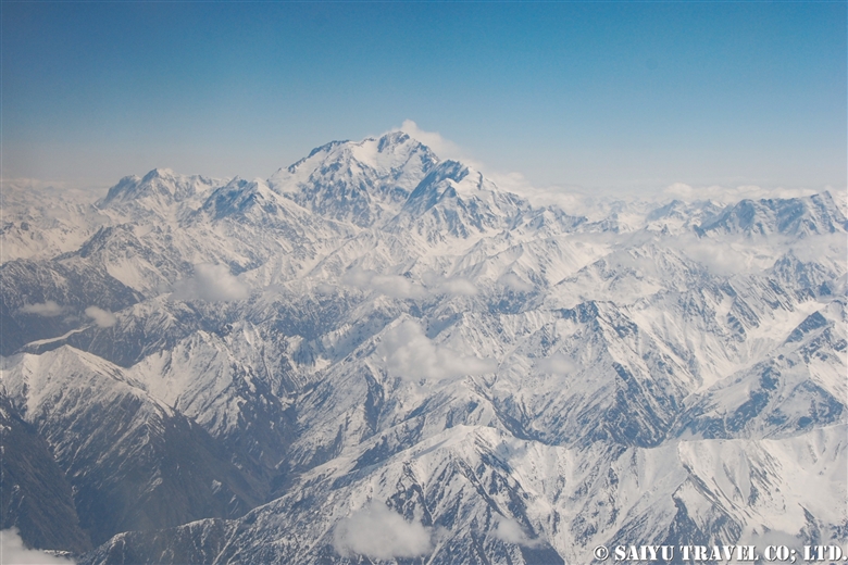
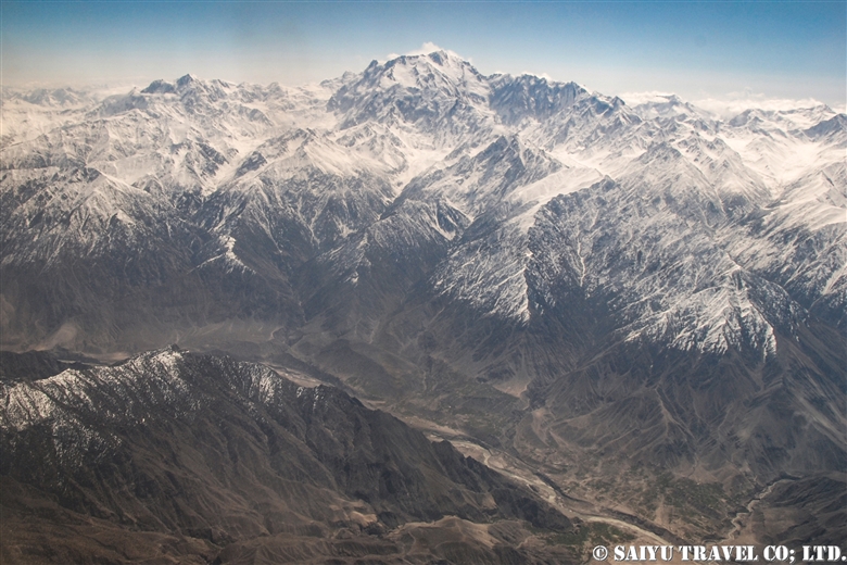
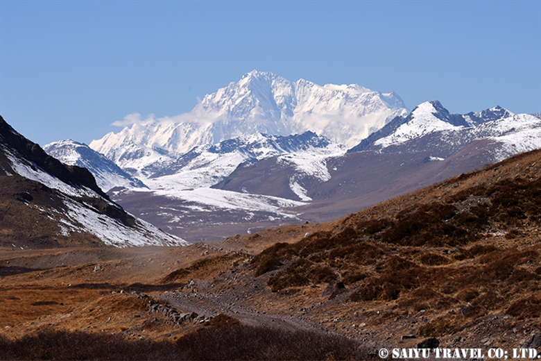
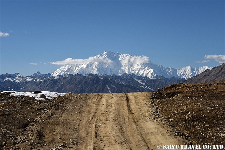
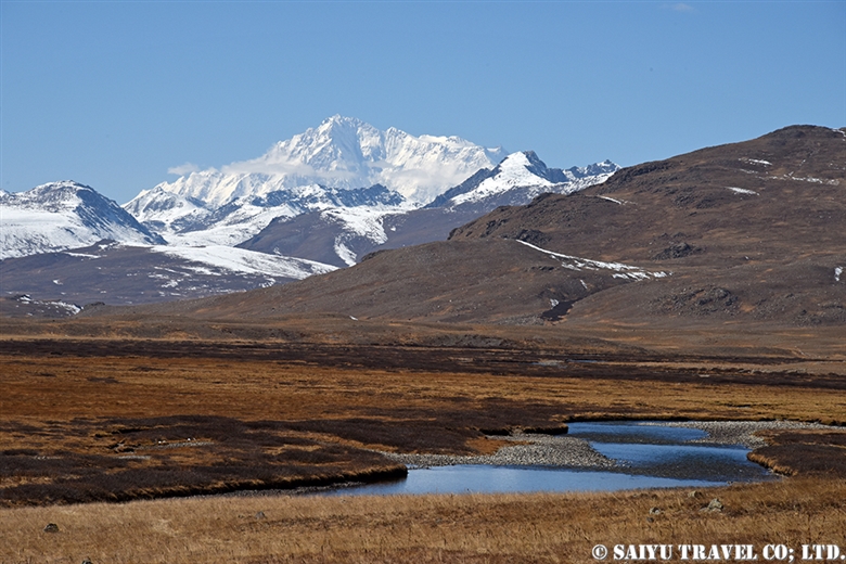
The Pakistan Airlines flight from Islamabad to Skardu on good weather days are renowned for their great views of the world’s 9th highest peak, Nanga Parbat which stands at 8,126 m (26,660 ft).

This video was taken on a sunny day in October during our visit as we flew on flight PK451. I took the video with my iPhone. I have been on this flight a number of times before, but on this day in particular, Nanga Parbat felt closer than ever before!


Nanga Parbat from PK451 (Aerial View)

The video linked below was taken with a Go Pro 10 by Amin Gazi Karim of the Indus Caravan who was on the same flight with us. His short reel highlights moments from the entire flight from flying towards Nanga Parbat to our landing in Skardu.

Skardu is now a popular destination among domestic Pakistani tourists, with flights from Karachi and Lahore during the summer season, with three arrivals a day on the weekends. Compared to in the past, there have been improvements on the flight operation rates.

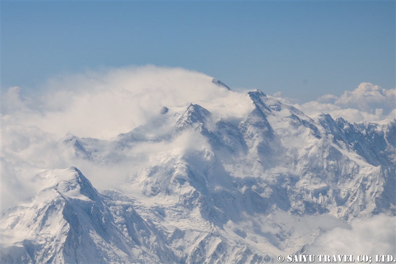
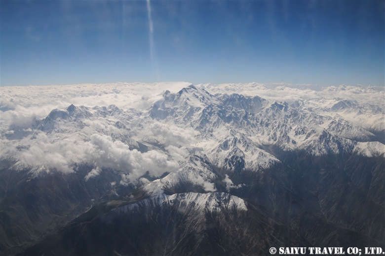
The peak of Nanga Parbat taken from the airplane. There are often clouds on the peak, so we were lucky to have a really clear view.

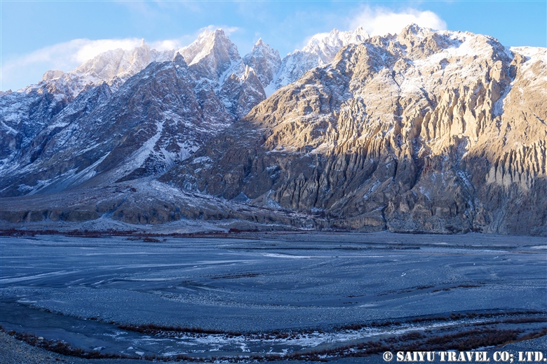
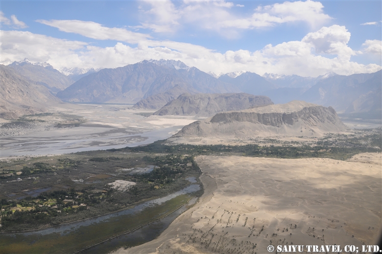
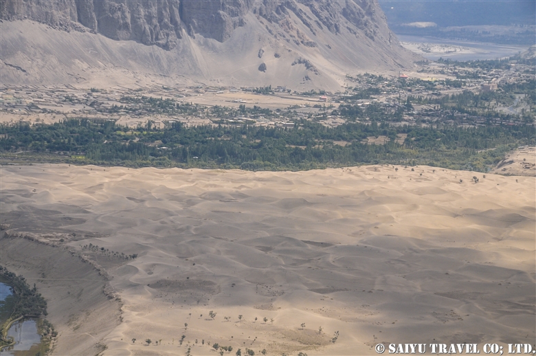
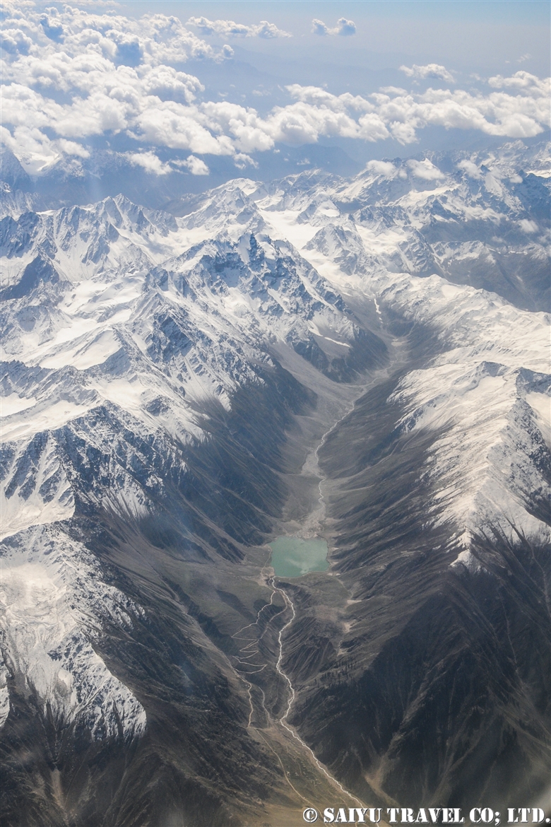
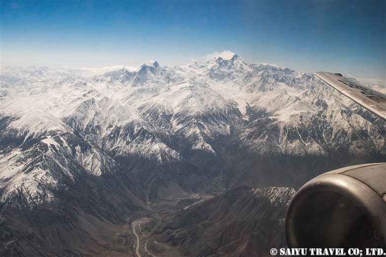
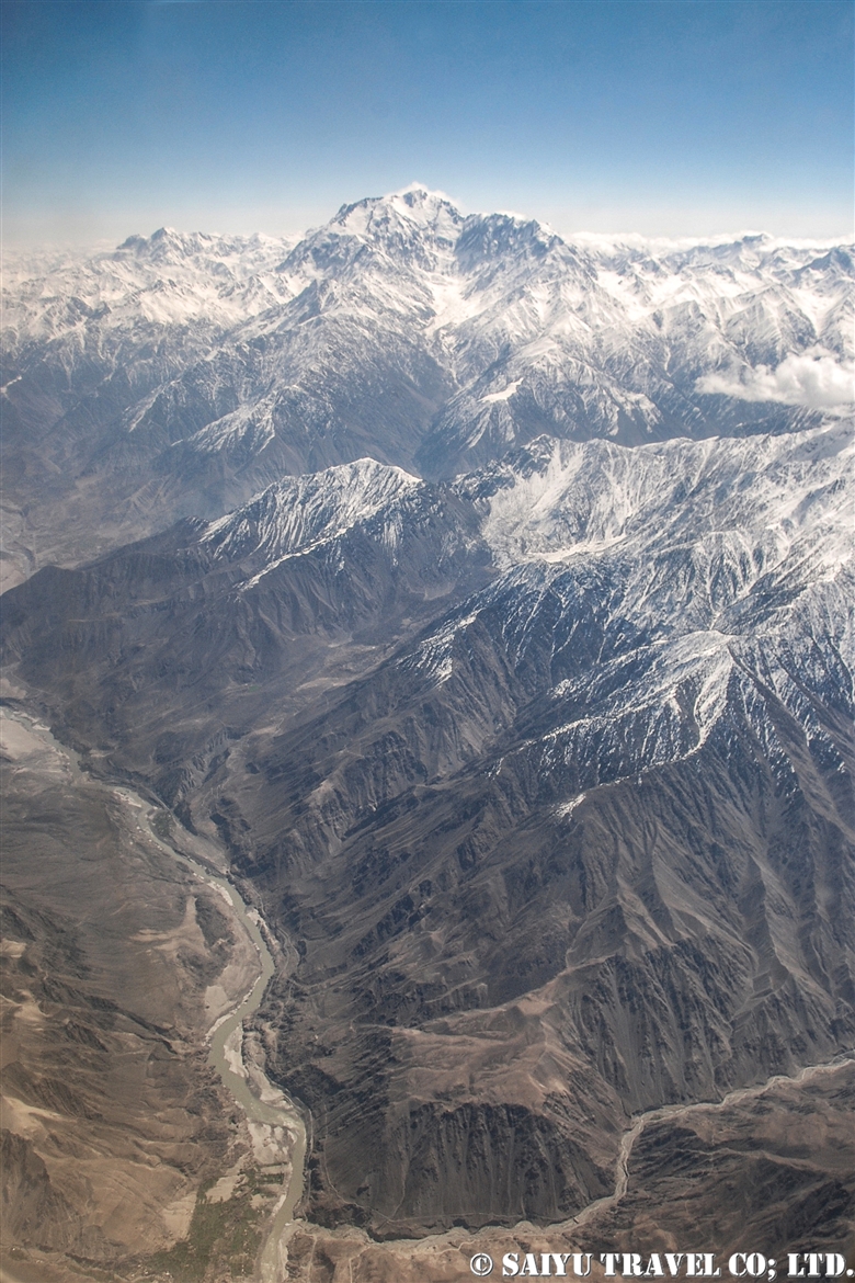
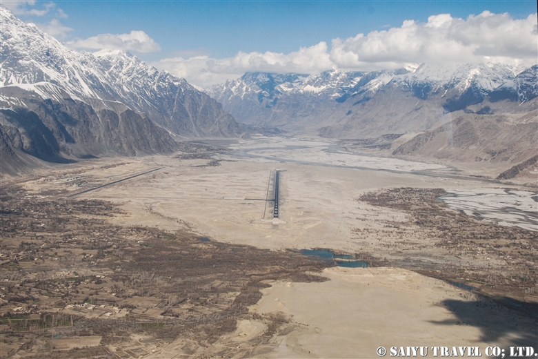
As we approach Skardu, the snow-capped mountains and valleys begin to appear.

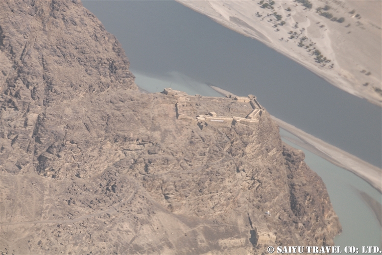
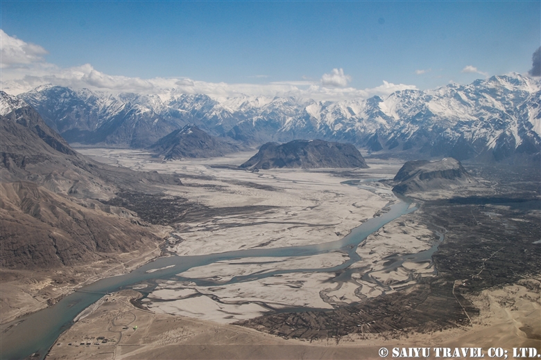
The flow of the Indus River has carved out the Skardu valley. Skardu Airport is right along the riverbank.

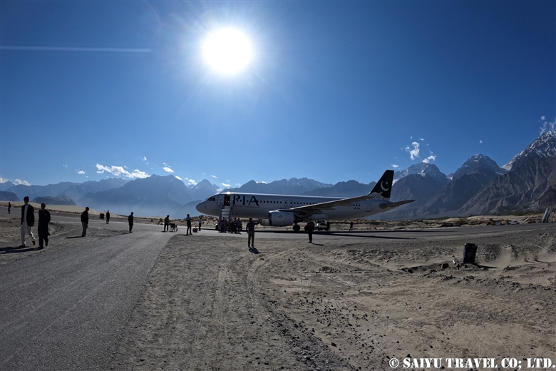
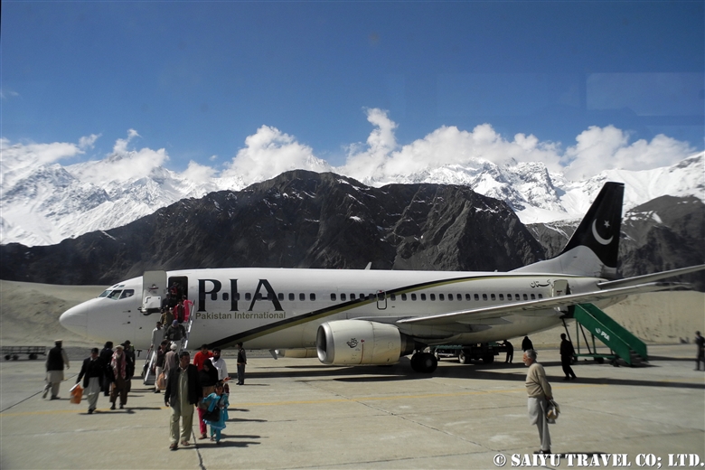
Landed at Skardu Airport. With the aim of it becoming an International Airport, there are various projects ongoing to expand it and maintenance is underway. In fact, it is located right on the boarder with India, and the military also uses the airport regularly, so there are plans for a new runway.

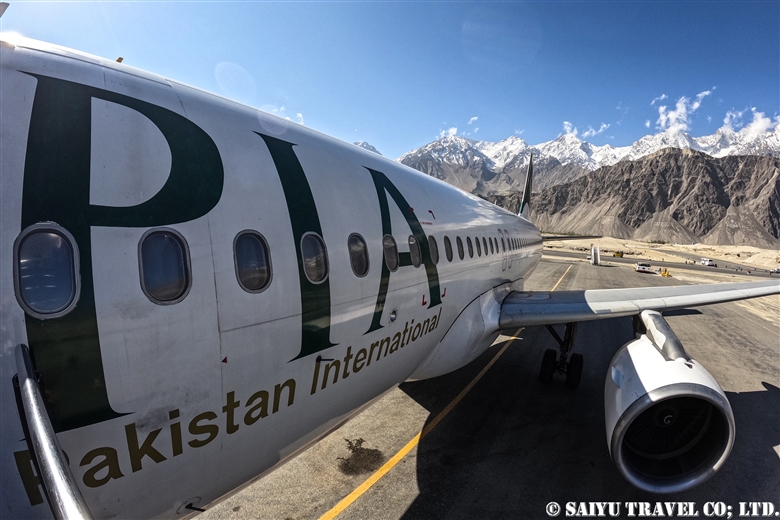
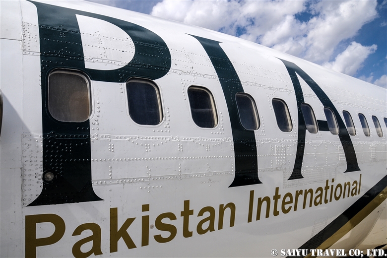
On November 30, 2021  Pakistan Airlines closed their branch in Japan. This airline that has connected Tokyo to Islamabad for nearly 30 years, will be gone and makes me so sad.

Thanks to Pakistan International Airlines and everyone who supported flight to Tokyo.


Image & text : Mariko SAWADA

Visit :Oct 2021, taking flight PIA 451 from Islamabad to Skardu

Category : = Video Clip Gilgit-Baltistan > ◆ Video Breathtaking Views of Pakistan > ◆ Gilgit-Baltistan > - Skardu Valley > ◇ Mountain of Pakistan > - Nanga Parbat / Himalaya Range
Tag : , , , , , , , , , , , , , , ,

Sarfranga cold desert, emerging from the sea of clouds: Skardu

The morning after it rained and snowed in Skardu. The valley all along the Indus River was bathed in fog.

Located on the banks of the Indus River in Skardu, is the Sarfranga Cold Desert. The name is based on it being at 2,500m (8,200 ft), as a high-altitude desert surrounded by high mountains. The sand along the river, forms beautiful dunes.

The sand dunes remind me of the scenery of the Sahara Desert or the Namib Desert, with the periphery of the sand dunes surrounded by peaks higher than 5,000m above sea level. Making it feel so mysterious.

Sarfranga cold desert emerging from the sea of clouds Skardu|スカルドゥ サルフランガ寒冷砂漠

This drone video was taken in the cold desert, while I was standing in the fog, operating the drone. Once the drone rose above the fog, you could see the landscape open up beautifully.

This is the scene of the fog settled over the Sarfranga dunes, as seen from the road to the Shigar Valley. The large Pakistani flag was drawn on the side of the rocky mountain.

The valley of the Indus River which flows from the Indian boarder was covered in fog.

The tips of the dunes emerging from the fog was strikingly beautiful.


Image & text : Mariko SAWADA

Visit : Oct 2021, Sarfranga Desert, Skardu, Gilgit-Baltistan

Category : = Video Clip Gilgit-Baltistan > ◆ Video Breathtaking Views of Pakistan > ◆ Gilgit-Baltistan > - Skardu Valley > - Shigar Valley
Tag : , , , , , , , , , , , , , , , , ,

Crossing the Shandur Pass in the Autumn

In late October, Northern Pakistan’s poplar trees turn a golden hue, making it the most beautiful season of the year. Travel from Gilgit to Shandur Pass through the Ghizer District is spectacular. With less traffic in the valley, the view along the road is one of the best.

On this day, we left Gupis to travel towards Chitral. There were rows of golden poplar trees reflecting the sun against the clear autumn sky. However, as we kept stopping to get photos of the dynamic landscape, our progress getting to Chitral was quite slow.

As we made our way uphill to Phandar, we found a herd of yaks that were being gathered together. Due to snow in the higher elevations, they were being brought down and were being herded together to be taken to their pasture lands.

A view of the bridge near Phandar. In the past, many of the suspension bridges like this were made of stone, wood and wire. But they are steadily being replaced by concrete bridges made by China. As a photographer, it is sad to see these kinds of bridges getting phased out.

Eventually, we started up the Shandur Pass. We saw a donkey caravan passing us as they were heading down, loaded with fuel for their fires during the cold winter. Their heavy load was packed with materials for firewood, including dried cow and yak droppings

Shandur Pass at the altitude of 3,700m (12,140 ft). The Gilgit-Baltistan and Khyber-Pakhtunkhwa boarder is here. At the check post, all the foreigners will be asked to confirm their documents here.

When mentioning Shandur Pass, it is worth noting that it is famous for the “World’s highest altitude Polo Competition” the Shandur Polo Festival, which takes place in the summertime. The stadium was also covered by the snow.

This is a lake covered in ice on the Shandur Pass. This part of the road is extremely difficult to pass where the melting snow and sand mixes together into a muddy mess, causing a chaotic scene. 。

The steady, dependable vehicle of choice on these rough back country roads, is what is locally called the “Toyota Jeep.” These Toyota Land Cruisers from the 1970’s and 80’s are the go-to vehicle and have been retrofitted with the “Northern Pakistan Kit” both inside and out, which is designed to take a beating, but to get you to your destination.

These older jeep-type cars have been declining recently as newer land cruiser models become more popular, which is coming from Afghanistan into Gilgit-Baltistan and Khyber Pakhtunkhwa (Non Custom Paid Cars).

Even so, when it comes to driving in the snow, these rugged cars have a track record for being the most dependable. I’m so glad to know that even now, such an old Japanese car is still so heavily relied upon in the mountains of Pakistan. It is playing a vital role of connecting a remote village and delivering the supplies they need.

As we made our way down from the Shandur Pass, at the foot of the mountains, we stopped for a late lunch in the village of Laspur. We had lentils, curry made of freshly harvested potatoes, chicken curry, rice pilaf and naan.

In Laspur, this father and his daughter were running the wonderful “chaihana”. I was enchanted by the smile of this young lady.

We continued on our journey, taking the rough road to Mastuj, and then on to Chitral. By the time we arrived in Chitral, it was already dark.


Image & text : Mariko SAWADA

Visit  :Oct 2021, Gupis, Phandar, Shandur Pass – Gilgit-Baltistan & Khyber pakhtunkhwa

Category : ◆ Gilgit-Baltistan > - Shandur Pass > - Ghizer / Shandur Pass
Tag : , , , , , , , , , , , , , , ,

Plumbeous water redstart (Chitral)

We found a male Plumbeous water redstart on the banks of the river running through Tooshi-Shasha Conservancy near Chitral, Khyber Pakhtunkhwa.


Unfortunately, it was raining; it seemed like it would turn into snow soon enough. We came in search of markhor, as we were told they often come to the riverbanks in the afternoon. So, we waited. That was when we observed both the Plumbeous water redstart and the White-capped water redstart.


A male Plumbeous water redstart displaying, with its tail wings spread out.

These redstarts breed in South Asia, Southeast Asia and China at altitudes of 2,000 meters to 4,000 m and then in winter, they will descend to slightly lower altitudes to overwinter there. In Pakistan, they are found in the mountainous areas in the north where the altitude is not so high, and it seems to be common near Chitral and Murree.


As we looked up at the mountainous slopes above the river, we could see a herd of Kashmir Markhor coming down towards us. And among them was a big male with a pair of enviable horns!


Photo & Text: Mariko SAWADA
Observation: Dec 2020, Tooshi-Shasha Conservancy, Chitral, Khyber Pakhtunkhwa
Reference: Helm Field Guides “Birds of Pakistan”

Category : ◆Khyber Pakhtunkhwa > - Chitral > ◇ Birds of Pakistan
Tag : , , , , , , , , , , , , , , , , , ,

(video) Red-billed Chough

“Red-billed Chough” in the mountains of northern Pakistan.

They can be seen gathering around the fruits of the Hippophae rhamnoides.


Red-billed Chough, Pakistan


Video & text : Mariko SAWADA

Observation : Dec 2020, Morkhun – Sost, Gilgit-Baltistan

Category : = Video Clip Gilgit-Baltistan > ◆ Video Breathtaking Views of Pakistan > ◆ Gilgit-Baltistan > - Gojar > - Morkhun > ◇ Birds of Pakistan
Tag : , , , , , , , , , , , , , , , , , , ,

Lammergeir /Bearded Vulture (Chitral Gol National Park)

I remember the first time I saw this bird, I was in Ladakh, India and I was shocked exclaiming, “What in the heck is that!?!” And the answer was “Lammergeir”. Despite knowing how it is spelled, it was still a mystery as to how to pronounce it, but since everyone says ‘Lamagaye,’ I also pronounce it that way.

This name seems to be an old German name; it is more commonly known in English as the Bearded Vulture. But the bird looks so cool, that you’ll want to call it “Lammergeir” instead.


A bearded vulture flying against the backdrop of the Hindu Kush Mountain Range, observed at the Chitral Gol National Park.

Bearded vultures are birds found in the mountainous regions of central Eurasia, in East Africa and Southern Europe, and seen using steep drop off cliffs. It is a large bird with a total length of 115 cm, but the wingspan is closer to 3meters across. As the English name suggests, the bearded vulture, is a member of the vulture family, but their distinguishing feature is a feathered head & is completely different image as other vultures.


Bearded vultures feed on carrion, specializing on old meat and particularly bone marrow. It has been observed that they fly high holding the large bones, only to drop them to break them, on the rocks below to expose the bone marrow.


When I see a vulture is flying in the sky, I always think, “Where are the dead animals?” But it seems that this vulture will only visit once the other vultures (such as Himalayan & Black vultures) are done. They are the only vertebrate animal that gets the majority of its food from consuming bone marrow (70-90%!).

There are various cultural theories surrounding this bird, that it maybe appears in Arabian Nights called the “Roc, mythological bird in middle east,” as possibly the model for it or in the ancient Persian myths as “Homa, the mythological bird in Iran.” In ancient times, these vultures seem to have carried a special reverence in the imagination of the people.


Photo & Text: Mariko SAWADA
Observation: Dec 2020, Chitral Gol National Park, Chitral, Khyber Pakhtunkhwa
Special Thanks: KPK Wildlife Department, WWF Pakistan, Tomo AKIYAMA

Category : ◆Khyber Pakhtunkhwa > - Chitral > ◇ Birds of Pakistan
Tag : , , , , , , , , , , , , , , , , , ,

Red-billed Chough ( Upper Hunza)

In the mountainous areas of northern Pakistan, there are “red billed crows” and “yellow billed crows.”

Strictly speaking, they are classified into the crow family Corvidae and the genus Pyrrhocorax, appropriately called red-billed chough and the yellow-billed chough (also known as Alpine Cough).

‘Chough’ is pronounced “chuf /tʃʌf ” and they breed in the highlands above 5,000m during the summer season. In the winter, they form large flocks and decend down into the valley.

Distributed through the Eurasian and African continents, the genus is divided into eight subspecies. The one found in northern Pakistan is Pyrrhocprax pyrrhocorax himalayanus, which also inhabits the Himalayan mountain region to western China. A prominent feature are the large, bluish-purple glossy wings. In Europe and in Africa, Choughs can be observed at an altitude of 2,000 to 3,000 m, but in the Himalayan Karakorum, there is only a chance to see them at higher elevations of 3,000m to 5,000m.


I could see red-billed choughs along the riverbanks near Morkhun village. In the winter, the upper Hunza is strikingly beautiful, as a vast landscape of jagged rocks etched by time are layered with snow like a masterful piece of art.


While I was watching these red-billed choughs, a herd of goats and sheep passed through to go to their grazing pastures. In the Upper Hunza there are 7 villages that during the summer will keep the yaks, sheep and goats in the Khunjerab national park area. But in the tough winter, only the adult yaks are left in the highlands, while the yearling yaks born in the summer, goats and sheep are brought down to the villages at around 3,000m. Then everyday these herds are taken to the pastures to graze.


The paths that the villagers use to move the herds are lined with red & yellow billed chough. Generally since the red-billed will form large flocks, there are usually a smaller number of yellow-billed chough in the groups.


These are flocks of red-billed chough that are gathering seeds or fruit from the trees along the side of the Karakoram Highway.

Hippophae rhamnoides are a deciduous shrub found widely in Eurasia. In north Pakistan, it is a very important tree for wild birds, whose fruits are eaten during this harsh winter.


The long, curved, red colored beaks. But that isn’t the only thing that red! Their legs are also a red color!

Keep a watchful eye out when you are in the Upper Hunza and Skardu areas in the winter months. At first you may think you are seeing crows…but actually you might be lucky to see black birds adorned with red and yellow beaks! It is no ordinary crow!


Photo & text : Mariko SAWADA
Observation : Dec 2020, On the KKH ( Morkhun – Sost),  Gilgit-Baltistan
Special Thanks : TOMO Akiyama

Category : ◆ Gilgit-Baltistan > - Gojar > - Morkhun > ◇ Birds of Pakistan
Tag : , , , , , , , , , , , , , , , , , , ,

Pakistan International Airlines, take off from Skardu! The full picture of Nanga Parbat!

This is a description of my flight from Skardu to Islamabad using Pakistan International Airlines.

The Gilgit flight is usually very early in the morning, and due to the sunrise from behind the Nanga Parbat, everything looks white. However, the Skardu flight takes off a little later, when the sun is higher up in the sky. So it means the mountains are beautifully illuminated, although it may be a little cloudier when compared to the early morning hours.


When you take off from the Skardu Airport, you will see the outlying villages on the edges the city, poplar-lined streets, the Indus River, and boundary of the Katpana Desert.


The Skardu Fort, also known as Kharpocho, was built on a cliff along the Indus River in the 16th century.


Sand dunes in the Cold Desert can be seen stretching from the Skardu Valley to the Shigar Valley. It is a rare desert at a high altitude of about 2,500 m, which is quite unique in the world. The sand dunes are small and scattered from Ladakh, India’s Nubra Valley to Skardu but the dunes get bigger and more beautiful in the area from Skardu to Shigar.


This is Nanga Parbat, the 9th highest peak in the world. When I left Skardu, I thought it would be too cloudy and we wouldn’t be able to see it, but the southwestern side was clear.


The summit looked to be very windy, blowing the snow off the peak.


The main peak of Nanga Parbat is at an elevation of 8,126m, and the banks of the Indus River are at about 1,100m. So from the window of the plane, you can see the topography with a height difference of 7,000 m! It’s a really rare opportunity to be able to see 23 kilometers straight down and be able to compare the height of the mountains.


And this is the whole picture of the Nanga Parbat massif. The north side Chongra Peak, Raikot Peak, and the Main Peaks.


This is deep in the Naran Valley, Saiful Maluk Lake. It used to be such a pristine place, but regrettably, it has become a sad example of a tourist destination that has become full of garbage, due to the increase in visitors in recent years.

Well, we are coming back to reality now, and soon we’ll enter the Punjab Plain and touchdown at Islamabad.


Photo & Text : Mariko SAWADA
※These photos were taken on a September flight from Skardu to Islamabad on Pakistan International Airlines.

Category : ◆ Gilgit-Baltistan > - Skardu Valley > - Nanga Parbat / Himalaya Range
Tag : , , , , , , , , , , , , , ,

Best Views of Nanga Parbat! PIA Pakistan International Airlines ★ Skardu Flight

A panoramic view of the Nanga Parbat massif from a flight from Islamabad to Skardu

These mountain flights in northern Pakistan are often canceled. The reason is, of course, the quickly changing weather in the mountains. Considering that, in the last few years, the flight rate has improved considerably. In particular, if you were to try to move by car the distance of the Skardu flight, it would take two full days by land. But taking this “picturesque flight” it only takes one hour to travel the same distance.

You should really see this scenery from the Skardu flight! For the Skardu line, if taking the regular route (depending on the weather), you will see Nanga Parbat on the right and K2 on the left (if you are lucky!) just before arriving in Skardu. K2 is often hidden by the clouds and is only visible a little at the very end of the flight. So sitting on the Nanga Parbat side will give you more time to enjoy the mountainous view.

When you take off from Islamabad, you will increase altitude while slowly circling up in the Punjab Plain. Soon, you start to see the mountainous view at the western end of the Himalayas. If you look closely below, you can also see the Indus River and the Karakoram Highway running alongside it.


Nanga Parbat is seen as a gigantic mass of mountain. It is 8,126m, the 9th highest peak in the world.


My personal favorite is to see both the Indus River and Nanga Parbat. It’s hard to see in the photo, but below you can see the Indus River and the Karakoram Highway. The Indus River is a large river that crosses the border from Ladakh, India, and enters Pakistan passing through Skardu, and flows beyond that into the Arabian Sea.

This great mountainous region of Pakistan borders the Indus River. The Himalayas to the south of the great river and the Karakorum Mountains to the north of it. This is where the ancient Indian Plate and the Eurasian Plate collided to form these vast mountain ranges.


And in this photo, at the bottom, the altitude of the riverbank of the Indus River is 1,100-1,200m, while at the top, the summit of Nanga Parbat is 8,126m. If you draw a straight line, there is a height difference of 7,000m in a distance of about 23km!


Shortly after the view of Nanga Parbat disappears, you enter the Skardu Valley. Surrounded by the mountains of Karakorum, the open valley of Skardu contrasts so much. It is a magnificent view shaped by the Indus River.


Pakistan International Airlines circles around the town of Skardu, which is like an oasis lined with poplar trees. You will see Satpara Lake and finally land at the airport in Skardu.


Arrived safely in Skardu.

Can you see the mountains if you can’t get the window side? ···Nope!  There is no choice but to take turns looking out the small airplane windows. And…should your flight be cancelled, you have to stay flexible and just be content to enjoy the views of the Karakoram Highway and the mighty Indus River from the car!


Photo & text: Mariko SAWADA

*The photo is taken from the right seat of the actual Pakistan Airlines Skardu flight.

Category : ◆ Gilgit-Baltistan > - Skardu Valley > ◇ Mountain of Pakistan > - Nanga Parbat / Himalaya Range
Tag : , , , , , , , , , , , , , , ,

Nanga Parbat (8,126m) from the Deosai Plateau

Nanga Parbat, the ninth highest mountain in the world. It is a mountain also known as, “The Killer Mountain”, because many climbers died on their way to the summit, during the last century.

There are several famous places from where you can have a breathtaking view of Nanga Parbat. Such as Fairy Meadows, Herrligkoffer Base Camp, that overlooks the Himalaya’s largest ice wall, “Rupal Wall”, with the differences of 4,500 meters.

Nevertheless, Nanga Parbat from the Deosai Plateau side is also admirable!

We entered “Deosai National Park” from the Chilam gate.
Brace yourself. This is just a view from the entrance of “Deosai Plateau”.

You can see this splendid sight just from the roadway!

Soon you will see picturesque Sheosar Lake with reflecting blue water… It is at an altitude of 4,140m.
From here you can see Nanga Parbat, against the backdrop of the lake, in the sky.

We drove further to Kala Pani from Sheosar Lake. Nanga Parbat can be seen from the heart of Deosai plateau.

We visited this place in early October. The temperature of the camp at night dropped to below freezing, but I was able to see the beautiful Nanga Parbat, blessed with the fine autumn weather.

Photo & Text : Mariko SAWADA
Visit: Oct 2015, Deosai Plateau, Gilgit-Baltistan

Category : ◆ Gilgit-Baltistan > - Deosai National Park > ◇ Mountain of Pakistan > - Nanga Parbat / Himalaya Range
Tag : , , , , , , , , , , , , , , ,