“Alter Rock”, Thalpan – Petroglyphs along the Indus River

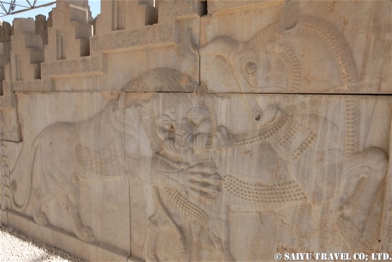
The Altar Rock at Thalpan is located on the sandy north bank of the Indus River. The rock is carved with motifs, mainly animal rather than Buddhist motifs. This is a fascinating example of Petroglyphs from the ancient Silk Road.

Since ancient times, Thalpan has had many visitors who come and go through this area.  It was the nomads who first chose this site to carve. The rock face in front of the Alter Rock may have been used as a veritable ‘altar’, with various animals and slaughter scenes depicted.
These Petroglyphs with non-Buddhist motifs are thought to date from the mid-1st millennium BC.

overall view of Alter Rock

One of the Petroglyphs that stands out on this Altar Rock is this image of a Warrior with Sacrifice. It appears to be a scene of a man slaughtering an  animal (many sources call it a goat, but as an animal lover, it looks like an ibex to me). The figure of a Central Asian-style man holding a large knife is very distinctive.

The man’s dress is thought to be that of an equestrian nomad of the time, and it has been suggested that he may be from the Parthia, a dynasty that flourished on the Iranian plateau from the 3rd century BC to the 3rd century AD.

This animal sacrifice (or slaughter) Petroglyphs motif suggests that the influence of Central Asian peoples was stronger than the influence of Buddhism, which forbids the killing of animals.

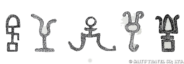
This is a designed horse or unicorn with its forelegs bent at 45 degrees.

This pose, called “Knielauf,” was used in ancient Greece to depict a flying condition and was also popular in Achaemenid Persian art. The horse’s mane and tail are braided, giving them an appearance of bows.

Is it a designed ibex? The circular eyes are also an Iranian expression.

This shows a deer-like creature with antler and a predator with two tails chasing it. As a wildlife observer in Pakistan, it looks like a snow leopard attacking an ibex on a cliff to me. What is interesting, is that there is a head of a snake, at the end of the jagged line that also looks like a cliff.

One theory is that it shows an ibex in trouble, with a snake in front, a snow leopard behind, plus a hunter and his dogs, and nowhere to go.”

Such wavy designs are said to be a common feature of the art of the Altai region in southern Siberia.

The presence of Petroglyphs with Iranian elements at Altar Rock is not surprising, as Gandhara and Taxila were already satraps of the Achaemenid period. It is surprising that there was interaction between the Altai region of southern Siberia and this Indus region in the north, across one of the most mountainous regions in the world.

Petroglyphs from Thalpan Zyarat depict motifs from the Okunev culture of southern Siberia.

A large Buddha figure with a halo is seated with four smaller seated Buddha figures, also all with halos.

Each Buddha is in Dhayana Mudra sign and their garments cover their shoulders, with gracefully drawn parallel robe crests. Such garment crests are similar to designs found in the Gupta empire art, which flourished in India between AD 320 – 550.

A creature, possibly an ibex, is depicted on the same rock, and its movement and direction suggest that the ibex was carved first, and then the Buddha image was carved on top of it.

The west panel is also covered with Petroglyphs.

The Alter Rocks are the masterpieces of the Indus River Petroglyphs.

As we posted in previous blogs, it is such a shame that these rock carvings will be lost forever due to the construction of the dam.


Photo & text: Mariko SAWADA

*Contact us, Indus Caravan for more information or to make arrangements for visiting Rock carving along the Indus river.

*Please follow us on YoutubeInstagram & Facebook

Category : ◆ Gilgit-Baltistan > - Indus river bank > ◇ Rock carvings / Petroglyph
Tag : , , , , , , , , , , , , , , , , , , ,

Hungry Tigress Jataka- Rock Carving of Chilas

“This blog is documenting the precious Silk Road heritage site, the ‘Indus rock carvings’, which will be lost forever in a few years when two dams on the Indus River are completed”


Have you ever heard of the Hungry Tigress Jataka「捨身飼虎」?  In Japan, the story of the Hungry Tigress Jataka is depicted on the side of the Tamamushi Zushi「玉虫厨子」, a national treasure in the collection of ancient Horyuji Temple(法隆寺), even before Kyoto was built – when Buddhism was freshly adoped by the Japanese elite.

There are rock engravings along the Indus River in Chilas where the Hungry Tigress Jataka can still be seen, despite certain degree of deterioration the engravings underwent.


About Hungry Tigress Jataka (Vyaghri-Jataka) 

Long ago, there was a king in India who had three brothers, every of them a prince. One day, the king and the three princes went to play in a bamboo forest. There they met a mother tiger with seven cubs. The animals were starving, emaciated and on the verge of starvation.
The three princes felt deep compassion, but two of them left, saying that they could not save the animals. The third prince said, “Bodhisattvas offer themselves out of compassion to save others. I will offer myself to save the life of a starving tiger “. The prince gave himself up and the tiger ate him. The story goes that the prince who saved the lives of the tiger was the Buddha himself in one of his previous lives.

More information on Hungry Tigress Jataka and the Tamamushi Zushi at Horyu-ji Temple can be found on the websites of the respective temples.

The following is a sketch of this rock engraving, although it is quite faded and difficult to make out.

Source : The Indus – Cradle and Crossroads of Civilizations (Pakistan-German Archeological Research)

This sketch of the rock engraving shows a lying prince, a tiger cub about to eat the prince, the father king and two brother princes watching from safe distance behind a rock.

Decipherment of the Brahmi script beside this image has also proved that it is Hungry Tigress Jataka (Vyaghri-Jataka).

The entire surface of the rock on which the Hungry Tigress Jataka is depicted. A large stupa is depicted in the centre. There is a hemispherical Anda on a square base, with Harmika, symbolic umbrellas and banners, which are characteristic of the Gandhara style. It is thought that Buddhism was at its peak influence in the Upper Indus around the 5th century.

Unfortunately, this precious rock engraving will also be lost when the dam is completed. “Unfortunately” is not the right word that can be used to describe it, perhaps. The destruction of the rock engravings began with the construction of the Karakoram Highway in the 1960s, and the rock engravings have been destroyed with every expansion of the road. Some were even lost when they were painted over by people who did not like the Buddhist motif for a time.

Painted rock engravings along the Karakoram Highway. The central figure of a snow leopard chasing an ibex was washed out in December 2020.

Again, the time was limited, but we worked on washing the rock engravings that had been painted.

This is the current state of the rock engraving. From right to left, Manjushri, Bejewelled Buddha with a devotee holding an incense burner or lamp and stupa. A trefoil-shaped arch surrounds the Buddha’s entire body, is in Kashmir style.

The picture below shows how this looked before the paint was applied.

Source:The Indus – Cradle and Crossroads of Civilizations (Pakistan-German Archeological Research)

We will continue to wash off the paint from these rock engraving panels.Please come and witness this wonderful Buddhist heritage before it is submerged in the dam.


Photo & text : Mariko SAWADA

Site : Chilas, Gilgit-Baltitstan

*About the article: the article is based on an old book. I wonder if other views and explanations exist. I would be very happy if you could let me know so that I can study it.

Reference :”Huma records on Karakoram Highway”, ” The Indus, cradle and crossroads  of civilizations”

*Contact us, Indus Caravan for more information or to make arrangements for visiting Rock carving along the Indus river.

*Please follow us on YoutubeInstagram & Facebook


Category : ◆ Gilgit-Baltistan > - the Karakoram Highway > - Indus river bank > ◇ Rock carvings / Petroglyph
Tag : , , , , , , , , , , , , , , , , , , , ,

Rock Carvings of Shatial, – Silk Road heritage – soon to be submerged in the Indus river dam

This blog is documenting the precious Silk Road heritage site, the ‘Indus rock carvings’, which will be lost forever in a few years when two dams on the Indus River are completed.


Stunning stupa depictions and inscriptions, “rock carvings of Shatial”

Shatial Rock Carvings, on a slope slightly off the Karakoram Highway down to the Indus River, located on the south bank of the Indus, between the Darel Valley to the east and the Tangir Valley to the west, were very important site for travelers, trade caravans and pilgrims on the Silk Road.

The rock carving ranges from those considered pre-Buddhist to those from the Gandhara heyday and post-Gandhara eras.

Firstly, the picture below shows the most famous rock carving in Shatial site. This rock art is impactful enough to elicit “wow!” response even from an ordinary tourist.

In the center of the rock is a large, delicately depicted stupa with many bells. On the left is a depiction of the “Sibi Jataka” and on the right is a votive stupa.

On the left side of the rock, the name of the stupa’s builder is inscribed in Kharoshthi script (or Gāndhārī, ancient Indo-Iranian script), which dates back to the 5th century.
Between the stupa and the votive stupa the names of people who lived back then (perhaps, some dignitaries) are inscribed in Brahmi and Sogdian script.

Two devotees dressed in Central Asian-style costumes approach the main stupa from three stepping stones. This staircase leads to a plinth decorated with a ‘four-stepped design’. Two pillars support the beam and the domed stupa. Bells are also attached to the beam, stupa and niche.
The stupa is topped by a series of umbrellas, from the top most of which hang down banners on either side like an arch. Small bells are also attached to the umbrellas, making this rock engraving different and novel from the other stupas.

The votive stupa to the right of the main stupa has four steps leading up to a high base, depicting a triangular stupa with a series of umbrellas above it and flags billowing and fluttering. It is a different style of depiction from the main stupa.

This figure on the left shows the ‘Sibi Jataka’.


About Sibi Jataka

(The Jataka is the stories of former lives of the Buddha )

There was a kind-hearted king named King Sibi.
A dove chased by a falcon flew to King Sibi and asked for help.

The falcon came to King Sibi and said, “I have not eaten for many days and if I do not eat the dove, I will die from starvation. Whose life do you consider more important, the dove’s or mine?”

So King Sibi thought that the falcon’s life is also important, so he cut off a piece of meat from his own leg, weighing the same as the dove, and placed it on the balance. But the dove was heavier, so he cut off the flesh again and placed it on the balance, but the weights were not equal.

King Sibi thought deeply and put his own body on the balance, and it balanced. The king said to the hawk, “Please eat me and get well”.
King Sibi tried to save the dove’s life by giving his own life to the falcon.

The falcon, knowing King Sibi’s heart, appeared to him in the form of Indra God and he saluted King Sibi’s action by saying, “You will become a Buddha in the future”.


In this rock carving, the Buddha sits in a cave, holding a ‘dove’ in his hand. The person depicted on the right holds a balance. The object on the balance is the flesh of King Sibi, which was cut off to save the dove’s life.
Below the Buddha holding the dove, devotees are depicted on both sides.

The above description is just one of many stories behind carvings in the main stupa. Shatial site has many other unique, valuable iconographies.

This is the carving on the rock opposite the main stupa, “Yantra”, a holy set of symbols at the center to the right, and “Labyrinth” on the bottom left.


Above and below are Sogdian tamga, emblems used by ancient Eurasian sedentary and nomadic tribes and their influenced cultures, represented in rock carving.

Sogdian Tamga

It’s difficult to see, but can you see the person holding what looks like a cup?

This is a rock carving of Sogdian performing a ritual in front of an altar, most probably. Probably a fire worship ritual?


Other animal rock carvings are depicted by people who walked the Silk Road. The rock carvings in the upper Indus, Gilgit and Hunza river basins are mainly ibex wild goat, with snow leopards and markhors goats, but here we see camels and elephants depicted.

The elephant figures remind us of the proximity to India. Apart from the picture below, there were several rock carvings that appeared to be camels and elephants, but only those that more or less certain are shown here.

Petroglyph of Bactrian Camel
Petroglyph of Goose
Petroglyph of Bactrian Camel

There is always something new to discover at the Shatial site.

By the way, the village seen from the rock carving site is full of dwellings that have been built at a rapid pace to get compensation for the submerged dwellings caused by the dam. The environment around the ancient rock carving has changed considerably.


Photo & text : Mariko SAWADA

*About the article: the article is based on an old book. I wonder if other views and explanations exist. I would be very happy if you could let me know so that I can study it.

Reference :”Huma records on Karakoeum Highway”, ” The Indus, cradle and crossroad of civilizations”

*Contact us, Indus Caravan for more information or to make arrangements for visiting Rock carving along the Indus.

*Please follow us on YoutubeInstagram & Facebook

Category : ◆Khyber Pakhtunkhwa > - Indus river bank > ◇ Rock carvings / Petroglyph > ◇ Heritage of Pakistan
Tag : , , , , , , , , , , , , , , , , , , , , ,

Skardu – Indus Valley in Spring

You will be amazed by the scenery as you arrive in Skardu on a domestic flight; almost all tourists take photos as soon as they arrive. The airport is on a desert plain, surrounded by snow-capped peaks, on the banks of the Indus River.

Skardu’s airport is on an high-altitude desert of 2,230m. Last year, it was promoted to “International Airport.” Recently, the operation rate of the Skardu route has improved, and it is now flying not only from Islamabad, but also from Karachi and Lahore in summer. However, in case of flight cancellation, there is no land route from Karachi. It is still safer for foreign tourists to choose flights from Islamabad instead.

Video of Islamabad – Skardu flight with the Nanga Parbat right at the front!

It takes about 20 minutes from the airport to the town of Skardu. Inhabited by the Balti people, Skardu means ‘land between two high places’ in the Balti language. It was once part of Tibet and was also a trading center to Kashmir. It later became Islamized, and after the independence of India and Pakistan in 1947, it went through three wars and in the end, it belonged to Pakistan.

March 23rd, when I arrived, was Pakistan Day. On March 22, 1940, Muhammad Ali Jinnah proposed the founding of Pakistan at a meeting of the All-India Muslim League, and on the following day, on the 23rd, the founding of the country was unanimously resolved. It is an important Pakistani Memorial Day, just like Independence Day.
There must have been an event at school, as there were children walking down the street with national flags in their hands.

Skardu’s Bazaar, a store that sells beans and grains.

A villager who came to buy goods from Kowardo village in the suburbs of Skardu. Their face is a bit Tibetan, unlike the Hunza and Punjab regions.
Balti men are known to be strong and are active in the K2 base camp trek and climbing in the summer.

A shop in the bazaar also had pink rock salt that was mined in the “Salt Range” from the Punjab region. There are various uses for it like salt licks for livestock, and smaller blocks are used when drinking “namkheen chai” (salty chai).
About Himalayan Salt: The Salt Range

At the Skardu vegetable market, a shipment of vegetables and fruits from the Punjab region arrived.

On this day, the apricots of Skardu were almost in full bloom

The Indus River seen from Hussain Abad Village in Skardu Valley. At this time of year, the Indus River is not mixed with melted glacier water and has a beautiful blue color.
The Indus River flows from Ladakh, India. 93% of the 3,180km (1,976 miles) long Indus River flows through Pakistan. After leaving the northern mountainous region, it flows across Pakistan into the Arabian Sea.

Skardu Valley looking back from the road from Skardu to Gilgit. This large canyon, 10 km wide and 40 km long (6.2 mi wide x 24.9 mi long), is said to have been formed by the glaciers of the Indus and Shigar Rivers between 3.2 million years ago and the Holocene period.

I took one last look before entering “Skardu Road,” which connects Karakorum Highway and Skardu.

The valley of Skardu is a very beautiful place with apricot blossoms in the spring, greenery in the summer and golden poplars in autumn.


Photo & text : Mariko SAWADA

Visit : March 2023, Skardu, Gilgiti-Baltistan

*Contact us, Indus Caravan for more information or to make arrangements for visiting Skardu, Northern Pakistan.

*Please follow us on YoutubeInstagram & Facebook

Category : ◆ Gilgit-Baltistan > - Indus river bank > - Skardu Valley
Tag : , , , , , , , , , , , , , , ,

Shigar Valley in the Early Spring

Just after Nowruz (March 21), I visited the Shigar Valley. Nowruz is the Iranian New Year, but it is also celebrated in northern Pakistan. In Persian, “Now” means “new”, “Ruz” means “day”, and it falls on the vernal equinox. On this day, they start working in the fields and start new things.

On the domestic flight from Islamabad to Skardu, there were many elderly people heading to Skardu. They usually will spend the harsh winter in Islamabad and Karachi, where their sons and grandchildren live, and later return to their villages around Nowruz. The flight was full of villagers.

Shigar Village seen from the entrance of the valleyThe Shigar Valley is called the gateway to ‘Karakoram,’ and this ‘Shigar Road’ continues to the end of the motorway, Askole. Trekking and mountaineering start from Askole, walking on the Baltoro Glacier to K2, Broad Peak and Gasherbrum base camp. This is the path most people who aim for K2 take. The Shigar River is fed by the Braldu River, which flows from the Baltoro and Biafo Glaciers.

Apricot blossoms

The time I visited was when the apricot flowers were in full bloom. It can only be in “full bloom” for 1-2 days. Even so, there are differences in how the apricot blossoms bloom depending on the altitude, the amount of sunlight, and the amount of water, so I was able to see many stages of the apricot blossoms.

Shigar Village is the largest village in Shigar valley. Shigar Fort, managed by the Serena Hotel chain, is a lovely hotel that has been renovated from an old feudal lord’s castle. I walked around the hotel, and they are the village’s children.

Shigar Village
Shigar village

Compared to the past, Shigar Village has developed more than the image of the rustic village, and in the center, there are more cars now. But just taking a stroll around the village, you can enjoy the scenery and have some memorable encounters with the villagers.

Recently, more and more people are going to the Hashupi Fruit Garden, which is located further inside Shigar Village. The views of the valley and villages from Shigar Village to Hashupi Village are very beautiful. The scenery of the village also continues to be rustic.

Time spent with the children of the village
Photoshoot of the apricot blossoms

In the early morning, head to the Sarfranga cold dessert.

The Sarfranga Cold Desert lies on the bank of the Indus River, at the entrance to the Shigar Valley. It is a superb view point where you can see the sand dunes with the snowy mountains in the background.

Hussainbad Village seen from the Sarfranga sand dunes
The snowy mountains of Karakorum seen from the sand dunes

And after the morning shoot, I had a picnic breakfast, and the chai was the best!


Photo & text : Mariko SAWADA

Visit : March 2023, Shigar Valley, Skardu, Gilgit-Baltistan

Category : ◆ Gilgit-Baltistan > - Skardu Valley > - Shigar Valley
Tag : , , , , , , , , , , , , , , ,

Appreciating the Remaining Rock Art & Lamenting Their Impending Loss (Part 4) Gonar Farm

The last of the rock art blogs, which I will introduce to you is on the banks of the Indus at Gonar Farm. From Chilas, drive east on the Karakorum Highway for about an hour, then we get off the car and walk for another 30 minutes. We arrived on the outskirts of the village, dotted with rock art. It is a rock art that everyone in the know is already aware of.

It’s a light climb up, and after walking through the fields of the village, you arrive at the location.

A lot of rock art remains on the big rock, on the outskirts of the village in an open area.

A steep mountain range makes the backdrop of the petroglyphs.

The strange thing about this location is that it is a little far from the Indus River. It is possible that the Indus River once flowed through here and has now changed its flow, or perhaps it was a place that people gathered away from the river. I will imagine many scenarios as I walk around here looking at the art left behind.

The rock art of Gonar Farm has been significantly well-preserved. Perhaps it is because there were fewer visitors, but all of the rock paintings were clear. This Buddha has a happy expression, with folded hands, and adorned in the preists’robes kesa.

Most of the petroglyphs are related to Buddhism, and many that remain are images of pagodas.

There are carvings that are right on the ground, but these pagodas and other engravings remain free of damage because there are fewer people who would trample on it.

Some of the non-Buddhist etchings, are like this image of a plant and a handprint.

Regrettably, the rock art which I have introduced so far, are all destined to be flooded, upon the construction of the dam scheduled by 2027. Some of these rocks will be relocated and preserved by the government, but most of the more than 50,000 images will be submerged. I hope that these stones, which are engraved with the activities, thoughts and beliefs of the various people who traveled on the Silk Road, will have a chance to be seen by as many people as possible before they disappear underwater forever.


Photo & text : Koji YAMADA

Visit  : Nov 2021, Gonar Farm, Gilgit-Baltistan

Category : - the Karakoram Highway > ◆ Gilgit-Baltistan > - Indus river bank > ◇ Rock carvings / Petroglyph > ◇ Heritage of Pakistan
Tag : , , , , , , , , , , , , , , , , ,

Appreciating the Remaining Rock Art & Lamenting Their Impending Loss (Part 3) Shatial

This blog is about the rock art from Shatial. It is known as a “Buddhist site” because a huge pagoda petroglyph, which is included in many of the tours to visit the Hunza region. This time, I was able to take a leisurely tour to look around more, and I found that there are many other rare works than just the famous pagoda.

Rock engraving of the pagoda, buddha image

Since Shatial is such a well-used transit point to cross the Indus River, since ancient times, many merchants, pilgrims, travelers, as well as Buddhists, have passed through. Many distinct designs and images were carved by the travelers. I will introduce a number of these rarer rock engraving.

A person who is raising their right hand

At first glance, it may seem that this person raising their right arm up, may be angry or upset, but the round halo behind his head indicates that this person was an Enlightened Buddha.

A Swastika symbol

This 卍represents a swastika, which is a symbol of Buddhism along with the Dharmachakra wheel.

PitchforkThis is a three-pronged pitchfork. You can try to imagine whether it was used as a weapon, a religious symbol or for agriculture, but either way, it has been in use since ancient times.

Ancient characters engraved on the rock

There are not only pictures but also various writing engraved on the stones. It is believed to be languages like Karosti, Sogdian, Aramaic, and more which have been found here.

The center image to me, looked like three fingers with nails, but it may actually be depicting a plant.

This looks like a Buddha statue with Naga in the background, but it also looks like a flame, so there is a theory that it is a fire worship platform.

A person wearing a mask

This is a person wearing a round mask with horns. The person is also wearing a skirt-like outfit which was very interesting.

Many animals were also depicted as well.

The face of a camel

The camels were an essential animal for the travelers in their journey along the Silk Road.

An elephant

Did the Indian elephants come this far up?

It was a small image, but animals like antelope were also engraved.

In Shatiar, various things were engraved in rock paintings; things used by ancient people of that time, the things they saw, and objects they worshiped. Just looking at this timeless rock art made me feel like I travelled back in time and experienced part of the hustle and bustle of daily life on the Silk Road.

Photo & text : Koji YAMADA

Visit : Nov 2021, Shatial, Khyber Pakhtunkhwa

Category : - the Karakoram Highway > ◆Khyber Pakhtunkhwa > - Indus river bank > ◇ Rock carvings / Petroglyph > ◇ Heritage of Pakistan
Tag : , , , , , , , , , , , , , , , , , , , ,

Appreciating the Remaining Rock Art & Lamenting Their Impending Loss (Part 2)

In this installment, the rock art introduced here along the Indus River near Tharpan. From Chilas, driving east on the Karakorum Highway, cross the bridge across the Indus River, and then follow the road called Tharpan Road, is where these rocks are located. Since this area of the river is very wide, the rock paintings remain over such a large area, and the rocks there are huge, so there are various rock paintings that have remained here.

Rock art depicting a pagoda

It only speculation, but it is thought that this was a large gathering place for people to cross the Indus River because the riverbank is so wide. It seems that many kinds of people of different backgrounds, may have gathered here. Since many were Buddhists, there are many rock paintings related to Buddhism, and there are still many large and magnificent pagoda carved with sharp, straight lines which remain.

Tibetan pagodas depicted with flags at the top

Many of the depictions of Buddha were drawn only using lines, and delicate decorations were rarely seen.

A statue holding the beads in his left hand

The rock paintings other than those related to Buddhism were all spectacular and very interesting as well.

A person with something like a balance

This is a person who has something like a balance next to a pagoda. I wonder, is it depicting the laborer who built the pagoda?

Ibex and circles

This painting depicts an ibex and a sun-like circle. According to the archaeologist’s guide, this circle depicts a “circular trap” used for hunting. Perhaps because it was a large gathering area for various ethnic groups, there are still some outstanding statues left in the area.

In the photo below, there is a person wearing a Persian costume.

A person wearing a Persian costume

There were also rock paintings of animals drawn in the Persian style.

Animals drawn in the Persian style

In the designs of Persepolis, it is comment that the eyes of the animals are drawn with large circles.

The Apadana, lion and bull in relief, Persepolis

And below, the art that caught my interest in Tarpan was the image of a person who might be a Parthian.

A person who seems to be a Parthian

The Parthian Empire, which originated since the 3rd century BC, in what is now Turkmenistan and dominated West Asia, was split around 20 AD at the end of its reign. It was split into the Indo-Parthian by King Gondophares. This Indo-Parthian, which was once the capital of Taxila, was also active in the Indus River. Below is a statue of the Parthians in the Tehran Archaeological Museum. The appearance of the person wearing something like a helmet with a brim is common to see in the rock carvings.

A Parthian statue at the Archaeological Museum in Tehran

Once again in this figure, the person holds the hunted animal in the right hand and a sword in the left hand. It is a typical kind of design that was commonly seen for long time in West Asia.

Bronze plate from the Tehran archeological museum

In this photo, a copper plate from the period 1000 BC, was excavated in the Azerbaijan region of the Tehran Archaeological Museum. A person stands in the center, holding up their hunted prey in both hands. It is also the prototype of the work “Renjumon” in which 20 small circles surround a large circle design.

Artifacts from Jiroft in the collection of the Tehran Archaeological Museum

This photo is of an item that is also from the Bronze Age, the Jiroft culture, as seen in the Tehran Archaeological Museum. It is a soapstone vessel. The figure holds up huge scorpions, similarly, in both hands. I was very surprised that such designs and from different era designs are reflected in so many similar ways on the carvings in the rocks, along the Indus River.

The following picture is of the Parthian-carved rock, taken at a distance.

Rock with various carvings, masterpiece of Tharpan

In the lower center area of the photo, depicts the Parthians and the Persian style of drawing the animals are on the left, while the Buddha and four servants are carved to the right of the Parthians.

The Buddha and his four followers

Buddhism was also practiced in Parthian India, which is roughly the same period when these rock paintings were made. The fact that such various ethnic groups, religious icons, and animals all drawn in various styles, on the same rocks, tells us that this Tarpan was a great gathering place for the diverse people passing through. This is proof which embodies the significance of the Silk Road. I just can’t help but be overwhelmed with sorrow, to think that this place will sink to the bottom of the lake once the dam is completed.


Photo & text : Koji YAMADA

Visit : Nov 2021, Tharpan, Gilgit-Baltistan

Category : - the Karakoram Highway > ◆ Gilgit-Baltistan > - Indus river bank > ◇ Rock carvings / Petroglyph > ◇ Heritage of Pakistan
Tag : , , , , , , , , , , , , , , , ,

Appreciating the Remaining Rock Art & Lamenting Their Impending Loss (Part 1) Meandering Along the Karakorum Highway

I will introduce photos of the rock paintings I came across during my November 2021 visit, traveling along the Indus River. This blog will be broken up into several parts to cover the many different things I saw.

~~~~~~~~

In northern Pakistan, on the banks of the Indus River -from Shatial to Hunza, there are said to be more than 50,000 historic rock paintings that remain. These rock paintings mark the places where travelers crossed the Indus River, as they traveled along the Silk Road. When the Indus River waters were too precarious, travelers were forced to wait on the banks until the water levels fell enough to be able to make a safe crossing. While they waited, these carvings in the rocks were made by the various travelers, pilgrims, and merchants who were from all over. Most of the themes of the pictures relate to Buddhist traditions, but there are various motifs of animals (such as Ibex ,snow leopard) carved perhaps before Buddhism passed through this area. There are various ethnic groups represented based on the written languages as well, such as Kharosthi, Sogdian and Brahmi engraved.

A  bridge crossing over the Indus River

A modern bridge crossing over the Indus RiverWith most of the regular sightseeing tours being lead to Hunza and in this area, due to strict travel restrictions on the times allowed between destinations, you cannot take much time to make stops to see the rock art along the Karakorum Highway, as you could in the past. Last year, I made a research tour in November, taking time to stay in Chilas for a few nights, allowing me time to take leisurely tours of the riverbank to inspect and record the rock art I saw.

I was so shocked that there were so many rock paintings along the Karakorum Highway, places that I had so many times before, usually only passed on the road, without a thought. These photos were taken at Hudur, which is about 20 minutes west of Chilas along the Karakorum Highway.

Rock art of a pagoda with the flags fluttering in the wind

There are many places outside of Hudur where you can see many pagodas depicted in the rock art, probably made during the Kushan Dynasty in the height of Buddhism being spread across many different regions, and the various people who came from all over, as they travelled along the Silk Road.

A person reaching out with both hands, holding objects

A person holding a piece of armor in his left hand and a hunted animal in his right hand. This type of design, in which a person is drawn facing straight forward with the objects held in both hands held high, is one that has long been used in West Asia.In Gichi, just 10 minutes east of Hudur, there were many rock paintings of pagodas. Perhaps this is because many Buddhists stayed there, or because these relics were left untouched in the area.

Rock art of a pagoda that remains in Gichi-1.

In Oshibat, located about 10 minutes further east of Gichi, as soon as you get off the bus, you can see rock art scattered here and there. There were many there, but each one was very interesting and aroused my curiosity.

Rock art with an ibex image on the lower right side

On the lower right side you will clearly see the long-horned Ibex, and then to the left side, perhaps a hunter who is chasing it, looking very dynamic and looks like they are running.

Rock art with handprints and footprints

I’m not sure if it’s out of pure boredom, just waiting for the river water to go down, perhaps it is an old type of graffiti being carved, or perhaps it has a more mystical meaning. It is unclear.

Rock Art depicting what could be a Greek person

Painted with what appears to be a tool of some sort, this figure has a Greek-hairstyle and is painted in a Greek-style.

A figure that seems to be Greek

Drawn with the face in a side profile, the heavily emphasized eyes, the long fluttering hair and the type of wear that is similar to the image of Alexander the Great (in the next image).

A mosaic of Alexander the Great

This mosaic of Alexander the Great (Historical Museum of Sughd, in Khujand, Tajikistan) riding his steed Bucephalas.The next photo is of rock art that is located only 5 minutes by bus from the Shangrila Hotel, where I stayed in Chilas. I have visited this site on general sightseeing tours to Hunza and nearby locations many times before. But when I took more time to look around, I found a very detailed and expertly carved pagoda designs.

Rock art of a pagoda
A very detailed Buddha and pagoda drawn into the rock art near the Indus River

All of this rock art will sadly, be destined to be flooded by a dam, which is going to be completed around 2027. Some rock paintings will be relocated and preserved, but most of the more than 50,000 pieces, will be left behind and submerged by the river. I would like to continue to introduce you to the precious rock art that will be lost in the next installments of this blog.


Photo & text : Koji YAMADA

Visit : Nov 2021, Chilas area, Gilgit-Baltistan

Category : ◆ Gilgit-Baltistan > - the Karakoram Highway > - Indus river bank > ◇ Rock carvings / Petroglyph > ◇ Heritage of Pakistan
Tag : , , , , , , , , , , , , , , , , , , , , ,

Nanga Parbat (8,126m) As Seen From the Snowy Deosai Plateau

From the Deosai Plateau, there are several points where you can see the world’s 9th highest peak, Nanga Parbat (8,126m/26660 ft), but the best spot, is to descend from Sheosar Lake to the Astore valley, in my personal opinion.

It was quite a difficult undertaking, actually, but I aimed for a chance to get photos of Nanga Parbat from the snowy Lake Sheosar. First, we have to avoid travel the day after it snows on the Deosai Plateau because the road is impassable. Second, even if you make it to the Lake Sheosar, it must be a sunny clear day to see Nanga Parbat, so there really are not many days when you can have these perfect conditions.

Lake Sheosar surrounded by snow. This trip happened to be a day trip from Skardu, but it was quite difficult to travel on the snow-covered roads. Still, the scenery was rewarding when we reached it, and there was no one else there at that time.

When I looked to the west, Nanga Parbat appeared over the lake. Too bad, that the clouds were covering it a little, but still, we could make out the mountain just enough.

Heading down to Astore valley, you can see the entire mountain of Nanga Parbat. It is amazing that we can see this scene and get there by car.

Amin, our guide took a commemorative photo with Nanga Parbat. Due to the road conditions, on the way back, we cannot linger for long here. After observing flock of the Caspian gull and common coot on the Lake, we quickly headed back to Skardu.


Photo & text: Mariko SAWADA
Visit: Oct 2021, Shoesar Lake, Deosai National Park, Gilgit-Baltistan

Category : ◆ Gilgit-Baltistan > - Deosai National Park > ◇ Mountain of Pakistan > - Nanga Parbat / Himalaya Range
Tag : , , , , , , , , , , , , , , , ,