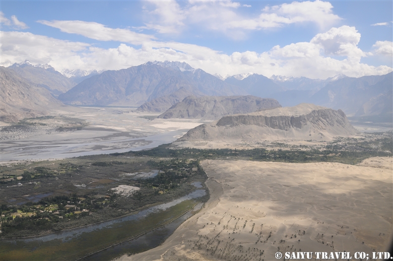
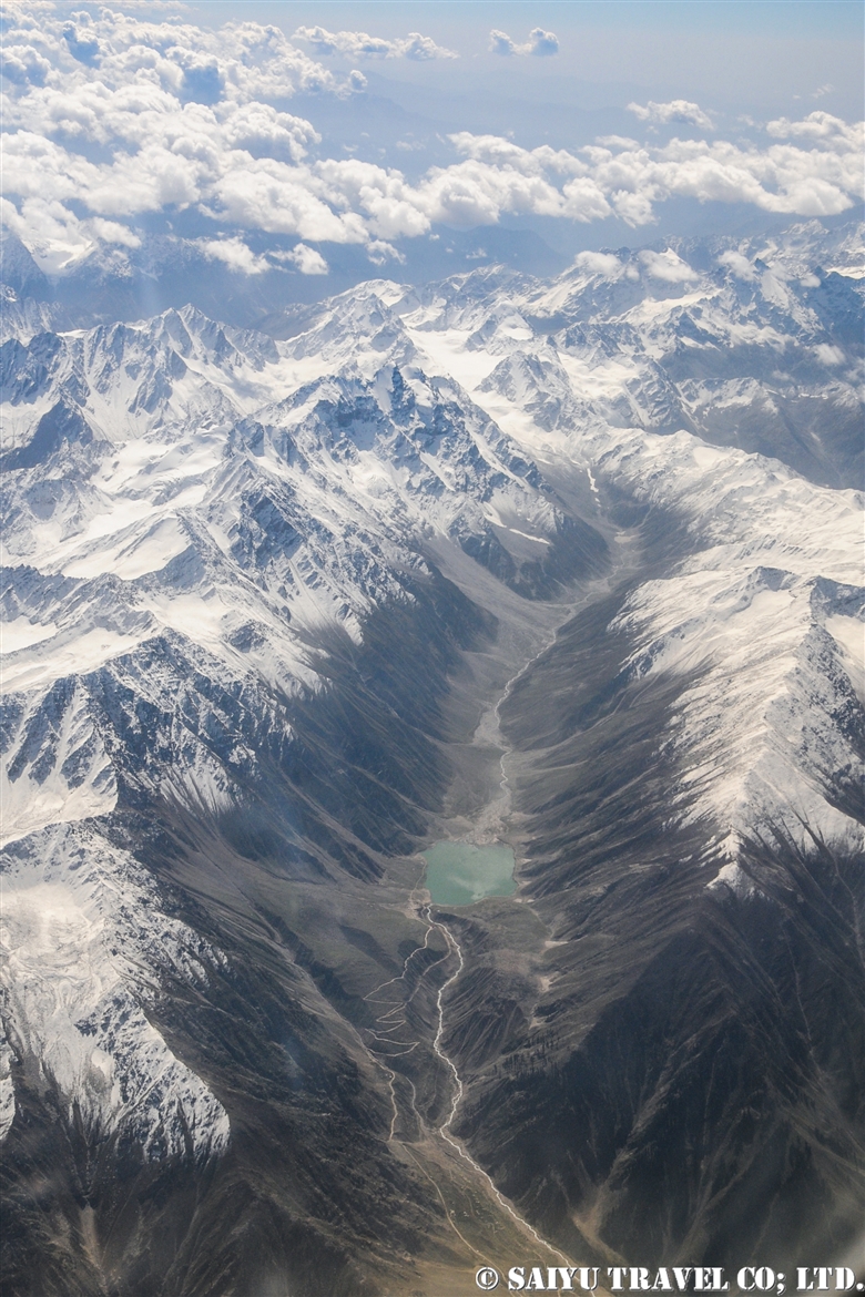
Skardu’s superb landscapes; Walking the Sarfranga Cold Desert

This is a photo of the Sarfranga Cold Desert, taken from the drone we sent up from the entrance of the Shigar Valley on the outskirts of Skardu.

Located along the Indus River in Skardu, the Sarfranga Cold Desert is a dry desert system surrounded by alpine mountains at an altitude of 2,500m (8,202 ft). The strikingly beautiful sand dunes along the banks of the Indus river, form part of the desert,

Sarfranga Cold Desert (Skardu)

It was a particularly beautiful morning, visiting these rare wonders of the world “sand dunes surrounded by snowy alpine peaks.” Even for these well-traveled people, who had already seen various deserts around the world, this was a rare sight indeed.
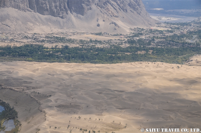
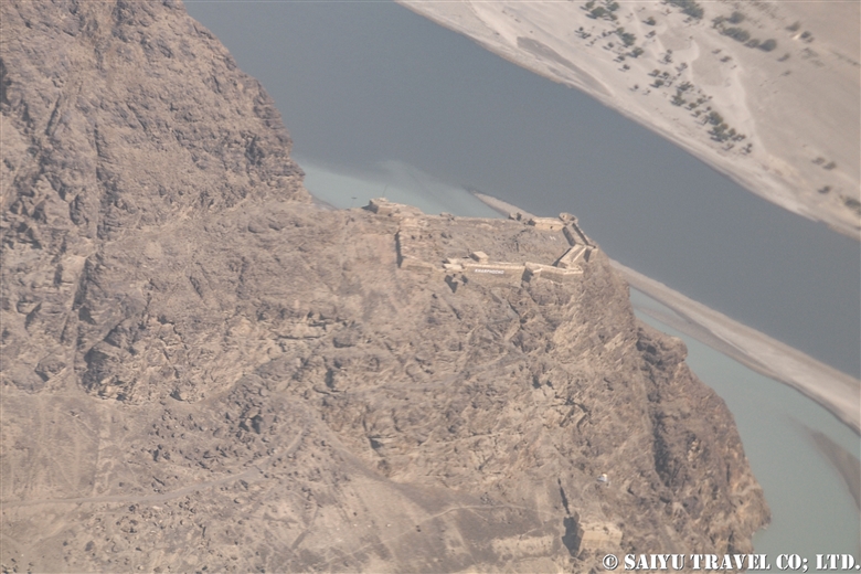
Off in the distance we could see Hussain Abad Village.

Climbing the highest dune, we could enjoy a 360°view of the high alpine peaks all around us.


Image & Text : Mariko SAWADA

Visit : Oct 2021, Sarfraga Cold Desert, Shigar-Skardu, Gilgit-Baltistan

* Contact Indus Caravan for more information or to make arrangements for your trip to Skardu !

Category : = Video Clip Gilgit-Baltistan > ◆ Video Breathtaking Views of Pakistan > ◆ Gilgit-Baltistan > - Skardu Valley > - Shigar Valley
Tag : , , , , , , , , , , , , , , , , ,

Flight PK452、Flying from Skardu to Islamabad!

In a previous blog, we already posted the video of the flight of PK451, flying from Islamabad to Skardu, so now we are posting a video from the return flight PK452 from Skardu, on a relatively good weather day. The clouds were covering Nanga Parbat, as we passed the peak around noon that day.

To the video of PK451

PK452 Skardu to Islamabad


Image & text :Mariko SAWADA

Travel date : Oct 2021, taking flight PIA 452 from Skardu to Islamabad

For the arrangement of tavel, shooting in Paistan,  please contact us Indus Caravan.

Youtube Channel – Indus Caravan  

Category : = Video Clip Gilgit-Baltistan > - Nanga Parbat > ◆ Video Breathtaking Views of Pakistan > ◆ Gilgit-Baltistan > - Skardu Valley > ◇ Mountain of Pakistan > - Nanga Parbat / Himalaya Range
Tag : , , , , , , , , , , , , , , , ,

View of Nanga Parbat from Flight PK451!

The Pakistan Airlines flight from Islamabad to Skardu on good weather days are renowned for their great views of the world’s 9th highest peak, Nanga Parbat which stands at 8,126 m (26,660 ft).

This video was taken on a sunny day in October during our visit as we flew on flight PK451. I took the video with my iPhone. I have been on this flight a number of times before, but on this day in particular, Nanga Parbat felt closer than ever before!


Nanga Parbat from PK451 (Aerial View)

The video linked below was taken with a Go Pro 10 by Amin Gazi Karim of the Indus Caravan who was on the same flight with us. His short reel highlights moments from the entire flight from flying towards Nanga Parbat to our landing in Skardu.

Skardu is now a popular destination among domestic Pakistani tourists, with flights from Karachi and Lahore during the summer season, with three arrivals a day on the weekends. Compared to in the past, there have been improvements on the flight operation rates.

The peak of Nanga Parbat taken from the airplane. There are often clouds on the peak, so we were lucky to have a really clear view.

As we approach Skardu, the snow-capped mountains and valleys begin to appear.

The flow of the Indus River has carved out the Skardu valley. Skardu Airport is right along the riverbank.

Landed at Skardu Airport. With the aim of it becoming an International Airport, there are various projects ongoing to expand it and maintenance is underway. In fact, it is located right on the boarder with India, and the military also uses the airport regularly, so there are plans for a new runway.

On November 30, 2021  Pakistan Airlines closed their branch in Japan. This airline that has connected Tokyo to Islamabad for nearly 30 years, will be gone and makes me so sad.

Thanks to Pakistan International Airlines and everyone who supported flight to Tokyo.


Image & text : Mariko SAWADA

Visit :Oct 2021, taking flight PIA 451 from Islamabad to Skardu

Category : = Video Clip Gilgit-Baltistan > ◆ Video Breathtaking Views of Pakistan > ◆ Gilgit-Baltistan > - Skardu Valley > ◇ Mountain of Pakistan > - Nanga Parbat / Himalaya Range
Tag : , , , , , , , , , , , , , , ,

Sarfranga cold desert, emerging from the sea of clouds: Skardu

The morning after it rained and snowed in Skardu. The valley all along the Indus River was bathed in fog.

Located on the banks of the Indus River in Skardu, is the Sarfranga Cold Desert. The name is based on it being at 2,500m (8,200 ft), as a high-altitude desert surrounded by high mountains. The sand along the river, forms beautiful dunes.

The sand dunes remind me of the scenery of the Sahara Desert or the Namib Desert, with the periphery of the sand dunes surrounded by peaks higher than 5,000m above sea level. Making it feel so mysterious.

Sarfranga cold desert emerging from the sea of clouds Skardu|スカルドゥ サルフランガ寒冷砂漠

This drone video was taken in the cold desert, while I was standing in the fog, operating the drone. Once the drone rose above the fog, you could see the landscape open up beautifully.

This is the scene of the fog settled over the Sarfranga dunes, as seen from the road to the Shigar Valley. The large Pakistani flag was drawn on the side of the rocky mountain.

The valley of the Indus River which flows from the Indian boarder was covered in fog.

The tips of the dunes emerging from the fog was strikingly beautiful.


Image & text : Mariko SAWADA

Visit : Oct 2021, Sarfranga Desert, Skardu, Gilgit-Baltistan

Category : = Video Clip Gilgit-Baltistan > ◆ Video Breathtaking Views of Pakistan > ◆ Gilgit-Baltistan > - Skardu Valley > - Shigar Valley
Tag : , , , , , , , , , , , , , , , , ,

Snow Leopards Etched On Rock (Indus riverside, Chilas)

There are many rock engravings which can be seen on the Indus River (Gilgit River/ Hunza River) basin in northern Pakistan, especially along the rocky shores from Shatial to Hunza, where the number are said to exceed 50,000 drawings.

The oldest ones date back to the BC, depicting hunting scenes and of the Alpine ibex, and with newer “Rock Paintings” that were carved by passing merchants, pilgrims and invaders who were all traveling on the Silk Road. On the banks of the Indus River around the Chilas area, is a sort of “Rock Carving Gallery.” When leading a general tour, I point out the carvings that were made by passing Buddhists but this time, I searched specifically for “snow leopards etched on the rocks.”


This is the scene of “Snow Leopard hunting the Alpine ibex” which can be seen from the Karakoram Highway, not far from the Chilas Shangri-La Hotel, a hotel often used by the foreign tourists.


Sometimes, the local people who dislike the images of Buddha paint over them with a lime-like substance. These are washed off and cleaned in a way as to not damage the rock carvings. 。


The ears and body have a very wolf-like shape, but the long and thick tail shows that it is a snow leopard.


The rock carvings along the Karakoram Highway have been considerably damaged by being painted over by locals. However, on the opposite riverbank across the bridge, there was considerably less damage and we could find some rock carvings in good condition.


A pagoda is depicted in the image. Early etchings were carved using a hard stone, but those of the Buddhist pilgrimages era are more delicate using more precise carving tools. The pilgrims aiming for “Gandhara,” who would have carved the image of the Buddha and the pagoda, may have been waiting out a high-water event along the Indus River, crossing here once the water levels dropped.


Not only Buddhists, but various people from different ethnicities and religions have crossed this area. This is perhaps a drawing of a person who has killed an Alpine ibex, possibly a person from Central Asia?  


And…over here, on some materials they describe this drawing being of a “mythical creature,” but it is the same as the horns of the Markhor!


A rock face with various pictures engraved on it.


It is a bit hard to make out, but it looks like a snow leopard is attacking its prey!


And on this one, it is even harder to see, but this depicts a snow leopard attacking an Alpine ibex on a cliff. It is a rare design where the artist drew the “cliff” on a rock canvas.


On the right is an ibex, and on the left, a snow leopard.


This time, I walked around for 2 hours, and could find 3 snow leopards etched in the rocks.

Unfortunately, the rock carvings in the Chilas area will be submerged by the Diamer-Bhasha Dam Project, which will be completed in the next few years. I have heard that some of the more famous rock carvings will be relocated, but most of them will be lost forever.

The drawings of wild animals etched by these ancient people are a lasting sign of their civilization and proof of that era. Isn’t there a way to conserve these somehow?


Photo & text: Mariko SAWADA

Visit: April 2021, Chilas, Gilgit-Baltistan, Pakistan

※This article was uploaded in May 2021 to http://www.saiyu.co.jp/blog/wildlife/

Category : - Snow Leopard > - the Karakoram Highway > ◆ Gilgit-Baltistan > - Indus river bank > ◇ Rock carvings / Petroglyph
Tag : , , , , , , , , , , , , , , , , , , ,

Petroglyphs of Shatial (Karakoram Highway)

Please visit our latest blog about Shatial Petroglyphs with more detail(2023)

Heading north on the Karakoram Highway as you enter Gilgit-Baltistan, the famous Buddhist archeological sites can be found between the Tangir and Darel Valleys. It is called the Shatial Rock Art Carving/Petroglyphs.

Since ancient times, this area was the point known as the “Old Silk Road” where the Indus River connects to the other valleys as a junction or crossroads.

Shatial has long been famous as a location for the “Ancient Buddhist Rock Carvings,” but even before these carvings were there, the tradition was for travelers, such as merchants and pilgrims, passing through Central Asia would carve their names and times into the rocks. These images of ancient characters (Sogdian or Bactrian) can be found near the bridges of Shatial.


People graze their goats along the banks of the Indus River. Rocks that were weathered down by water and time into sand. This is a place where people used to come to look for gold, but not so much anymore.


Taking the bridge that hangs over the Indus River in the Tangir Valley. Travelers from afar would cross this river during the winter months when the water was low, etching their footprints in the riverbanks. During the Buddhist era, monks and pilgrims would make their way to  “Gandhara.” They carved the Jataka tales and Stupas into the large rocks, creating an alter on the riverbanks.


The bridge of Shatial and Art Rock Carvings. Depicted is a stupa and the form of a Buddha carved into the stone.


Motifs of ibex are also engraved on the upper right. Ibex only live in elevations of 3,000m or higher so possibly the travelers saw them on the way along the Hunza River as they crossed the Hindu Kush – Karakoram Mountain range. There are no dates or names of the artists included with each carving, but these are precious relics that pay tribute to the history and people who have lived here since ancient times.


Sadly, the scenery along the Indus river is about to change.

There are two major projects to build dams between Besham and Chilas along the Karakoram Highway. There will be the Dasu Dam and Daimer Basha Dam Hydroelectric Power Plants installed along the river.
Although this plan has been in place for a long time, the construction is proceeding at a very fast pace as there is a shortage of power. This is following a decision to cancel the plans for a coal burning power plant.

Parts of the Karakoram Highway and some villages will be submerged, but along with that the historical features and the lifestyle of the people who live along the Indus river will also be forever altered. It is a great pity that such scenery along this great river will be lost.

Some of the main rock paintings will probably be relocated, but many of them will be submerged.

How much time does this scenery have left?

It was hard to get to and such a long-distance trip to get to see the Karakoram Highway and landscape. But it is in its final countdown.

Will this end up being only a precious memory?


Photo & Text : Mariko SAWADA
Visit: Dec 2020, The Karakorum Highway, Shatial, Gilgit-Baltistan

Category : ◆ Gilgit-Baltistan > - the Karakoram Highway > - Indus river bank > ◇ Rock carvings / Petroglyph
Tag : , , , , , , , , , , , , , , , , , , , ,

Pakistan International Airlines, take off from Skardu! The full picture of Nanga Parbat!

This is a description of my flight from Skardu to Islamabad using Pakistan International Airlines.

The Gilgit flight is usually very early in the morning, and due to the sunrise from behind the Nanga Parbat, everything looks white. However, the Skardu flight takes off a little later, when the sun is higher up in the sky. So it means the mountains are beautifully illuminated, although it may be a little cloudier when compared to the early morning hours.


When you take off from the Skardu Airport, you will see the outlying villages on the edges the city, poplar-lined streets, the Indus River, and boundary of the Katpana Desert.


The Skardu Fort, also known as Kharpocho, was built on a cliff along the Indus River in the 16th century.


Sand dunes in the Cold Desert can be seen stretching from the Skardu Valley to the Shigar Valley. It is a rare desert at a high altitude of about 2,500 m, which is quite unique in the world. The sand dunes are small and scattered from Ladakh, India’s Nubra Valley to Skardu but the dunes get bigger and more beautiful in the area from Skardu to Shigar.


This is Nanga Parbat, the 9th highest peak in the world. When I left Skardu, I thought it would be too cloudy and we wouldn’t be able to see it, but the southwestern side was clear.


The summit looked to be very windy, blowing the snow off the peak.


The main peak of Nanga Parbat is at an elevation of 8,126m, and the banks of the Indus River are at about 1,100m. So from the window of the plane, you can see the topography with a height difference of 7,000 m! It’s a really rare opportunity to be able to see 23 kilometers straight down and be able to compare the height of the mountains.


And this is the whole picture of the Nanga Parbat massif. The north side Chongra Peak, Raikot Peak, and the Main Peaks.


This is deep in the Naran Valley, Saiful Maluk Lake. It used to be such a pristine place, but regrettably, it has become a sad example of a tourist destination that has become full of garbage, due to the increase in visitors in recent years.

Well, we are coming back to reality now, and soon we’ll enter the Punjab Plain and touchdown at Islamabad.


Photo & Text : Mariko SAWADA
※These photos were taken on a September flight from Skardu to Islamabad on Pakistan International Airlines.

Category : ◆ Gilgit-Baltistan > - Skardu Valley > - Nanga Parbat / Himalaya Range
Tag : , , , , , , , , , , , , , ,