Flight PK452、Flying from Skardu to Islamabad!

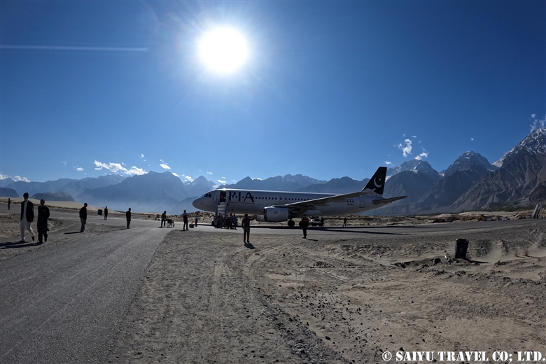
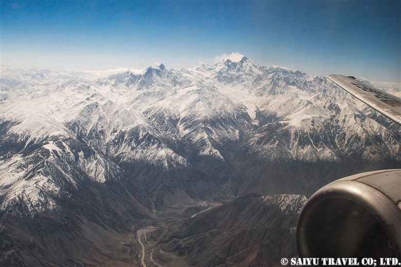
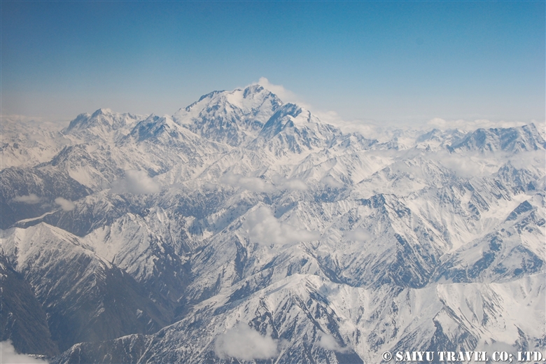
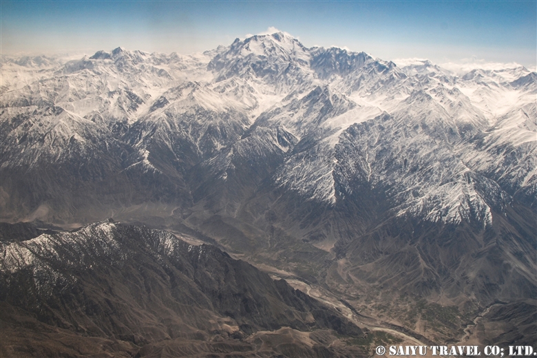
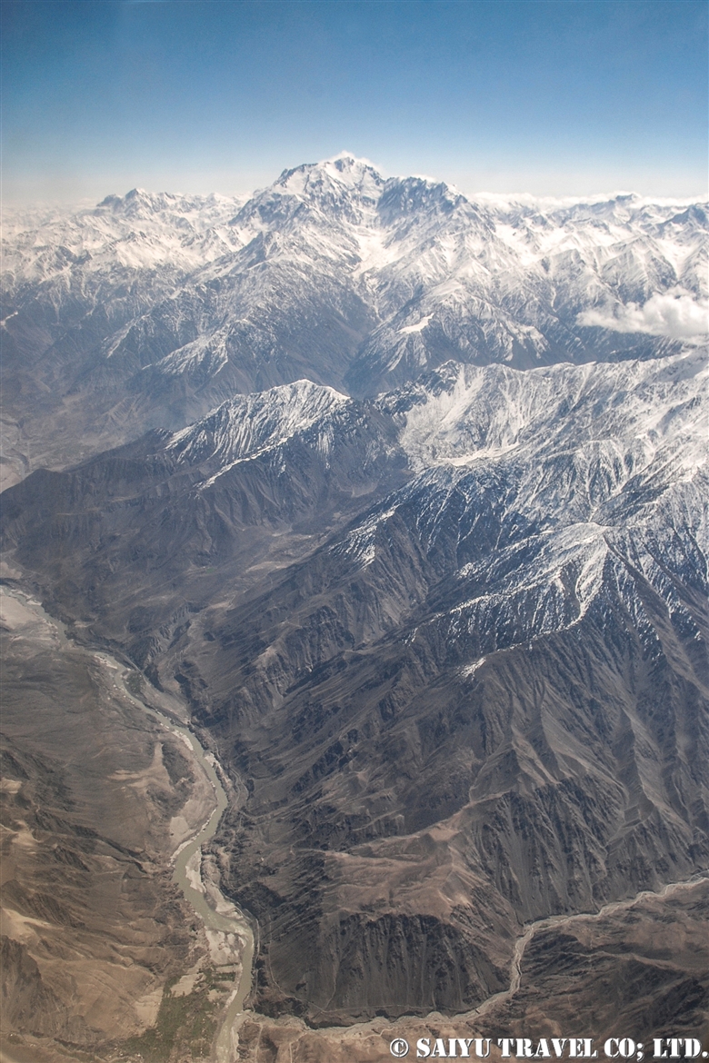
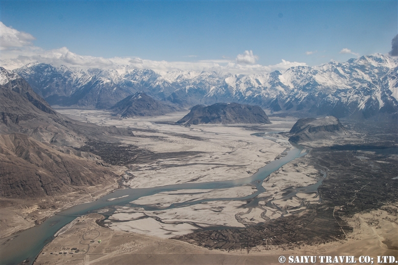
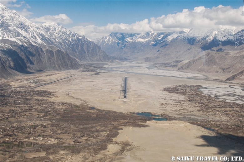
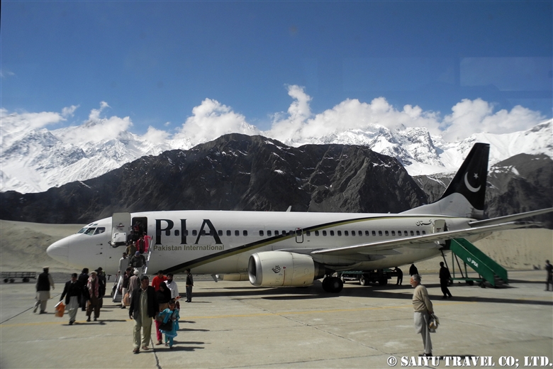
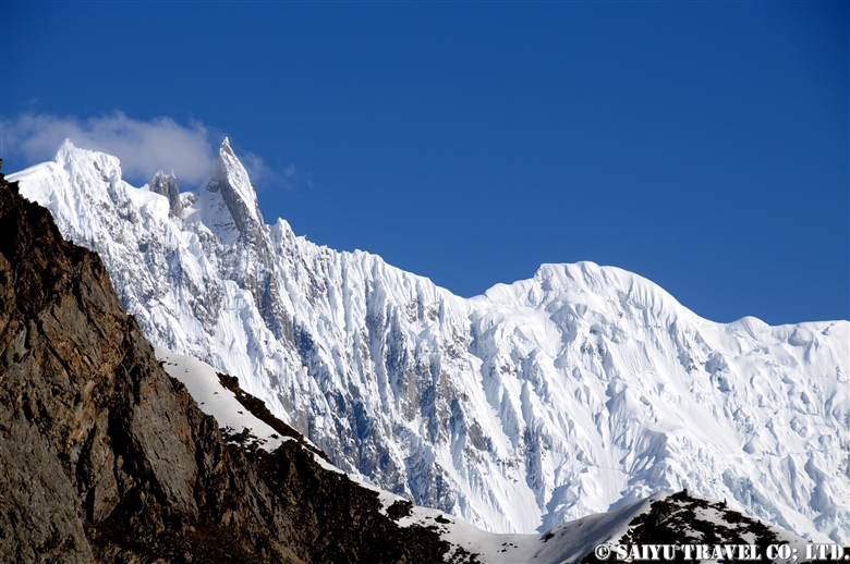
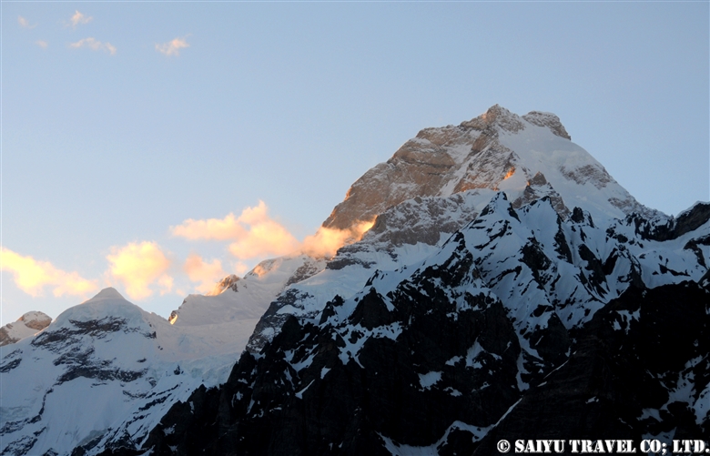
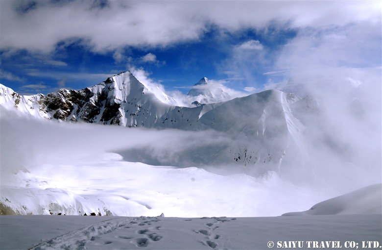
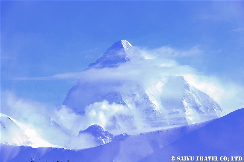
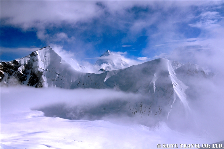
In a previous blog, we already posted the video of the flight of PK451, flying from Islamabad to Skardu, so now we are posting a video from the return flight PK452 from Skardu, on a relatively good weather day. The clouds were covering Nanga Parbat, as we passed the peak around noon that day.

To the video of PK451

PK452 Skardu to Islamabad


Image & text :Mariko SAWADA

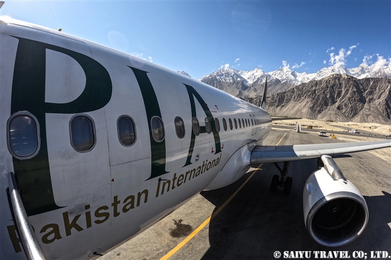
Travel date : Oct 2021, taking flight PIA 452 from Skardu to Islamabad

For the arrangement of tavel, shooting in Paistan,  please contact us Indus Caravan.

Youtube Channel – Indus Caravan  

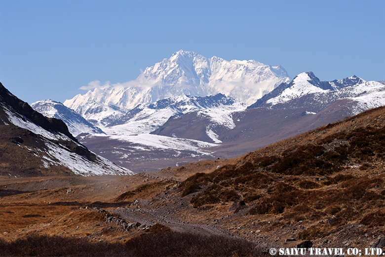
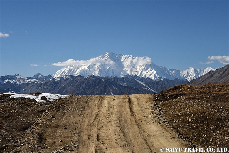
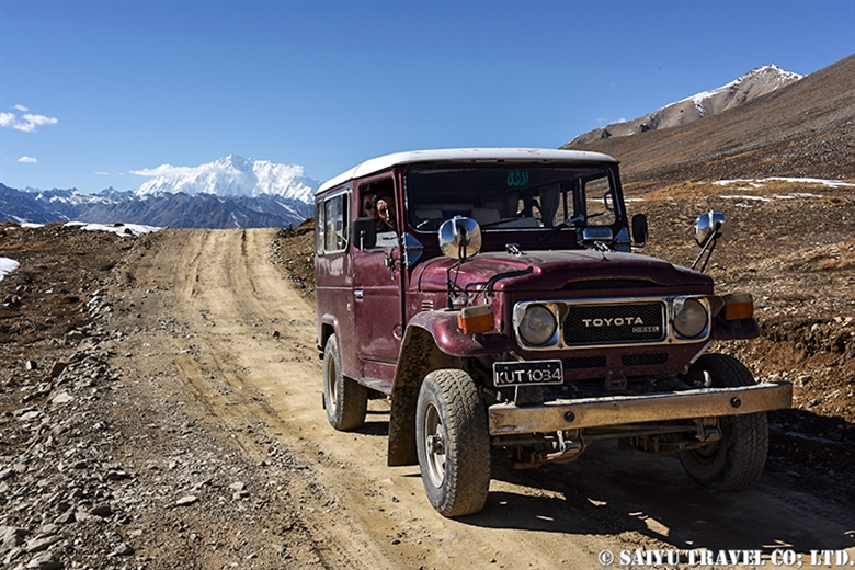
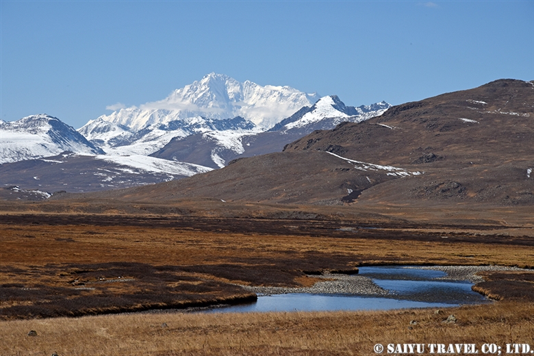
Category : = Video Clip Gilgit-Baltistan > ◆ Video Breathtaking Views of Pakistan > - Nanga Parbat > ◆ Gilgit-Baltistan > - Skardu Valley > ◇ Mountain of Pakistan > - Nanga Parbat / Himalaya Range
Tag : , , , , , , , , , , , , , , , ,

View of Nanga Parbat from Flight PK451!

The Pakistan Airlines flight from Islamabad to Skardu on good weather days are renowned for their great views of the world’s 9th highest peak, Nanga Parbat which stands at 8,126 m (26,660 ft).

This video was taken on a sunny day in October during our visit as we flew on flight PK451. I took the video with my iPhone. I have been on this flight a number of times before, but on this day in particular, Nanga Parbat felt closer than ever before!


Nanga Parbat from PK451 (Aerial View)

The video linked below was taken with a Go Pro 10 by Amin Gazi Karim of the Indus Caravan who was on the same flight with us. His short reel highlights moments from the entire flight from flying towards Nanga Parbat to our landing in Skardu.

Skardu is now a popular destination among domestic Pakistani tourists, with flights from Karachi and Lahore during the summer season, with three arrivals a day on the weekends. Compared to in the past, there have been improvements on the flight operation rates.

The peak of Nanga Parbat taken from the airplane. There are often clouds on the peak, so we were lucky to have a really clear view.

As we approach Skardu, the snow-capped mountains and valleys begin to appear.

The flow of the Indus River has carved out the Skardu valley. Skardu Airport is right along the riverbank.

Landed at Skardu Airport. With the aim of it becoming an International Airport, there are various projects ongoing to expand it and maintenance is underway. In fact, it is located right on the boarder with India, and the military also uses the airport regularly, so there are plans for a new runway.

On November 30, 2021  Pakistan Airlines closed their branch in Japan. This airline that has connected Tokyo to Islamabad for nearly 30 years, will be gone and makes me so sad.

Thanks to Pakistan International Airlines and everyone who supported flight to Tokyo.


Image & text : Mariko SAWADA

Visit :Oct 2021, taking flight PIA 451 from Islamabad to Skardu

Category : = Video Clip Gilgit-Baltistan > ◆ Video Breathtaking Views of Pakistan > ◆ Gilgit-Baltistan > - Skardu Valley > ◇ Mountain of Pakistan > - Nanga Parbat / Himalaya Range
Tag : , , , , , , , , , , , , , , ,

Best Views of Nanga Parbat! PIA Pakistan International Airlines ★ Skardu Flight

A panoramic view of the Nanga Parbat massif from a flight from Islamabad to Skardu

These mountain flights in northern Pakistan are often canceled. The reason is, of course, the quickly changing weather in the mountains. Considering that, in the last few years, the flight rate has improved considerably. In particular, if you were to try to move by car the distance of the Skardu flight, it would take two full days by land. But taking this “picturesque flight” it only takes one hour to travel the same distance.

You should really see this scenery from the Skardu flight! For the Skardu line, if taking the regular route (depending on the weather), you will see Nanga Parbat on the right and K2 on the left (if you are lucky!) just before arriving in Skardu. K2 is often hidden by the clouds and is only visible a little at the very end of the flight. So sitting on the Nanga Parbat side will give you more time to enjoy the mountainous view.

When you take off from Islamabad, you will increase altitude while slowly circling up in the Punjab Plain. Soon, you start to see the mountainous view at the western end of the Himalayas. If you look closely below, you can also see the Indus River and the Karakoram Highway running alongside it.


Nanga Parbat is seen as a gigantic mass of mountain. It is 8,126m, the 9th highest peak in the world.


My personal favorite is to see both the Indus River and Nanga Parbat. It’s hard to see in the photo, but below you can see the Indus River and the Karakoram Highway. The Indus River is a large river that crosses the border from Ladakh, India, and enters Pakistan passing through Skardu, and flows beyond that into the Arabian Sea.

This great mountainous region of Pakistan borders the Indus River. The Himalayas to the south of the great river and the Karakorum Mountains to the north of it. This is where the ancient Indian Plate and the Eurasian Plate collided to form these vast mountain ranges.


And in this photo, at the bottom, the altitude of the riverbank of the Indus River is 1,100-1,200m, while at the top, the summit of Nanga Parbat is 8,126m. If you draw a straight line, there is a height difference of 7,000m in a distance of about 23km!


Shortly after the view of Nanga Parbat disappears, you enter the Skardu Valley. Surrounded by the mountains of Karakorum, the open valley of Skardu contrasts so much. It is a magnificent view shaped by the Indus River.


Pakistan International Airlines circles around the town of Skardu, which is like an oasis lined with poplar trees. You will see Satpara Lake and finally land at the airport in Skardu.


Arrived safely in Skardu.

Can you see the mountains if you can’t get the window side? ···Nope!  There is no choice but to take turns looking out the small airplane windows. And…should your flight be cancelled, you have to stay flexible and just be content to enjoy the views of the Karakoram Highway and the mighty Indus River from the car!


Photo & text: Mariko SAWADA

*The photo is taken from the right seat of the actual Pakistan Airlines Skardu flight.

Category : ◆ Gilgit-Baltistan > - Skardu Valley > ◇ Mountain of Pakistan > - Nanga Parbat / Himalaya Range
Tag : , , , , , , , , , , , , , , ,

Crossing the Gondogolo La Pass from the Baltoro Glacier

The quiet peak of Karakorum before dawn seen from Gondogolo La (pass). From the left, K2, Broad Peak, G4, G3, G2, G1.


The route over Gondogoro La (at 5,680m), considered to be the ultimate trekking route to see K2, the second highest mountain in the world. As it requires snow wall climbing gear, make sure to check the rope work skill  thoroughly.


Taking glimpses behind us at K2 and Broad Peak, every now and then, we head toward  our base camp, Ali Camp (5,010m), to get over Gondogoro La. Checking in with the Islamabad office by satellite phone, we get the weather report. Fortunately, it will be clear tonight, so without hesitation, we decide to make our climb before dawn.


Our porters always carry the heavy equipment that we all use. This elderly man passed us quickly as we all crossed the Gondogoro La Pass, without much difficulty and waited for our mountain descent back at the camp. The local staff are always amazing through it all. Hats off to them for sure.


1am: Head out from base camp. Climbing up a snow wall using jumar, with an average slope of 50 degrees.


At last, 5:20 on July 6, 2012, we arrived at top of Gondogoro La!
A photo of my youthful self and the ridgeline behind me are K2 and Broad Peak.


As the sun rises, the down slope becomes a little loose and the risk of avalanche and rockfall increases. We rushed to get down the mountain.


A long, steep descent is more difficult than the climb up.


We arrived in a totally different world from the snow and ice world we just left high above. Camping in Khuspang, a lush campsite where so many alpine plants bloom.

I could finally let go of all the tension I was storing until now, and I slept like a log.


Photo & text :  Tomoaki  TSUTSUMI  from the expedition in Jun-July 2012


Category : ◆ Gilgit-Baltistan > ◇ Mountain of Pakistan > - Karakorum Range
Tag : , , , , , , , , , , , , , ,

Shimshal Pamir : Getting Over the Shopodin Pass(5,346m)with 52 Yaks and 61 People

This entry is about the the Shimshal Pamir journey in June 2011. In this trip, I was focused on the ‘yak route’. In 1993, the ‘Tang route’ was created because the Yaks could not pass there.  This ‘yak route’ allowed the Shimshal people to connect to the meadows, passes and villages together during their seasonal passage. One of the most daunting, as well as a highlight of the route, is going over the Shopodin Pass (5346m/ 17,540ft).

This time, as a record in the history of Shimshal, 52 yaks, and 61 people (11 Japanese, 3 Saiyu Travel staff of Pakistan [Pakistanis] and 47 Shimshal villagers) challenged the pass.


Climbing the Shopodin Pass. At the end of June, after over 5,000m elevation, there were pockets of remaining snow, and the melting snow water created muddy waterfalls. I climbed over a 150m of rocky terrain and from there on, rode on a yak directly to the top of the pass.


Nearing the top of the pass soon. This is Mr. Qazi, who is known as the Shimshal village ‘Yak Master’. In his youth, he had climbed high peak in the past, but today, he rode his own yak over the pass.


Just before reaching the top of pass, we offered our prayers of gratitude.


At the top of Shopodin Pass. Blessed with good weather, the view of the pass where we reached with the yak and the villagers was utterly breathtaking. From the cliff edge of Shopodin Pass at 5,346m, the even taller ranges of the Upper Hunza Passu’s Sispare and beyond to the Hisper Mustagh mountain range’s Distaghil Sar, Adver Sar, etc. a panorama of 7,000m peaks, an amazing landscape spreads out before us.

Later, there was a celebratory dance on the top of Shopodin Pass. When you are happy, you dance…that is the culture of the Pakistanis in the city as also, for the Pakistanis in the mountains. In this Shimshal mountain trip, I heard many times, the songs by the elders, ‘Pamir means a rich pasture where humans and livestock living together’. I was deeply touched by this song which celebrates living with nature and giving thanks to the beauty of it.


So the difficult thing about the Shopodin Pass, is not uphill but the downhill climb. The dry 35-degree inclination downwards opposite the snow slope is the hardest section of the pass. Some paths are muddy with the snow water, and some are slippery rocky ledges.


It took about 2 intense hours of downhill paths, until we could reach the destination of the Zargarben – Shopodin camp site. Of course, the yaks could make their way down quickly and were already there eating grass when we arrived.


The next day, we arrived at Shimshal village. It would be the last day where I would walk together with the yaks and villagers. There was only a few more hours to be together with the team, that had challenged the journey for the last 12 days.

I offer my deep gratitude to the Shimshal villagers, the yaks and their handlers, the mountain guides, porters and everyone who participated in this tour.


Photo & text: Mariko SAWADA
Visit: Jun 2011, Shopodin Pass, Shimshal, Gilgit-Baltistan

※This article is an updated version of the blog posted in ‘Salam Pakistan’ in July 2011.

Category : ◆ Gilgit-Baltistan > ◇ Mountain of Pakistan > - Shimshal
Tag : , , , , , , , , , , , , , , , , , ,

K1- Masherbrum from Hushe valley

The glorious K1 Masherbrum (7,821 m) seen from the Hushe valley. You can clearly see it from near the Hushe village, but we went towards the camp of Brumbruma a little further.

In June, a lush green beautiful village of Hushe. It is a village that is an another gateway to the Karakoram.

A camp of Brumbruma, 4,500 m above sea level. No doubt, it was a snowy year.

“The Snow Leopard’s trap”, I saw on the way to Brumbruma from the Hushe village. Unquestionably, Snow Leopards must be protected at any cost… This seems to be an old one, and there are a lot of Snow Leopard sightings in the Hushe valley. Villagers here proudly say, “Come in the winter, We will show you the Snow Leopard.”

Majestic figure of Masherbrum.

A series of beautiful and sublime ice walls.

From the camp of Brumbruma, Masherbrum in the golden colors of sunset.


Photo & Text : Mariko SAWADA
Visit : Jun 2010, Brumbruma Camp, Hushe Valley, Gilgit -Baltistan

Category : ◆ Gilgit-Baltistan > ◇ Mountain of Pakistan > - Karakorum Range
Tag : , , , , , , , , , , , , , ,

Gondogoro-la from Hushe side, K2 appeared from the clouds

It is a record of a long time ago. In June, when there was a lot of snow, I climbed the Gondogoro La from the Hushe side.
The climbing on the Hushe side was long and challenging. Nevertheless, I continued to climb in the midst of the falling snow, and I was assuring myself not to expect the view of the mighty K2, “I may not see the scenery even if I go up”.
Indeed, it was enveloped in the clouds when we reached. I wanted to wait for a while but we couldn’t relax too much because we were worried about the risk of avalanche on our way back.

Suddenly, a miracle happened. The clouds ahead of the staff who went to Ali camp direction broke and K2 emerged from within.

View of K2 from Gondogoro La.

It was for a really short time, and a scene that I felt resembled “Space”.
The camera settings were also crazy during the climbing and the colors were a little funny. Nonetheless, every minute was rewarding.

Ali Camp side from Gondogoro La.

The way down to Hushe side, Khuspan Camp.

Finally, I went downhill at once to reach to our camp. At the camp, cook prepared some succulent “Tempura” for me…  it was quite heavy after the climbing!

Photo & Text : Mariko SAWADA
Visit : Jun 2010, Gondogoro-la, Hushe Valley, Gilgit -Baltistan

Category : ◆ Gilgit-Baltistan > ◇ Mountain of Pakistan > - Karakorum Range
Tag : , , , , , , , , , , , , , ,

Nanga Parbat (8,126m) from the Deosai Plateau

Nanga Parbat, the ninth highest mountain in the world. It is a mountain also known as, “The Killer Mountain”, because many climbers died on their way to the summit, during the last century.

There are several famous places from where you can have a breathtaking view of Nanga Parbat. Such as Fairy Meadows, Herrligkoffer Base Camp, that overlooks the Himalaya’s largest ice wall, “Rupal Wall”, with the differences of 4,500 meters.

Nevertheless, Nanga Parbat from the Deosai Plateau side is also admirable!

We entered “Deosai National Park” from the Chilam gate.
Brace yourself. This is just a view from the entrance of “Deosai Plateau”.

You can see this splendid sight just from the roadway!

Soon you will see picturesque Sheosar Lake with reflecting blue water… It is at an altitude of 4,140m.
From here you can see Nanga Parbat, against the backdrop of the lake, in the sky.

We drove further to Kala Pani from Sheosar Lake. Nanga Parbat can be seen from the heart of Deosai plateau.

We visited this place in early October. The temperature of the camp at night dropped to below freezing, but I was able to see the beautiful Nanga Parbat, blessed with the fine autumn weather.

Photo & Text : Mariko SAWADA
Visit: Oct 2015, Deosai Plateau, Gilgit-Baltistan

Category : ◆ Gilgit-Baltistan > - Deosai National Park > ◇ Mountain of Pakistan > - Nanga Parbat / Himalaya Range
Tag : , , , , , , , , , , , , , , ,