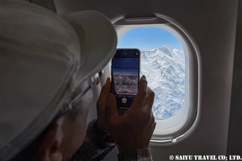
The domestic flight from Islamabad to Skardu is known for its spectacular mountain scenery when the weather is clear. In particular, Nanga Parbat (8,126m), the world’s ninth highest peak, can sometimes be seen directly in front of you (on the right side window seats (F) during outbound flights and the left side window seats (A) during return flights).
> A Video Showcasing the View of Nanga Parbat From Flight PK451
We generally recommend the Nanga Parbat side, but the view from the other side is quite remarkable as well.
The following is a report of my viewing experiences on both the seat A side (the non-Nanga Parbat side) and the seat F side (the Nanga Parbat side) of PK451, which I recently boarded.
In terms of airlines, both Air Blue and Pakistan International Airlines flights will offer similar views, but it is important to note that the exact scenery you see will differ depending on a number of factors, including the distance and route to Nanga Parbat, the weather, and the captain’s instructions at that time. Please keep that in mind while reading this article.
Detailed timeline of a flight scheduled to depart Islamabad 10:00 a.m.
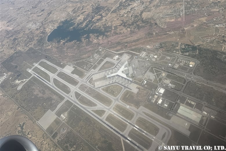
10:10 Takeoff from Islamabad Airport
10:12 Turn around, heading north.
10:14 (A side) Passing over Islamabad Airport
10:19-20 (A side) Spotted the Tarbela Dam and the Indus River on the left. During the summer season, the color of the Indus River is muddy due to the melted water from glaciers.

10:20 (A side) Tirich Mir (7,708m), the highest peak in the Hindu Kush, begins to come into view. It is the westernmost peak in the Hindu Kush mountain range, so it is easy to identify. Tirich Mir will remain visible for a while. Noshaq (7,492m), the highest peak of the Hindu Kush in Afghanistan, is just behind Tirich Mir and seems to be hidden from view.

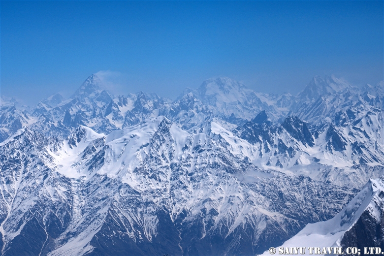
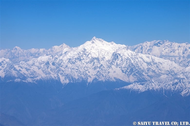
10:36 (F side) The 8,126-meter summit of Nanga Parbat lies in front of us. Nanga Parbat itself was visible from a bit earlier in the flight. On this day, we flew a route close to the peak of Nanga Parbat.

10:37 (F side) The peak of Nanga Parbat stood directly before our eyes.

10:38 (A side) The Hunza valley and Rakaposhi (7,788m) can be seen in the distance.
10:43 (A side) The steep mountains of the Karakorum, Baintha Brakk (7,285m), Ogre Ogre II, and Latok group (Latok I, II, III) along the Biafo Glacier are visible.
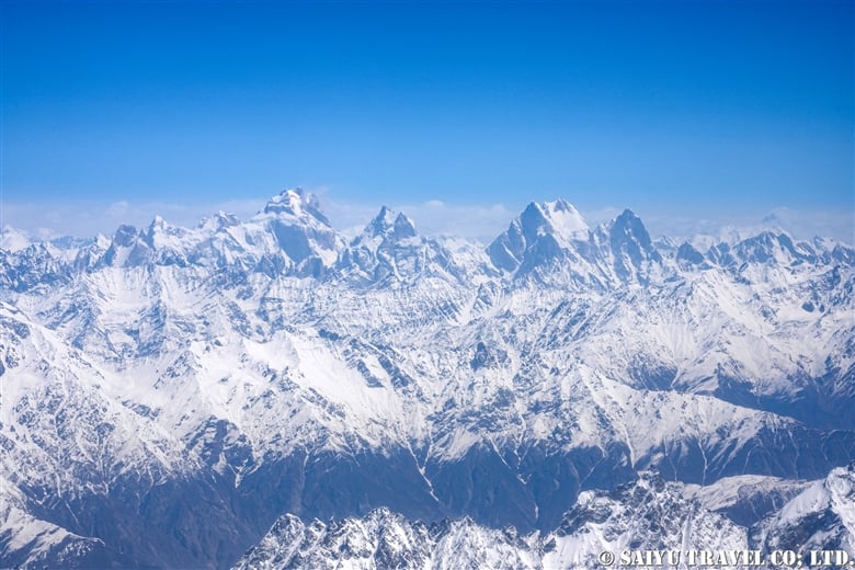
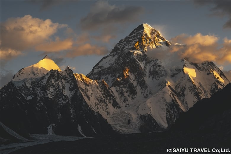
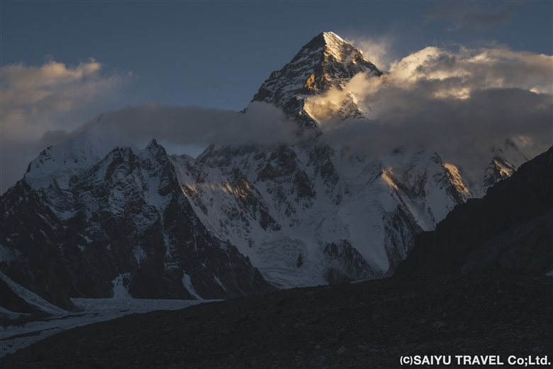
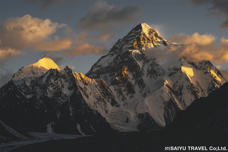
10:44 (A Side) K2 (8,611m), the second highest mountain in the world and Broad Peak (8,051m) begin to come into view. By this time, an in-flight announcement about the descent comes on. As the plane lowered altitude, I was impatient as K2 and other high peaks in the mountains in front of us became less and less visible.

10:45 (A side) K2 and Broad Peak, though only about half of each mountain is visible
10:46 (A side) Started descent. The mountains in the foreground are the peaks of the Shigar Valley, including Peak-B12.
10:46 (A side) The Skardu valley is now spread out in front of us; if seated on the F side, one should be able to see Satpara Lake.
10:47 (A side) I could see the runway of Skardu’s airport, which was built in the desert along the Indus River.

10:50 Turned around for the final approach.
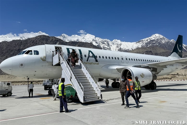
10:52 Landed successfully in Skardu Airport, surrounded by mountains. Most tourists took a picture before disembarking from the aircraft and boarding the bus to the terminal.
Skardu used to have only one flight a day from Islamabad, but now during the summer season, there are also flights from Lahore and Karachi, with six flights a day on domestic routes alone. In addition, international flights from Dubai have also started, and Skardu is rapidly growing as a tourist destination and mountain resort. On a clear day, this flight can definitely be counted among one of the area’s prime tourist highlights!
People often ask me whether I prefer the Nanga Parbat side or the K2 side. To that I would simply say that the Nanga Parbat side (the F side) is the one which allows most people to get the best view the majority of the time (provided, of course, that the weather is good).
The mountains visible from the A-side seats are difficult to recognize without prior study or experience, but for repeated trekkers and climbers to Pakistan, the view on the A-side will also be enjoyable, as they will be able to search for the mountains throughout the flight.
Another question I am often asked is which airline operates more smoothly, Pakistan International Airlines or Air Blue? To be honest, it all comes down to luck.
Image & Text: Mariko SAWADA
Flight Date: 27 April 2025
*The article uses actual time and photos taken during the flight. The view of the mountains on this route may vary depending on the weather and the route taken at that time. We ask that you take this into consideration before booking a flight.
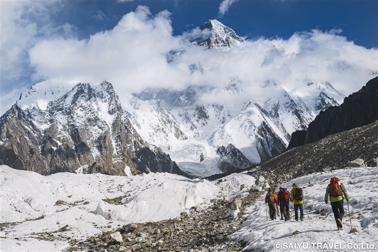
*Contact us, Indus Caravan for more information or to make arrangements for your stay and adventure in Pakistan.
*Please follow us on Youtube, Instagram & Facebook
Category : ◆ Gilgit-Baltistan > - Skardu Valley > ◇ Mountain of Pakistan > ◇ Pakistan Travel Tip > - Karakorum Range
Tag : Air blue , Concordia , K2 , Broad peak , Indus Caravan , Baltoro , k2bc , Saiyu Travel , Blaltoro glacier , PK451 , pakistan domestic flight , Tour operator Pakistan , Skardu flight , Pakistan photograhy tour , Skardu