”The King’s Road” Traveling to the end of Grand Trunk Road

When driving from the capital city of Islamabad to Peshawar, you might be asked “Will you take the motorway? Or the GT Road?”

This GT Road refers to the “Grand Trunk Road” the main road of the ancient Mughal Empire or “The King’s Road” Of course, it looks just like any other modern asphalt road, but it has a deep history.

In the first place, “The King’s Road” = Grand Trunk Road is an extensive network created by the Afghan dynasty Sher Shah Suri who, in the 16th Century, took power after the Mughal Empire and set about improving the roads. During the brief reign of the Suri Empire, the road from Agra to his hometown Bihar (India) was first completed. Then eastward to what is now Bangladesh, the road to Sonargaon was made. And westward to Multan, which is now Pakistan. The Mughal Empire returned and the whole Empire was expanded from the current port of Chittagong (or Chattogram), Bangladesh to the east, across the Khyber Pass to Kabul, Afghanistan, and developed into a vast Mughal Empire.

This “King’s Road” was rebuilt during the British India era. The British launched three invasion towards Afghanistan but failed to colonize it. This section from Calcutta to Peshwar, ending just before Afghanistan, was given the name “Grand Trunk Road” and it remains so to this day.
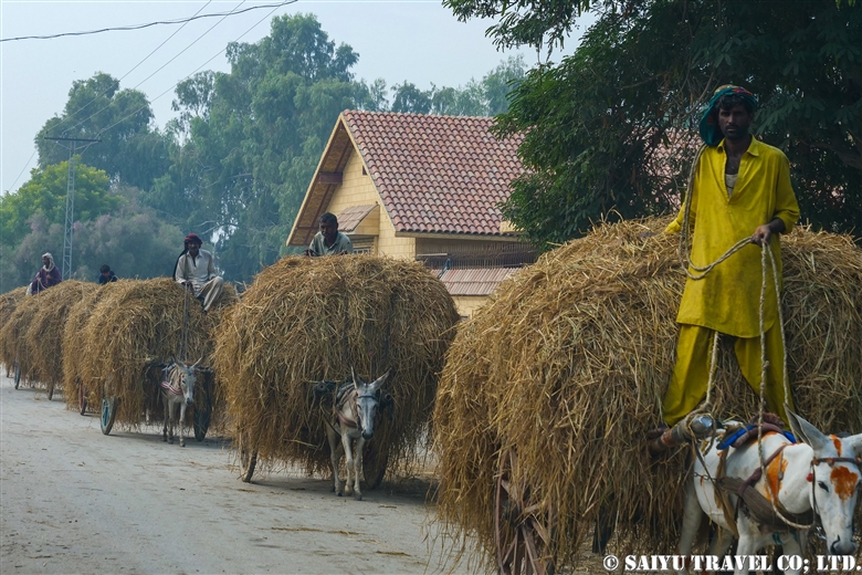
There are still remnants of the glory days of the prospering “Grand Trunk Road” that have been retained in small pockets.

Mughal Era Cobblestone Road

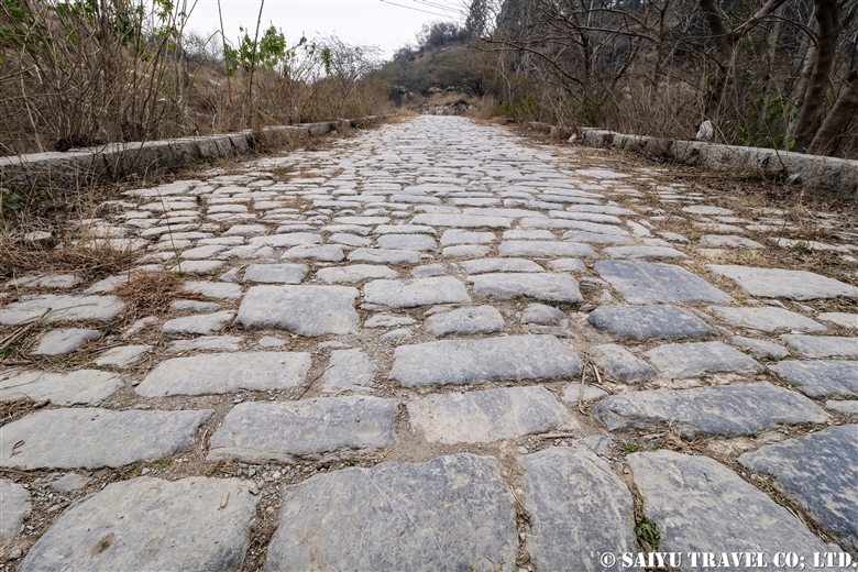
On the outskirts of Islamabad, there remains a cobblestone road from the Mughal Empire’s Grand Trunk Road. It can be found just beside the more modern GT Roads. The cobblestone road has the traces of wear by carriage wheels that travelled over it for so many years.

Lahore Fort (a UNESCO World Heritage Site)

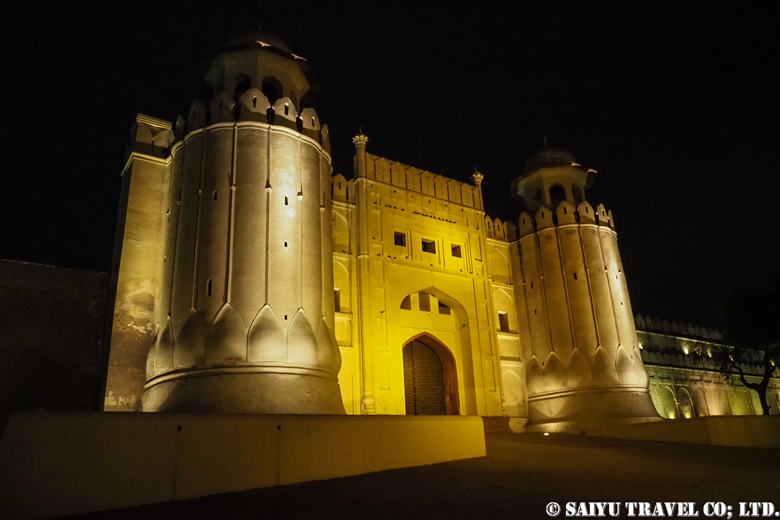
The ancient capital of the Mughal Empire, Lahore. Since then, many buildings have been built on top of the original castle that remains since the Mughal era. This is a photo of the main gate at night, Alamgiri Gate. The Shah Jahan period was when the gorgeous additions were made with the famous Sheesh Mahal “Palace of Mirrors” reminiscent of the prosperous times of the Mughal Empire.

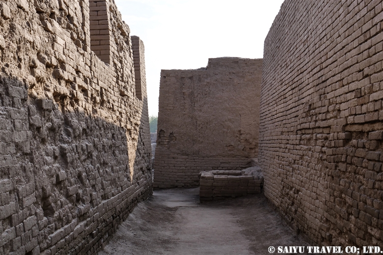
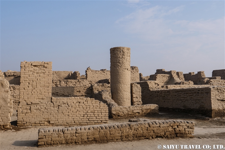
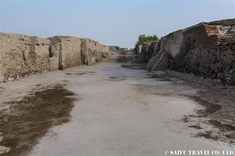
Rohtas Fort (a UNESCO World Heritage Site)

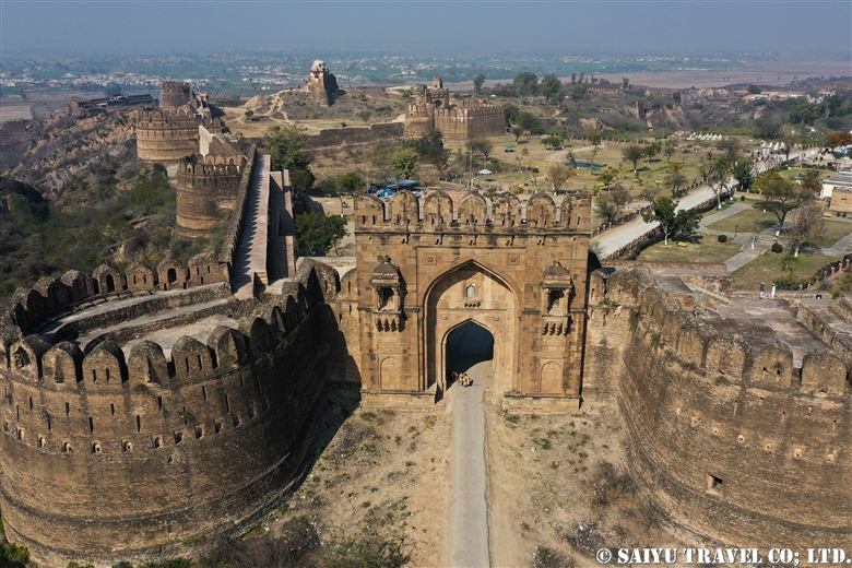
Built by Sher Shah Suri, sitting above the Grand Trunk Road. The Rohtas Fort was built by Sher Shah Suri to protect the strategic road from Peshawar to Lahore.
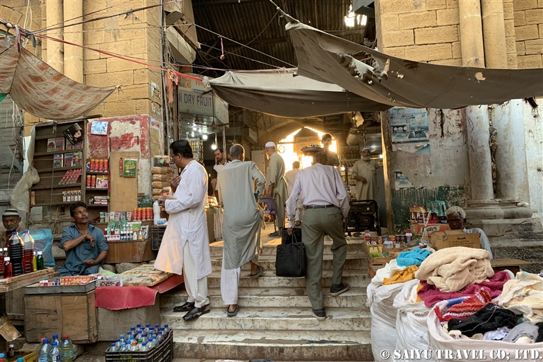
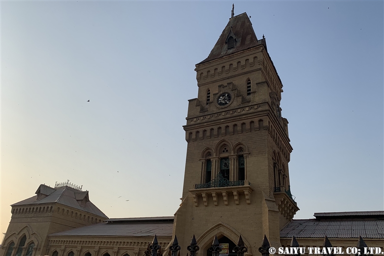
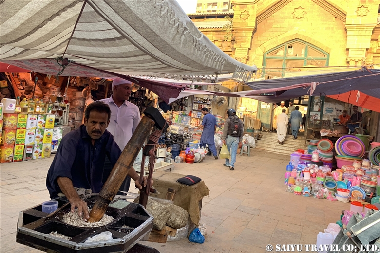
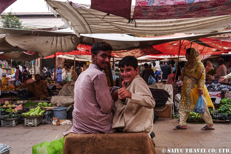
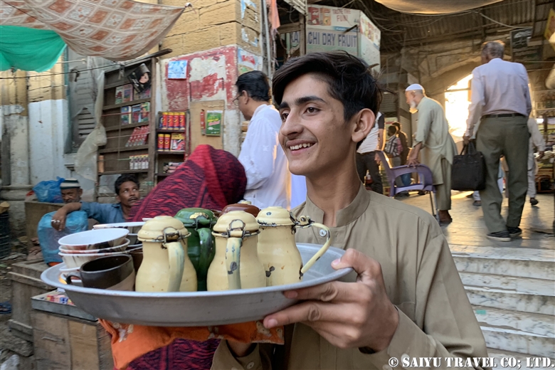
Caravan Serai

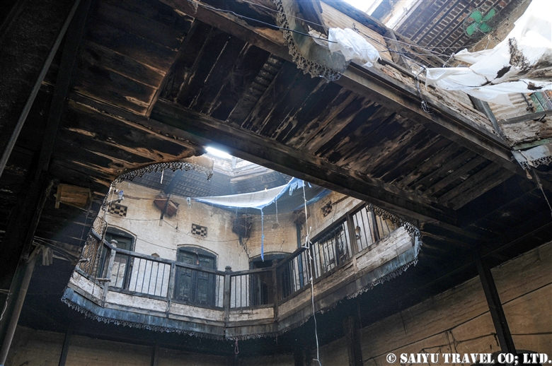
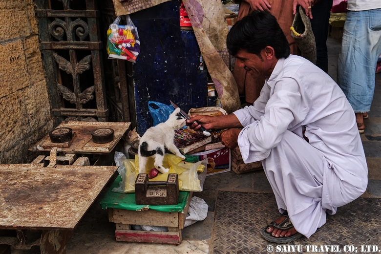
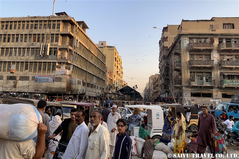
In the old bazaar of Peshawar, remains the caravan serai  which was a place for travelers to rest from their long journey. It was during the old days, that many merchants traveled through here and supported the vast Mughal Empire, and afterwards in colonial times as well. The Peshawar would have been a thriving place with products from all over Central Asia and India.

Khyber Gate

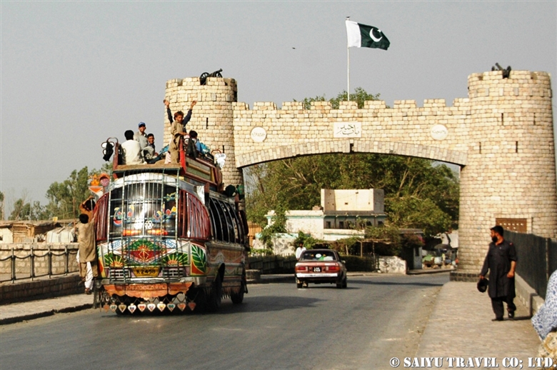
When traveling from Peshawar to Khyber Pass this is the monument and gate that stands at the entrance. On one side of the road is Jamrud Fort, a fort built by Sikhs who invaded an old fort and rebuilt it in 1823. In front of Khyber Pass, which connects between Central and South Asia, you can see the history of the battles that took place between various ethnic groups. After you cross the Khyber Pass, the Torkham boarder and the Grand Trunk Road continues into Afghanistan to the west.

Babur’s Tomb

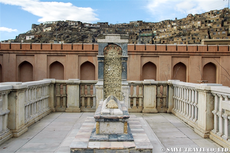
The first Emperor of the Mughal Empire was Babur. Originally from Central Asia, he set up his first base of operations in Kabul, and from there, set up the Punjab Plain, and conquered India, then in 1526 he founded the Mughal Empire as the emperor, in Agra. Just 4 years later, he died in Agra. He wished to have his tomb in his beloved Kabul, so after a war and some years later his family built a tomb in Kabul. (This photo was taken during restorations of Babur Gardens, so now it is even more beautiful to visit and see the elaborate Mughal Empire’s tomb.)

After the war in Afghanistan, the tomb of Barbur was in horrible disrepair, reflective of the destruction of the great Mughal Empire’s war history. The Afghanistan’s Urban Heritage Project to develop the city and revive its cultural identity with Bagh-e Babur, Babur’s Garden. It overlooks the same city that started and ended the Grand Trunk Road.

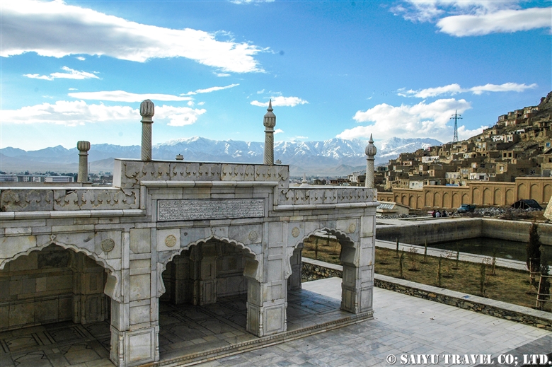
Winter in Kabul, from the Babur Gardens with the tomb of Babur.


Photo & text: Mariko SAWADA

※Photos of Kabul are from 2006 and the scenery may have changed since then.
※This article is an updated version of the blog posted in “Salaam Pakistan” in June 2011.


Category : - Monument / Heritage of Punjab > - Grand Trunk Road > ◆Khyber Pakhtunkhwa > ◆ Punjab > - Lahore > ◇ Heritage of Pakistan
Tag : , , , , , , , , , , , , , , , , , ,

Shimshal Pamir: Will you try the Kuch? I did!

Shimshal Pamir’s summer KUCH, a Summer migration
If you know anything about summer in Shimshal, then you know there is a big part of life the “Pamir.” This is the tradition of  KUCH, where the villagers move their livestock from Shimshal Village at the end of May. They first go to the summer village of Shuizherav and then at the end of June, make their way to the second summer village of Shuwerth.


Will you try the kuch? I will kuch!
It happened one day in June 2009. I walked along the Yak road to Shuizherav. My slow pace meant that I was overtaken by the Shimshal villagers. Everyone who passed uttered “Kuch” again and again. In order to help out with this great migration, everyone from men to the youth return from the city and gathered in the Shuizherav village. The exhausted goats and sheep had already started to gather in large numbers by the time we reached Shuizherav. As we all waited for the day of kuch, amongest the flocks of sheep and goats all surrounding my tent, day and night, I could participate in milking the sheep and goats. This was an amazing chance to experience summertime in the Shimshal life.


Heading towards the Pamir
It was decided last night, as I was told “Tomorrow is the kuch.”

Securing the household goods to the male yak, the house was cleaned up, and by 9 am the first group of yaks depart. Then the yak’s enclosure was opened and everyone started heading towards Pamir. The sheep and goats walk a little slower and arrive a little later. On the plateau, at the foot of Minglik Sar, you will pass the beautiful lake Lup Zoi, then eventually you will cross Shimshal Pass.


The yaks carry the load of household goods and pass in front of the 6,000m (19,685 ft) peak of Minglik Sar, in Shimshal. The yak carries a stove that has inside a baby goat that cannot walk.


Looking back from here, there is a panoramic scene of the yaks moving in. Forgetting that we are at an altitude of 4,900m (16,076ft), we are happily walking with the yaks to the summer village of Shuwerth in Pamir.


The herd of female yaks and the children as they cross Shimshal Pass.


The special ceremony to celebrate the kuch and summer life.

Start of the Summer for Shuwerth
The villager women of Shimshal live in Shuwerth for three months, grazing the animals and making dairy products. As soon as the kuch is over, a ceremony is held to pray for the safety of the villagers and a good harvest for the summer. People prepare their homes and take care of the livestock. In the evening, the usual practice of milking the animals takes place.


The paddock of Shuwerth. The scene of milking the animals every morning and evening.

I was so sad to say goodbye to the people who took care of me while I was there in Shuwerth, and as I left, I kept looking back at the view many times, as not to forget.


Photos & Text: Mairko SAWADA

Visit: June 2009, Shimshal Pamir, Shimshal, Gilgit-Baltistan

※This article is updated and based on the blog “Salaam Pakistan” first uploaded in March 2011. The Shimshal Kuch tradition is rapidly waning. I have heard that since my visit, you can no longer see the women from the villages in 2018 & 2019.


Category : ◆ Gilgit-Baltistan > - Shimshal
Tag : , , , , , , , , , , , , , ,

Where is Shimshal Pamir?

I have been travelling to Shimshal Pamir, located beyond Shimshal village, since 2009. It is not at all easily accessible and the lodging is located at altitudes exceeding 4,700m (15,420 ft). The mountain scenery and expansive natural vista is amazing but also, the traditional life of the Wakhi  people is fascinating as well. Shimshal is well known for their KUCH, the great migrations with their cattle, which you can also experience when you go to this special place.


Where is Shimshal Village?

Shimshal village was only recently connected by jeep road in 2003, in the upper Hunza valley. Located just near the boarder between Pakistan and China, it is just east of the Khunjerab Pass. If you take the Karakoram Highway north, passing through the heart of Hunza, Kalimabad, then you take the Attabad Lake tunnel, and on to Passu Village through 60 kilometers of dirt road…then you reach Shimshal Village. Prior to 2003, you would have had to walk the long trek, but now you can access this road with 4WD vehicle. Nonetheless, this road was once a trekking route with very steep canyons and great views of the Mulungutti Glacier, which extends out from Shimshal Village.


Shimshal Village

The village is located in a valley at an altitude of 3,000m (9843 ft). Until 1973 the Mir of Hunza were taxing dairy products and livestock in this area. It became part of the Islamic Republic of Pakistan in 1973 and part of the Shimshal land was designated Khunjerab National Park. In 2003, a road was connected to the area and life became a little easier but sadly, the youth have started migrating out to the city. Several guest houses in the village and a small hydroelectric facility provides power, although not very reliably. In recent years, there are an increasing tourist population attracted usually to the opportunities for mountain trekking.


Heading to Shimshal Pamir

Following the long, snow-covered winter, the villagers will start to graze their animals in late May. Livestock is the most important thing for making their livelihood. They take their yaks, goats and sheep graze in the summer pastures. This traditional big migration is called the Kuch, when they travel long distances to the ‘Pamir’ or summer pastures.


During the summer months, the women of the village are usually responsible for caring for the livestock and making the dairy products. Unfortunately, this tradition is rapidly being lost in modern times. Men may take various work either taking cattle to even more remote locations, working in towns or as porters and mountain guides.


Travelling on the Karakoram Highway from Islamabad, it is way beyond Kalimabad and Passu far into the mountain passes. Even deeper into the mountains past Shimshal village, you will walk into Shimshal Pamir.

It may take some time to get there, but it is a place where you can get a real feel of mountain life and their traditional way of life dependent on their animals.


Photos & text: Mariko SAWADA

※Photos were taken between 2009 and 2012 at Shimshal Village & Shimshal Pamir

※This is updated based on an article first uploaded in March 2011 for the Blog “Salaam Pakistan.”


Category : ◆ Gilgit-Baltistan > - Shimshal
Tag : , , , , , , , , , , , , , ,

Priest King of Mohenjodaro (National Museum of Pakistan, Karachi)

The great excavation of the Mohenjodaro mainly took place between 1922 – 1931. Many of Pakistan’s national treasures that were excavated before Pakistan’s independence in 1947, are stored in museums in Britain and India, but there are some valuable pieces still located in Pakistan.

One of the masterpieces that is housed at the National Museum of Pakistan is the “Priest King” of Mohenjodaro.

Mohenjodaro is the largest city of central Pakistan’s Indus Valley Civilization, which flourished between 2500 BC to 1800 BC. This Indus Valley Civilization was the oldest found in South Asia that eventually developed into the northwestern Indian subcontinent around the Indus River Basin. Archeologists from around the world are slowly revealing the significance of the life of the Indus Valley, but many mysteries remain unrevealed.

Despite the three other languages of ancient civilizations (Egyptian hieroglyphs, Mesopotamian and Chinese texts) already having been deciphered, the characters of the Indus language have not been deciphered yet. It shrouds the origins of their religion and history in mystery, but perhaps the biggest riddle is what caused their decline.

This statue of the Priest, housed in the National Museum of Pakistan in Karachi, is said to be a key in revealing the past relationship of the Indus Valley Civilization’s connection with Mesopotamia, based on the shape of the statue.

“Priest King” – Mohenjodaro :   Made from white soapstone, the modest size measures 17.5 cm high and 11 cm wide. During the excavation in 1927, it was unearthed from what was probably a noble’s house, a large building from the DK area.


The statue is adorned with a headband with a three-leaf pattern and was given the auspicious name of “Priest King.”

In fact, it is unclear if that is on display at Karachi’s National Museum is real or a replica. According to one theory, the real one is stored in a special vault for preservation, but when you ask the museum guard, they will tell you it is the original ‘real’ thing. So even this is wrapped in the mystery of the Indus Valley Civilization.


Photo & text: Mariko SAWADA
Visit: Feb 2020, Karachi, Sindh

※Photography inside the Museum is generally restricted. Large bags are also not allowed to be brought inside.

※This article was originally published as part of an article in “Salaam Pakistan” uploaded in September 2015.


Category : - Karachi > ◆ Sindh > ◇ Museum of Pakistan
Tag : , , , , , , , , , , , , , , , , ,

(video) Soaring Over the Magnificent Mud Volcanoes

In late February 2020, Balochistan coastal tour series ended in this season. The temperature during the day has also become much higher.

“Makran Coast and Mud Volcano” drone footage taken in this season.


Video & Text : Maiko SAWADA

Visit : Nov2019 -Feb2020, Makran Coast, Balochistan


Category : = Video clip Balochistan > - Mud Volcano > ◆ Video Breathtaking Views of Pakistan > - Hingol National Park > ◆ Balochistan > - Makran Coast
Tag : , , , , , , , , , , , , , ,

Necropolis of Mian Nasir Mohammad Kalhoro

On the way along the Indus Highway, a villager showed us the second largest in Sindh, the Necropolis of Mian Nasir Mohammad Kalhoro.


This group of tombs of the 17th Century Sindh Clan, from the Kalhoro Dynasty, is made up of groups of tombs for the royal families, priests, and on the outside, surrounded by the villagers’ tombs. It makes me wonder if perhaps this is how the World Heritage Site, Makli Hills might look if it was still expanding.


The graveyard is an interesting atmosphere, but the visitors also took in a good view from the Indus Highway of the ‘inland Sindh.’ It is a nostalgic and warm place to see this side of Pakistan.


Are they carrying wheat? Between the cars and trucks, there are donkey drawn carts carrying goods.


You can only see this kind of scene during the harvest season, the wheat being carted by the donkeys.


Harvesting from the fields. After the wheat harvest, the rice harvest begins.


This small truck is loaded down with luggage and people as it is heading towards a village out of the city. These Sindhi villagers kindly exchange smiles with us as they pass.


Photo & Text: Mariko SAWADA

Visit: Nov 2019, Necropolis of Mian Nasir Mohammad Kalhoro, Dadu, Sind

Category : - Monument / Heritage of Sindh > ◆ Sindh > ◇ Heritage of Pakistan
Tag : , , , , , , , , , , ,

(video) Rohtas Fort – Legacy of Sher Shar Suri

Rohtas Fort is one of the six World Heritage Sites in Pakistan.

A fortress built by Sher Shah (Founder of Sur Empire, a short-lived empire from 1539 to 1555)  who built the transportation networks that served as the foundation for Mughal empire.

Sher Shah built ” The Grand Trunk Road “between Kabul and the Punjab Plain and built Rohtas Fort on it’s middle way.

Aerial view of Lotus Fort by dronefootage.


Video &  text : Mariko SAWADA

Visit : Feb 2020, Rohtas Fort, Punjab

Category : = Video Clip Punjab > ◆ Video Breathtaking Views of Pakistan > - Monument / Heritage of Punjab > ◆ Punjab > ◇ Heritage of Pakistan
Tag : , , , , , , , , , , , , ,

The largest city in Pakistan, Karachi’s Empress Market

Karachi is not the capital city, but it is the largest city in Pakistan with a population of 16 million but it is said to unofficially be home to 20 million people. In the past, Karachi was an unsafe place due to ethnic conflicts and crime, but in recent years that has changed and things are starting to settle down.

It has transformed itself from a town that was dirty, poor and a place you didn’t want to look at to a really fashionable place with elite neighborhoods. If you compare it to Islamabad, the people are more open minded and the daily cost of living is cheaper so the people who live in the rural areas like  Hunza would rather come to Karachi.
Karachi’s historic and exotic bazaar is the Empress Market.


The name “Empress” comes from the market being built between 1884 and 1889, during the reign of the British Indian Empire, so it was named in honor of Queen Victoria.
Located in Saddar, the open air building and clock tower are visible from afar.

The historic architecture is beautiful backdrop for the market.


This specialist makes all kinds of oils from various things like coconuts and sunflower seeds.


Some young boys in the vegetable market.


A boy delivers us some Chai tea from the back of the market.


A man cuts pieces of meat off for a kitten. Near the meat market, there are so many cats.

That reminds me that I saw an article in 2015 saying that illegal wildlife sales were happening in this market. Just a few days ago, I saw people catching raptors illegally on the Balochistan coast and trying to sell them to the rich Arabs. It would be nice if the Pakistani Wildlife Department would work harder to stop these activities.


All around the market, there is the hustle and bustle of traffic in Saddar.

If you compare it to before, the security is much better, but it’s still important to be careful about keeping your valuables and cell phones safe.


Photo & Text: Mariko SAWADA
Visit: Feb 2020, Empress Market, Karachi, Sindh

Category : - Karachi > ◆ Sindh
Tag : , , , , , , , , , , , ,

Gadani Ship Breaking Yard

Have you ever wondered what happens to ships at the end of their service? …used to be that they would sink into the sea in the past, but now parts are often being dismantled and reused where possible. In postwar Japan, there was a rush to build ships, but these warships became unnecessary and various countries were dismantling them. Now the countries dismantling them are mostly in SE Asia. In Gadani they practice a technique called beaching. During the high tide, the boats will be hauled up on the sandy beach and then cut down for the steel and other recyclable parts.

According to the past records, the shipyard takes up about 10 kilometers of the Gadani shoreline and in the 1980’s there were 30,000 people working there, making it the largest in the world.
In 2016, there was a huge accident causing many casualties, so many new laws and regulations requiring insurance for the workers was enforced by the new government. When we visited, there were only a few shipyard businesses operating at that time.


At 2 PM, after his lunch break, this worker is getting back to work.


Huge coastal oil tankers and cruise ships are taken apart using manual labor.


We observed from afar so as not to get in the way as they worked.


The shore of Gadani…several ships on the exhausted shore.

When we visited the shipyard, there were demolition yard workers who seemed to be local Baloch people, as well as Pashtuns from far away Swat Valley. These hard-working Pashtun men left a lasting impact as they looked so strong, bright and masculine in such a harsh working environment.


Photo & Text : Mariko SAWADA
Visit: Nov 2019, Ship breaking yard of Gadani, Balochistan

Category : ◆ Balochistan
Tag : , , , , , , , , , ,

Mohenjodaro

This is the ruins of the Indus Valley Civilization, the city of Mohenjo-daro (also Moenjodaro).

It is the site of the largest urban archeological settlement, with its most active period between 2500 to 1800 BC. It is believed that up to 40,000 people inhabited this area, in the east is a fortified section (There is a Gandhara stupa, Ritual bath believed to have been used for religious ceremonies, bathing or purifying, and for political gatherings) and divided on the western side (there were houses for the nobles, shops and commoners homes also). So far, only 10 percent of the area has been excavated, and scattered all around are unexcavated mounds.

Meaning “Mound of the Dead people” in Sindhi the local language, back in the old days, this burial place was a site that locals were afraid to come close. In 1921 an Indian archeologist excavated the site calling it the “2nd and 3rd Century Gandhara” but upon exploring it, they had uncovered a city ruins of the Indus Valley Civilization, much older than they thought.

Extensive excavations were carried out by the Archeological Survey of India (A.S.I)  during the British India period until 1947. In 1980 it was designated a World Heritage Site. It is still unclear what might have caused the decline of the city. During the survey, a seal was discovered, but because the text of the Indus script that is engraved on the seal has not been deciphered yet, the true name of the town is unknown.


This Mohenjodaro  SD Area’s Gandhara Stupa, which dates back to 2nd or 3rd Century AD. There is a monastery surrounding the area which is built using bricks from the Indus Valley Civilization.


The famous “Great bath” area is 12m x 7m and 2.5m deep, and there are remain of  waterproofing on the elaborate wall made of bricks. It is said  that some religious ceremony was held here.  The stepped ghats (terraces) descending to the surface of the water are supposed to lead to Hindu features later.


A sewage system in the SD Area. It is covered with limestone rocks. Some of the DK area is built entirely underground.


This is also the sewage system in the SD area. Water from the Great Bath and other dwellings are directed through this channel to the Indus river. During that time, the Indus River ran very close to the town of Mohenjo-daro.


In the corner of this DK area home, is a “Rubbish Bin.” Similar efforts for “Trash collection” areas are also seen in the SD areas as well. Unfortunately, this concept of managing their garbage wasn’t carried into modern pakistan.


In the Urban DK area, an aristocratic house was a two story building, with access to the well even from the second floor.


“The Old Street” as it is called is the Main Street. On both sides it was lined with shops.

Recently, many domestic tourists of Pakistan have increased in visiting this site. Particularly at sunset, you will see many people.

Unfortunately, the time I visited Mohenjo-daro it was too cloudy to catch a good sunset. But my personal recommendation is to visit early in the morning, when you can enjoy “the deserted city of Mohenjo-daro.” without other tourists.

Photo & Text: Mariko SAWADA
Visit: Feb 2020, Nov 2019,  Mohenjo-daro, Sindh

*For inquiries and consultation, please go to Indus Caravan

*Please follow us on YoutubeInstagram & Facebook

Category : - Mohenjodaro > - Monument / Heritage of Sindh > ◆ Sindh > ◇ Heritage of Pakistan
Tag : , , , , , , , , , , , , , ,