A Snow Leopard Encounter! Karakoram Highway

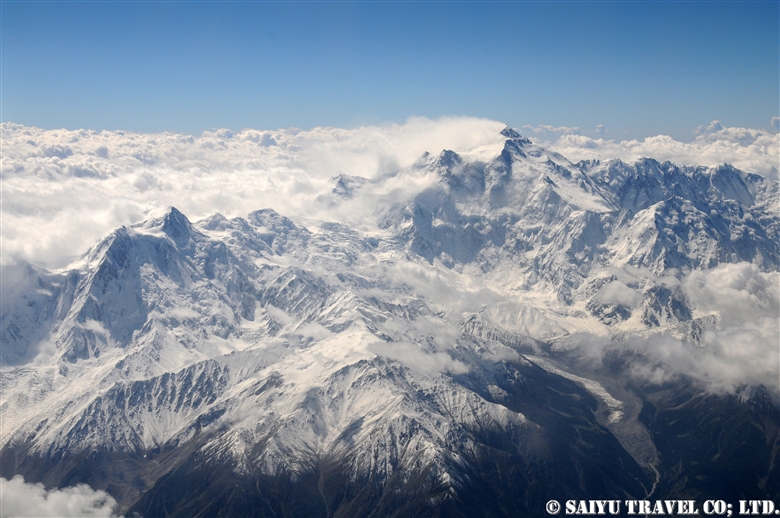
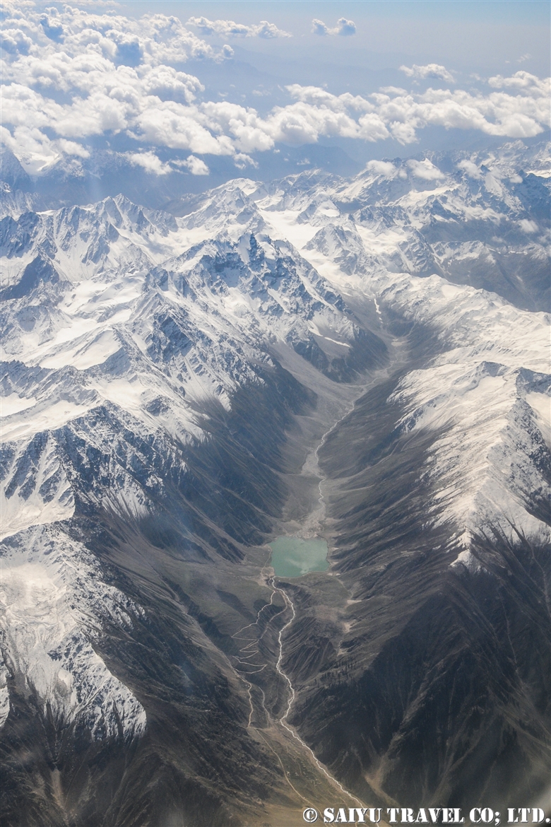
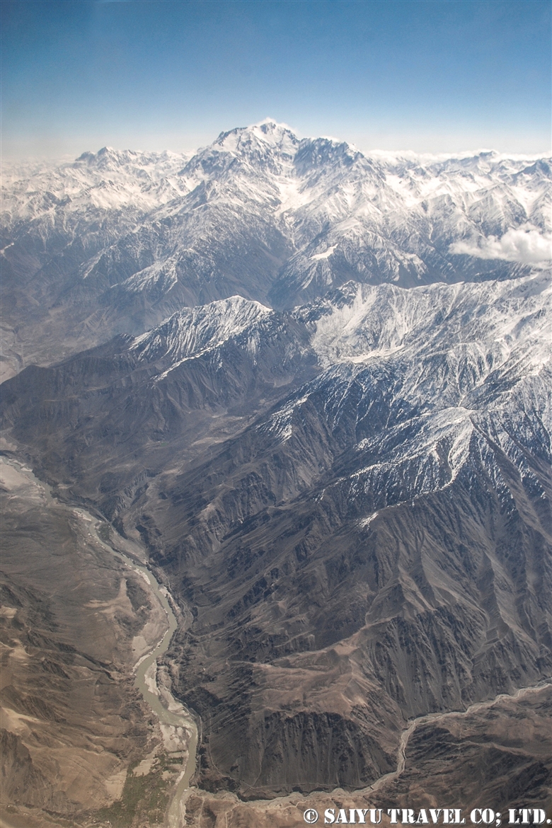
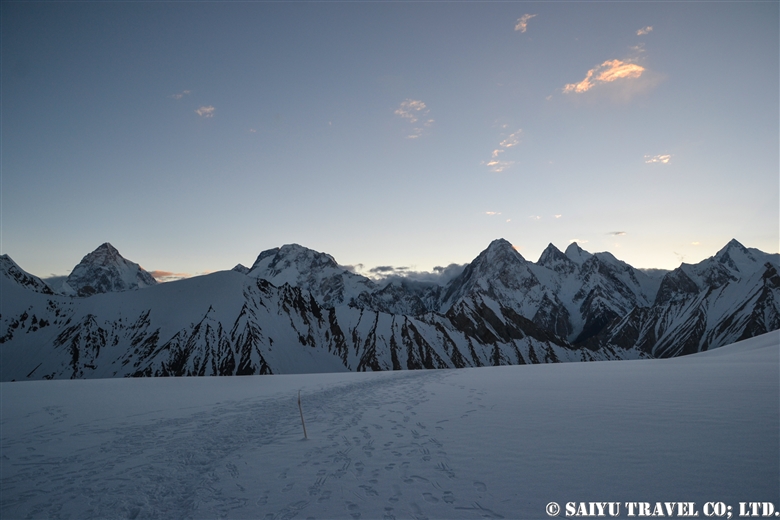
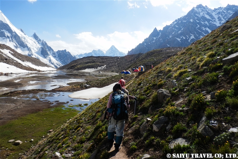
We arrived in Northern Pakistan in search of the snow leopards. While traveling on the Karakoram Highway, we observed the ibex and the vultures.

In Khunjerab National Park, there are many footprints on the roads and in the snowy fields of the river. On the Karakoram Highway, I also found traces of snow leopards after they slept in certain places and on  worn plastic pet bottles that were chewed up by the snow leopard kittens that had played with them as toys. Snow leopards seem to regularly come onto the Karakoram Highway, which makes for easier paths to travel at night and in the early morning hours when there are no cars around.

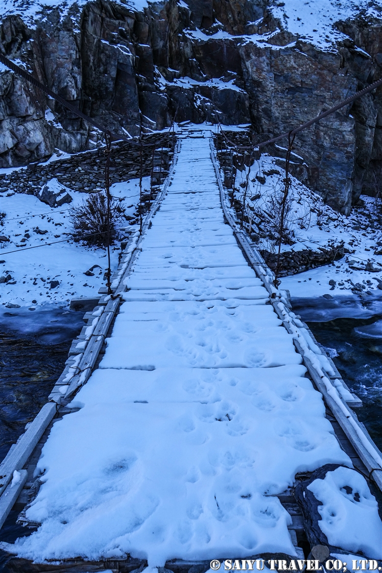
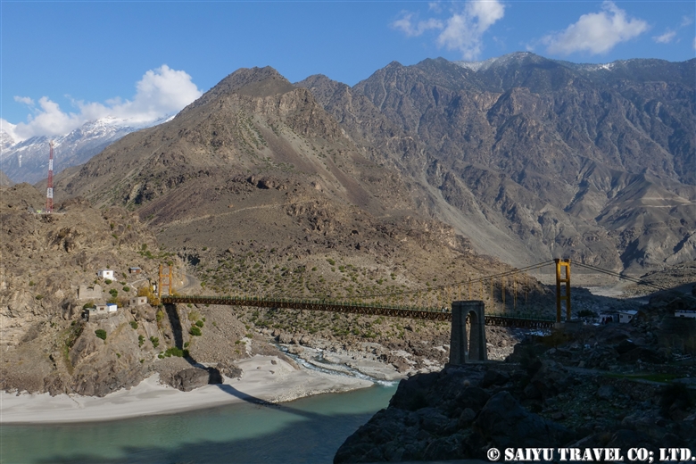
A suspension bridge covered with snow leopard footprints! Snow leopards can cross the rivers in narrow or frozen areas, but of course if there is a bridge, they will not hesitate to use it.

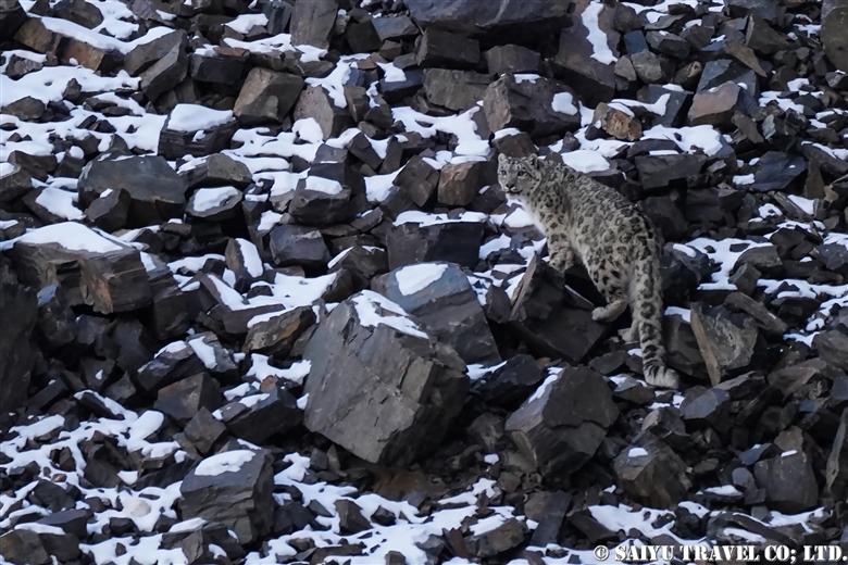
Around noon, as we were traveling along the Karakoram Highway, the guide suddenly shouted “Leopard!” And promptly stopped the car and got out. Staring out at the landscape saying “Bismillah, Bismillah (In the name of God),” and right there, was a snow leopard.

It was sitting on a rock just off the road, but as soon as it saw us, started walking away.
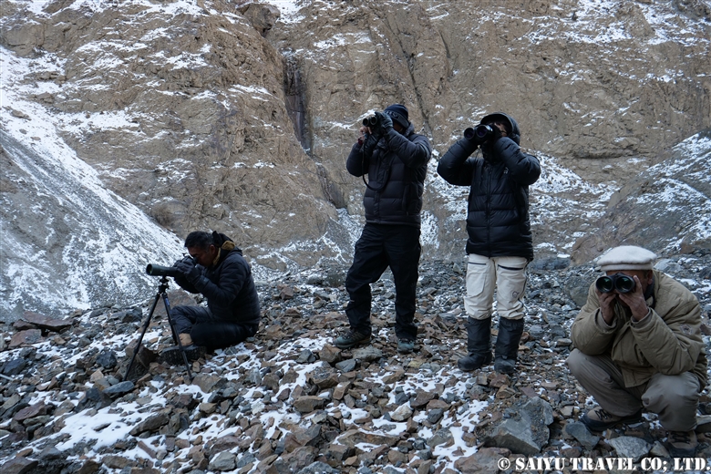
The guide is delighted with “Shaubashi, Shaubashi (Wakhi language meaning ‘Very good’ or ‘Well done’.) The pressure on the guide of trying to see a snow leopard, was released.

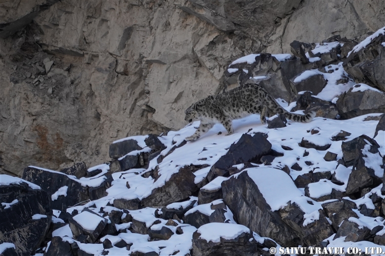
Even though we saw it, the snow leopard was so fast and it was difficult to catch a photo of it as it walked away. At 3,300 meters above sea level, we were so excited and became short of breath. As we took the photos, our hands were shaking, not sure if the photos would come out.

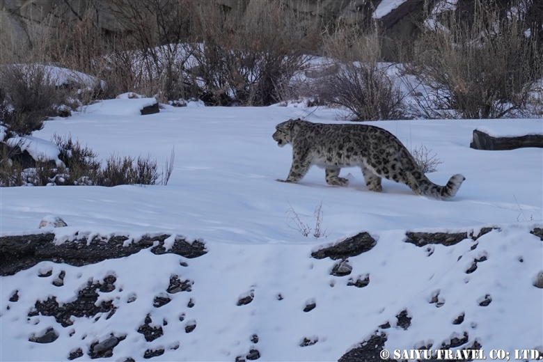
A Snow leopard, actually walking, in the snow. So often, Snow leopards are observed amongst rocky backdrops, so it was nice to finally be able to observe this snow leopard with the white snow, which it was named after.

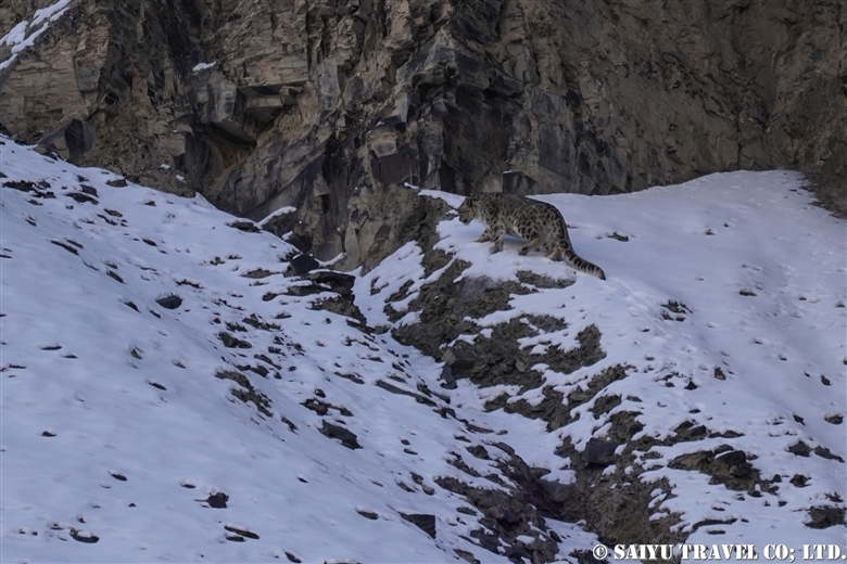
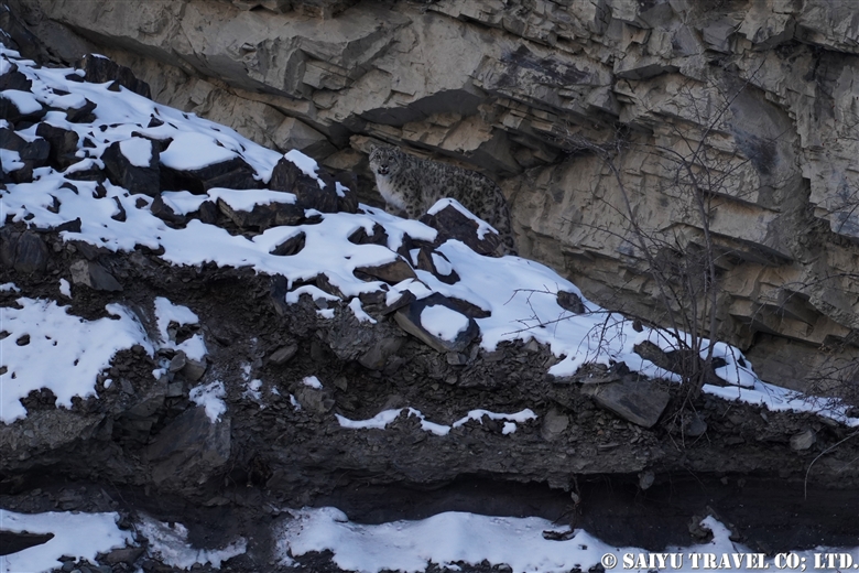
It climbed higher and higher, getting smaller and smaller.

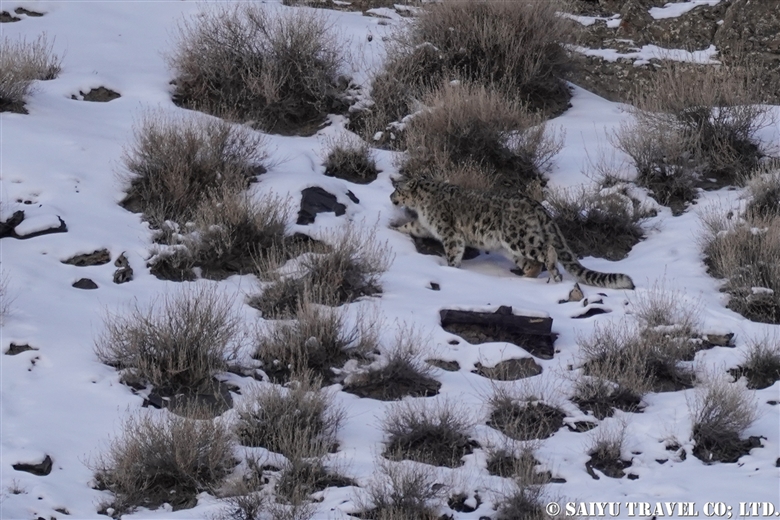
It continued moving further away. There were times when it overlapped and camouflaged with the tufts of grass, making it hard to find in the viewfinder.

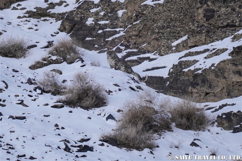
He showed me his face for just a few brief moments. This is the last photo. It started walking into the rocky area and soon disappeared.

The group as we watched this snow leopard until the very end.

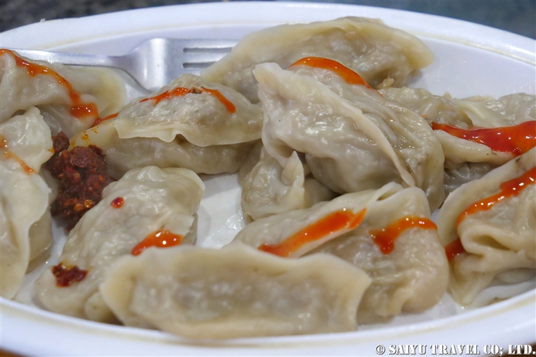
We returned to Sost at 2:30 pm for a late lunch. This day was a celebration for the guides (but no alcohol!). A buffet of different kinds of yak meat. All enjoyed a fusion of yak meat recipes, such as yak mantu (Xinjiang Uighur Autonomous Region, which borders Sost, Central Asian cuisine) and yak nihari (a dish of the Indian subcontinent that is stewed with beef parts and the bone marrow).


Photo & text: Mariko SAWADA
Observation: Dec 2020, Khunjerab National Park, KVO Area, Gojar, Gilgit-Baltistan
Special Thanks: Tomo AKIYAMA, Hussain ALI and Abul KHAN

Category : - Snow Leopard > ◆ Gilgit-Baltistan > - the Karakoram Highway > - Gojar > - Khunjerab National Park > ◇ Wildlife of Pakistan
Tag : , , , , , , , , , , , , , , , , ,

(video) Red-billed Chough

“Red-billed Chough” in the mountains of northern Pakistan.

They can be seen gathering around the fruits of the Hippophae rhamnoides.


Red-billed Chough, Pakistan


Video & text : Mariko SAWADA

Observation : Dec 2020, Morkhun – Sost, Gilgit-Baltistan

Category : = Video Clip Gilgit-Baltistan > ◆ Video Breathtaking Views of Pakistan > ◆ Gilgit-Baltistan > - Gojar > - Morkhun > ◇ Birds of Pakistan
Tag : , , , , , , , , , , , , , , , , , , ,

(Video)An Ibex Appeared on the Karakoram Highway!

After mid-December, Himalayan Ibex sometimes descend to the villages near Khunjerab National Park and the mountains close by. As the mountains become covered with snow in the winter, the herds of females move down to the lower altitudes. This is when ibex will start their breeding season, attracting the males to the herds.

This male ibex with his huge horns just suddenly appeared on the side of Karakoram Highway. Perhaps he was in hot pursuit of a female, and just forgot about his own safety, but he passed immediately next to us.


Himalayan Ibex on the Karakoram Highway


Text :Mariko SAWADA     Video : Yoko KADONAGA

Observation : Dec 2020, on the Karakoram Highway, Khunjerab National Park, Gilgit-Baltistan

Category : = Video Clip Gilgit-Baltistan > - the Karakoram Highway > ◆ Gilgit-Baltistan > - Ibex > ◇ Wildlife of Pakistan > - Khunjerab National Park
Tag : , , , , , , , , , , , , , , ,

(video) A Snow Leopard Observed from the Karakoram Highway

In late December, we headed to northernmost part of Pakistan in search of snow leopards. Making our way from the border town of Sost near China, and traveling the Karakoram Highway through Belly Checkpost, to Kooksil with the goal to observe the ibex, bearded vultures, and finally – the coveted appearance of a snow leopard!


Snow Leopard observed from the Karakoram Highway Pakistan


I would have never thought we could see a snow leopard from the Karakoram Highway! What a super lucky encounter with this one!

Video & text: Mariko SAWADA
Observation: Dec 2020, Wadkhun – Khunjerab National Park, Gilgit -Baltistan
Special Thanks: Tomo AKIYAMA, Hussain ALI and Abul KHAN

Category : = Video Clip Gilgit-Baltistan > ◆ Video Breathtaking Views of Pakistan > ◆ Gilgit-Baltistan > - Gojar > - Khunjerab National Park
Tag : , , , , , , , , , , , , ,

(video) Can you find the Snow Leopard? Sighted at Morkhun Village

This video shows when we had a sighting of a Snow Leopard in Morkhun Village. The locals were telling us “It’s right there!” but I had such a hard time spotting it for such a long time.

It had eaten an Ibex, and we watched the snow leopard with the local villagers, as it was sleeping on the other side of the river. So many people gathered to watch it, the snow leopard looked a little stressed.

Can you find it? Snow Leopard in Pakistan

In the morning, the snow leopard had killed and fed on the ibex and hid in the bush to rest in the rocks above. This video is of the snow leopard around 3pm, as it woke up. With villagers surrounding it by the time it realized, it looked a bit startled and did not know where to go to escape.

A Startled Snow Leopard in Morkhun Village Pakistan


Video & text :Mariko SAWADA

Observation : Jan 2019, Morkhun Village, Gojar, Gilgit-Baltistan

Special Thanks to Mr.Sultan Gohar (Khunjerab National Park)

Category : = Video Clip Gilgit-Baltistan > - Snow Leopard > ◆ Video Breathtaking Views of Pakistan > ◆ Gilgit-Baltistan > - Gojar > - Morkhun > ◇ Wildlife of Pakistan
Tag : , , , , , , , , , , , , ,

Petroglyphs of Shatial (Karakoram Highway)

Please visit our latest blog about Shatial Petroglyphs with more detail(2023)

Heading north on the Karakoram Highway as you enter Gilgit-Baltistan, the famous Buddhist archeological sites can be found between the Tangir and Darel Valleys. It is called the Shatial Rock Art Carving/Petroglyphs.

Since ancient times, this area was the point known as the “Old Silk Road” where the Indus River connects to the other valleys as a junction or crossroads.

Shatial has long been famous as a location for the “Ancient Buddhist Rock Carvings,” but even before these carvings were there, the tradition was for travelers, such as merchants and pilgrims, passing through Central Asia would carve their names and times into the rocks. These images of ancient characters (Sogdian or Bactrian) can be found near the bridges of Shatial.


People graze their goats along the banks of the Indus River. Rocks that were weathered down by water and time into sand. This is a place where people used to come to look for gold, but not so much anymore.


Taking the bridge that hangs over the Indus River in the Tangir Valley. Travelers from afar would cross this river during the winter months when the water was low, etching their footprints in the riverbanks. During the Buddhist era, monks and pilgrims would make their way to  “Gandhara.” They carved the Jataka tales and Stupas into the large rocks, creating an alter on the riverbanks.


The bridge of Shatial and Art Rock Carvings. Depicted is a stupa and the form of a Buddha carved into the stone.


Motifs of ibex are also engraved on the upper right. Ibex only live in elevations of 3,000m or higher so possibly the travelers saw them on the way along the Hunza River as they crossed the Hindu Kush – Karakoram Mountain range. There are no dates or names of the artists included with each carving, but these are precious relics that pay tribute to the history and people who have lived here since ancient times.


Sadly, the scenery along the Indus river is about to change.

There are two major projects to build dams between Besham and Chilas along the Karakoram Highway. There will be the Dasu Dam and Daimer Basha Dam Hydroelectric Power Plants installed along the river.
Although this plan has been in place for a long time, the construction is proceeding at a very fast pace as there is a shortage of power. This is following a decision to cancel the plans for a coal burning power plant.

Parts of the Karakoram Highway and some villages will be submerged, but along with that the historical features and the lifestyle of the people who live along the Indus river will also be forever altered. It is a great pity that such scenery along this great river will be lost.

Some of the main rock paintings will probably be relocated, but many of them will be submerged.

How much time does this scenery have left?

It was hard to get to and such a long-distance trip to get to see the Karakoram Highway and landscape. But it is in its final countdown.

Will this end up being only a precious memory?


Photo & Text : Mariko SAWADA
Visit: Dec 2020, The Karakorum Highway, Shatial, Gilgit-Baltistan

Category : - the Karakoram Highway > ◆ Gilgit-Baltistan > - Indus river bank > ◇ Rock carvings / Petroglyph
Tag : , , , , , , , , , , , , , , , , , , , ,

Red-billed Chough ( Upper Hunza)

In the mountainous areas of northern Pakistan, there are “red billed crows” and “yellow billed crows.”

Strictly speaking, they are classified into the crow family Corvidae and the genus Pyrrhocorax, appropriately called red-billed chough and the yellow-billed chough (also known as Alpine Cough).

‘Chough’ is pronounced “chuf /tʃʌf ” and they breed in the highlands above 5,000m during the summer season. In the winter, they form large flocks and decend down into the valley.

Distributed through the Eurasian and African continents, the genus is divided into eight subspecies. The one found in northern Pakistan is Pyrrhocprax pyrrhocorax himalayanus, which also inhabits the Himalayan mountain region to western China. A prominent feature are the large, bluish-purple glossy wings. In Europe and in Africa, Choughs can be observed at an altitude of 2,000 to 3,000 m, but in the Himalayan Karakorum, there is only a chance to see them at higher elevations of 3,000m to 5,000m.


I could see red-billed choughs along the riverbanks near Morkhun village. In the winter, the upper Hunza is strikingly beautiful, as a vast landscape of jagged rocks etched by time are layered with snow like a masterful piece of art.


While I was watching these red-billed choughs, a herd of goats and sheep passed through to go to their grazing pastures. In the Upper Hunza there are 7 villages that during the summer will keep the yaks, sheep and goats in the Khunjerab national park area. But in the tough winter, only the adult yaks are left in the highlands, while the yearling yaks born in the summer, goats and sheep are brought down to the villages at around 3,000m. Then everyday these herds are taken to the pastures to graze.


The paths that the villagers use to move the herds are lined with red & yellow billed chough. Generally since the red-billed will form large flocks, there are usually a smaller number of yellow-billed chough in the groups.


These are flocks of red-billed chough that are gathering seeds or fruit from the trees along the side of the Karakoram Highway.

Hippophae rhamnoides are a deciduous shrub found widely in Eurasia. In north Pakistan, it is a very important tree for wild birds, whose fruits are eaten during this harsh winter.


The long, curved, red colored beaks. But that isn’t the only thing that red! Their legs are also a red color!

Keep a watchful eye out when you are in the Upper Hunza and Skardu areas in the winter months. At first you may think you are seeing crows…but actually you might be lucky to see black birds adorned with red and yellow beaks! It is no ordinary crow!


Photo & text : Mariko SAWADA
Observation : Dec 2020, On the KKH ( Morkhun – Sost),  Gilgit-Baltistan
Special Thanks : TOMO Akiyama

Category : ◆ Gilgit-Baltistan > - Gojar > - Morkhun > ◇ Birds of Pakistan
Tag : , , , , , , , , , , , , , , , , , , ,

Pakistan International Airlines, take off from Skardu! The full picture of Nanga Parbat!

This is a description of my flight from Skardu to Islamabad using Pakistan International Airlines.

The Gilgit flight is usually very early in the morning, and due to the sunrise from behind the Nanga Parbat, everything looks white. However, the Skardu flight takes off a little later, when the sun is higher up in the sky. So it means the mountains are beautifully illuminated, although it may be a little cloudier when compared to the early morning hours.


When you take off from the Skardu Airport, you will see the outlying villages on the edges the city, poplar-lined streets, the Indus River, and boundary of the Katpana Desert.


The Skardu Fort, also known as Kharpocho, was built on a cliff along the Indus River in the 16th century.


Sand dunes in the Cold Desert can be seen stretching from the Skardu Valley to the Shigar Valley. It is a rare desert at a high altitude of about 2,500 m, which is quite unique in the world. The sand dunes are small and scattered from Ladakh, India’s Nubra Valley to Skardu but the dunes get bigger and more beautiful in the area from Skardu to Shigar.


This is Nanga Parbat, the 9th highest peak in the world. When I left Skardu, I thought it would be too cloudy and we wouldn’t be able to see it, but the southwestern side was clear.


The summit looked to be very windy, blowing the snow off the peak.


The main peak of Nanga Parbat is at an elevation of 8,126m, and the banks of the Indus River are at about 1,100m. So from the window of the plane, you can see the topography with a height difference of 7,000 m! It’s a really rare opportunity to be able to see 23 kilometers straight down and be able to compare the height of the mountains.


And this is the whole picture of the Nanga Parbat massif. The north side Chongra Peak, Raikot Peak, and the Main Peaks.


This is deep in the Naran Valley, Saiful Maluk Lake. It used to be such a pristine place, but regrettably, it has become a sad example of a tourist destination that has become full of garbage, due to the increase in visitors in recent years.

Well, we are coming back to reality now, and soon we’ll enter the Punjab Plain and touchdown at Islamabad.


Photo & Text : Mariko SAWADA
※These photos were taken on a September flight from Skardu to Islamabad on Pakistan International Airlines.

Category : ◆ Gilgit-Baltistan > - Skardu Valley > - Nanga Parbat / Himalaya Range
Tag : , , , , , , , , , , , , , ,

Best Views of Nanga Parbat! PIA Pakistan International Airlines ★ Skardu Flight

A panoramic view of the Nanga Parbat massif from a flight from Islamabad to Skardu

These mountain flights in northern Pakistan are often canceled. The reason is, of course, the quickly changing weather in the mountains. Considering that, in the last few years, the flight rate has improved considerably. In particular, if you were to try to move by car the distance of the Skardu flight, it would take two full days by land. But taking this “picturesque flight” it only takes one hour to travel the same distance.

You should really see this scenery from the Skardu flight! For the Skardu line, if taking the regular route (depending on the weather), you will see Nanga Parbat on the right and K2 on the left (if you are lucky!) just before arriving in Skardu. K2 is often hidden by the clouds and is only visible a little at the very end of the flight. So sitting on the Nanga Parbat side will give you more time to enjoy the mountainous view.

When you take off from Islamabad, you will increase altitude while slowly circling up in the Punjab Plain. Soon, you start to see the mountainous view at the western end of the Himalayas. If you look closely below, you can also see the Indus River and the Karakoram Highway running alongside it.


Nanga Parbat is seen as a gigantic mass of mountain. It is 8,126m, the 9th highest peak in the world.


My personal favorite is to see both the Indus River and Nanga Parbat. It’s hard to see in the photo, but below you can see the Indus River and the Karakoram Highway. The Indus River is a large river that crosses the border from Ladakh, India, and enters Pakistan passing through Skardu, and flows beyond that into the Arabian Sea.

This great mountainous region of Pakistan borders the Indus River. The Himalayas to the south of the great river and the Karakorum Mountains to the north of it. This is where the ancient Indian Plate and the Eurasian Plate collided to form these vast mountain ranges.


And in this photo, at the bottom, the altitude of the riverbank of the Indus River is 1,100-1,200m, while at the top, the summit of Nanga Parbat is 8,126m. If you draw a straight line, there is a height difference of 7,000m in a distance of about 23km!


Shortly after the view of Nanga Parbat disappears, you enter the Skardu Valley. Surrounded by the mountains of Karakorum, the open valley of Skardu contrasts so much. It is a magnificent view shaped by the Indus River.


Pakistan International Airlines circles around the town of Skardu, which is like an oasis lined with poplar trees. You will see Satpara Lake and finally land at the airport in Skardu.


Arrived safely in Skardu.

Can you see the mountains if you can’t get the window side? ···Nope!  There is no choice but to take turns looking out the small airplane windows. And…should your flight be cancelled, you have to stay flexible and just be content to enjoy the views of the Karakoram Highway and the mighty Indus River from the car!


Photo & text: Mariko SAWADA

*The photo is taken from the right seat of the actual Pakistan Airlines Skardu flight.

Category : ◆ Gilgit-Baltistan > - Skardu Valley > ◇ Mountain of Pakistan > - Nanga Parbat / Himalaya Range
Tag : , , , , , , , , , , , , , , ,

Crossing the Gondogolo La Pass from the Baltoro Glacier

The quiet peak of Karakorum before dawn seen from Gondogolo La (pass). From the left, K2, Broad Peak, G4, G3, G2, G1.


The route over Gondogoro La (at 5,680m), considered to be the ultimate trekking route to see K2, the second highest mountain in the world. As it requires snow wall climbing gear, make sure to check the rope work skill  thoroughly.


Taking glimpses behind us at K2 and Broad Peak, every now and then, we head toward  our base camp, Ali Camp (5,010m), to get over Gondogoro La. Checking in with the Islamabad office by satellite phone, we get the weather report. Fortunately, it will be clear tonight, so without hesitation, we decide to make our climb before dawn.


Our porters always carry the heavy equipment that we all use. This elderly man passed us quickly as we all crossed the Gondogoro La Pass, without much difficulty and waited for our mountain descent back at the camp. The local staff are always amazing through it all. Hats off to them for sure.


1am: Head out from base camp. Climbing up a snow wall using jumar, with an average slope of 50 degrees.


At last, 5:20 on July 6, 2012, we arrived at top of Gondogoro La!
A photo of my youthful self and the ridgeline behind me are K2 and Broad Peak.


As the sun rises, the down slope becomes a little loose and the risk of avalanche and rockfall increases. We rushed to get down the mountain.


A long, steep descent is more difficult than the climb up.


We arrived in a totally different world from the snow and ice world we just left high above. Camping in Khuspang, a lush campsite where so many alpine plants bloom.

I could finally let go of all the tension I was storing until now, and I slept like a log.


Photo & text :  Tomoaki  TSUTSUMI  from the expedition in Jun-July 2012


Category : ◆ Gilgit-Baltistan > ◇ Mountain of Pakistan > - Karakorum Range
Tag : , , , , , , , , , , , , , ,