Nanga Parbat (8,126m) As Seen From the Snowy Deosai Plateau

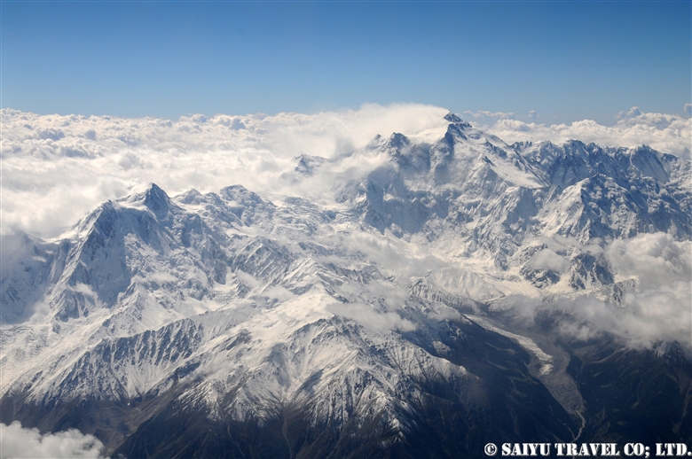
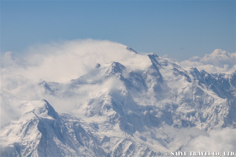
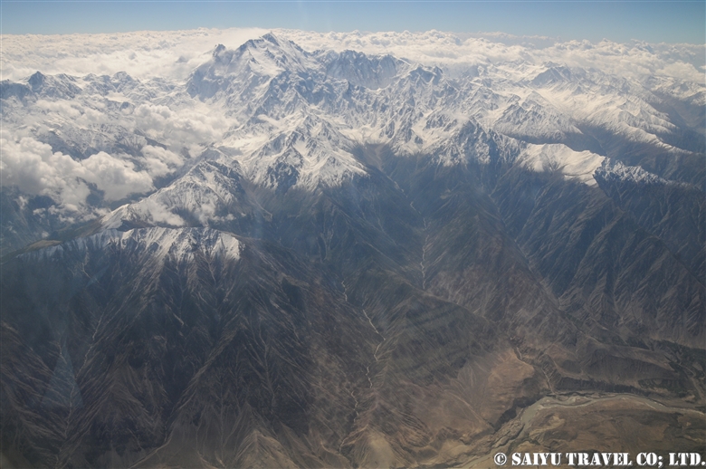
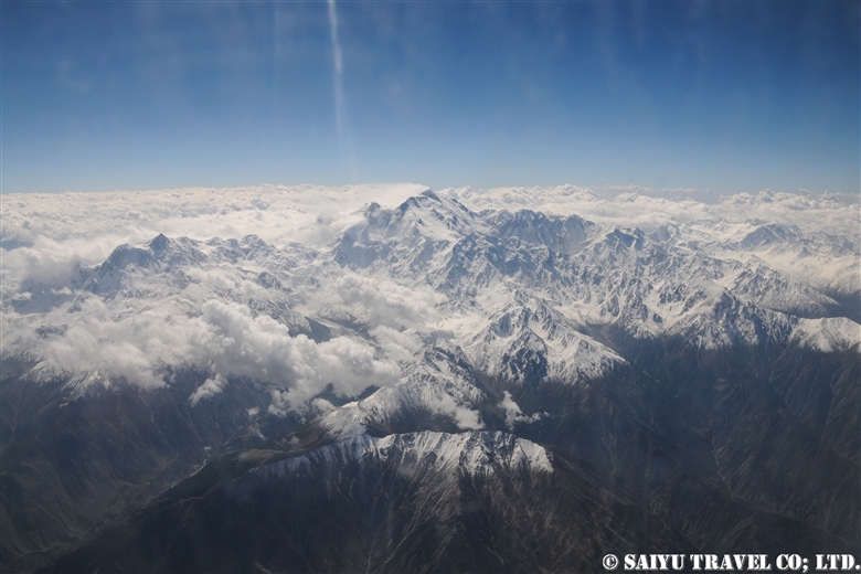
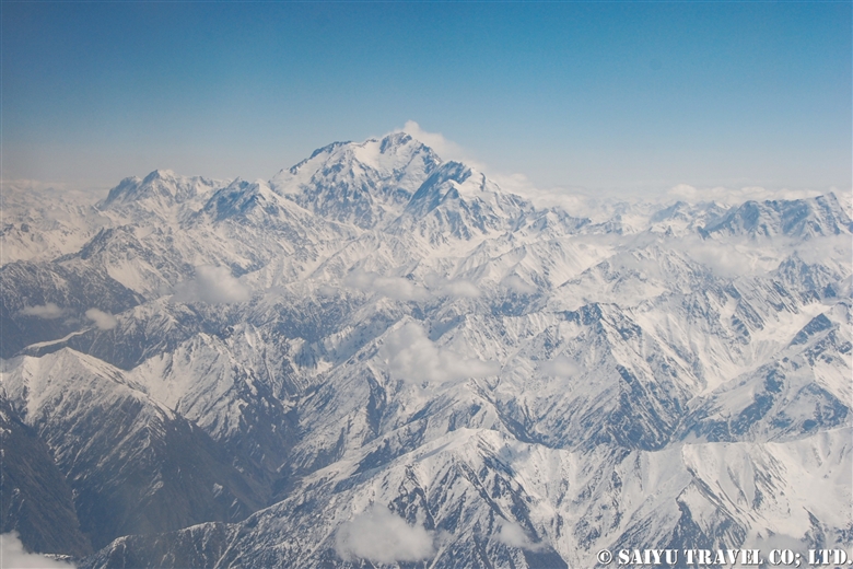
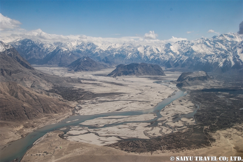
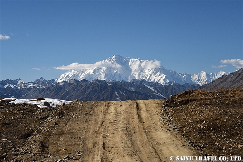
From the Deosai Plateau, there are several points where you can see the world’s 9th highest peak, Nanga Parbat (8,126m/26660 ft), but the best spot, is to descend from Sheosar Lake to the Astore valley, in my personal opinion.

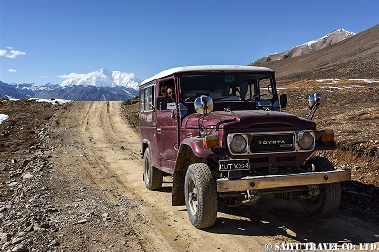
It was quite a difficult undertaking, actually, but I aimed for a chance to get photos of Nanga Parbat from the snowy Lake Sheosar. First, we have to avoid travel the day after it snows on the Deosai Plateau because the road is impassable. Second, even if you make it to the Lake Sheosar, it must be a sunny clear day to see Nanga Parbat, so there really are not many days when you can have these perfect conditions.

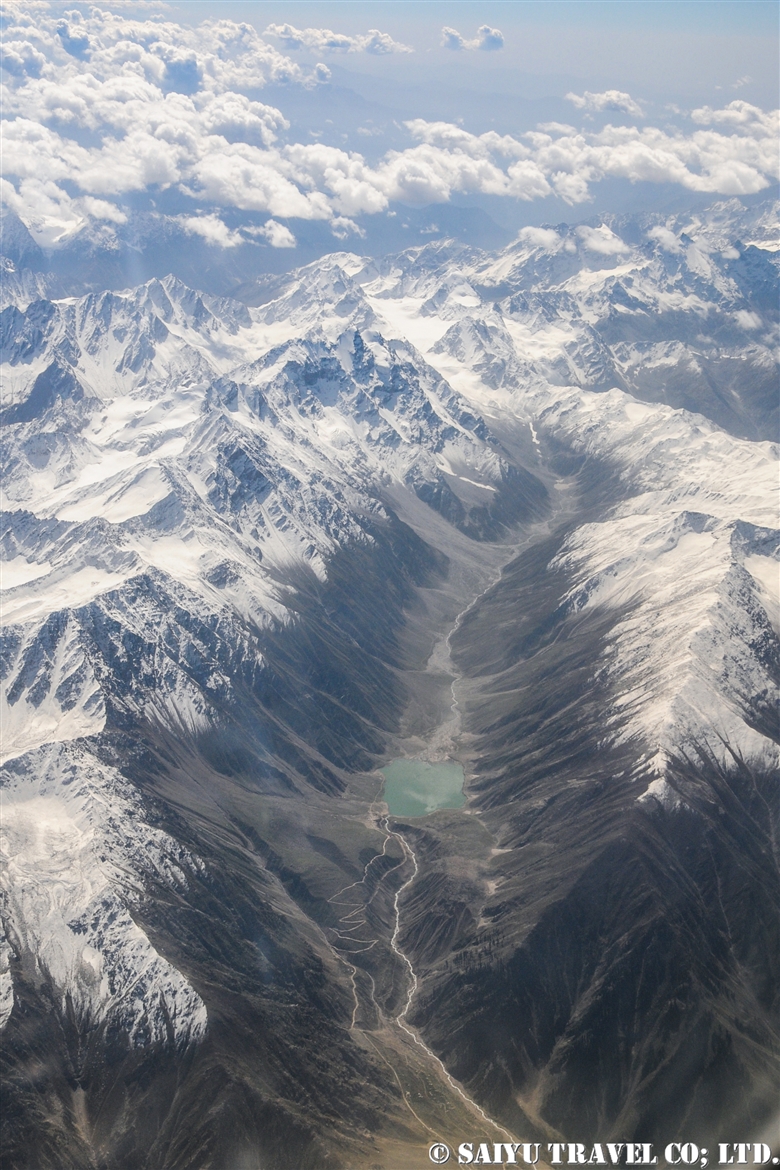
Lake Sheosar surrounded by snow. This trip happened to be a day trip from Skardu, but it was quite difficult to travel on the snow-covered roads. Still, the scenery was rewarding when we reached it, and there was no one else there at that time.

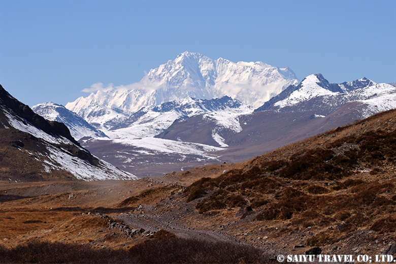
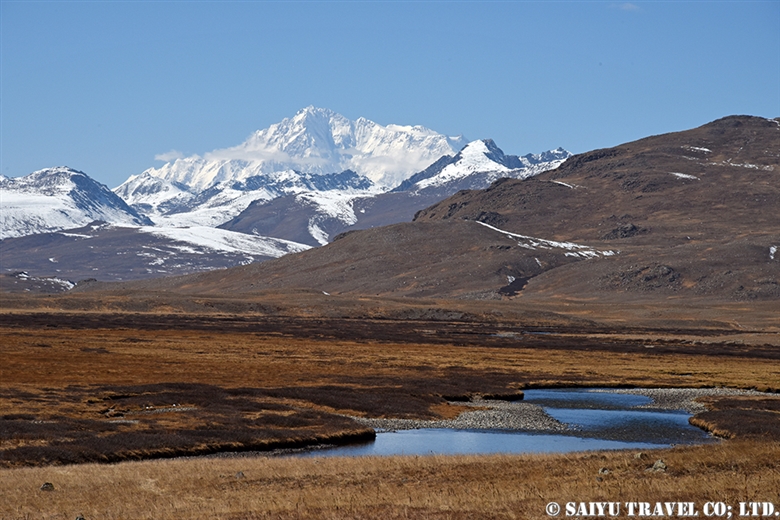
When I looked to the west, Nanga Parbat appeared over the lake. Too bad, that the clouds were covering it a little, but still, we could make out the mountain just enough.

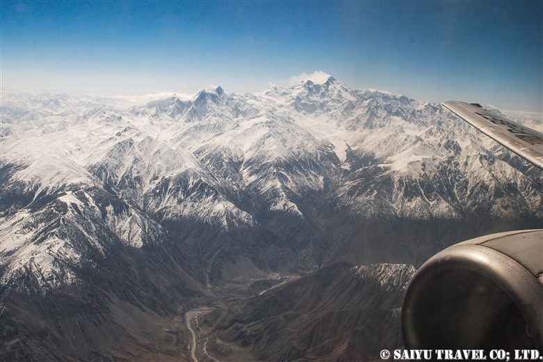
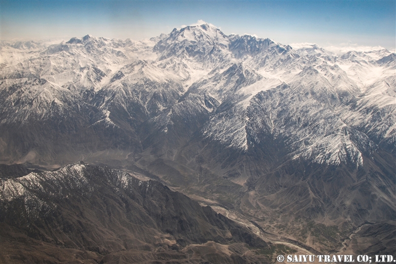
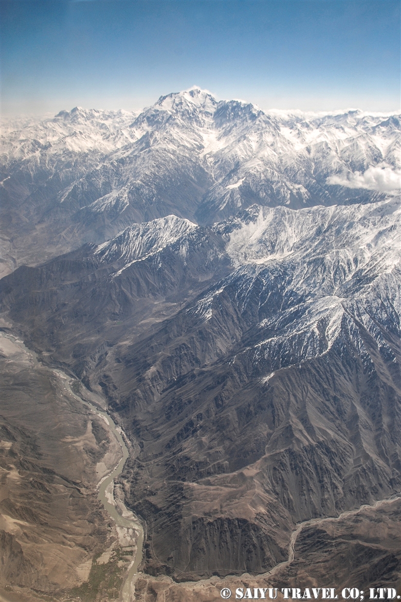
Heading down to Astore valley, you can see the entire mountain of Nanga Parbat. It is amazing that we can see this scene and get there by car.

Amin, our guide took a commemorative photo with Nanga Parbat. Due to the road conditions, on the way back, we cannot linger for long here. After observing flock of the Caspian gull and common coot on the Lake, we quickly headed back to Skardu.


Photo & text: Mariko SAWADA
Visit: Oct 2021, Shoesar Lake, Deosai National Park, Gilgit-Baltistan
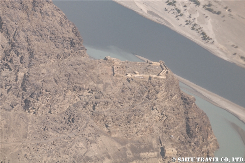
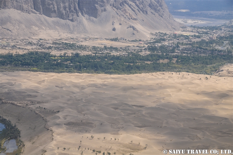
Category : ◆ Gilgit-Baltistan > - Deosai National Park > ◇ Mountain of Pakistan > - Nanga Parbat / Himalaya Range
Tag : , , , , , , , , , , , , , , , ,

Flight PK452、Flying from Skardu to Islamabad!

In a previous blog, we already posted the video of the flight of PK451, flying from Islamabad to Skardu, so now we are posting a video from the return flight PK452 from Skardu, on a relatively good weather day. The clouds were covering Nanga Parbat, as we passed the peak around noon that day.

To the video of PK451

PK452 Skardu to Islamabad


Image & text :Mariko SAWADA

Travel date : Oct 2021, taking flight PIA 452 from Skardu to Islamabad

For the arrangement of tavel, shooting in Paistan,  please contact us Indus Caravan.

Youtube Channel – Indus Caravan  

Category : = Video Clip Gilgit-Baltistan > ◆ Video Breathtaking Views of Pakistan > - Nanga Parbat > ◆ Gilgit-Baltistan > - Skardu Valley > ◇ Mountain of Pakistan > - Nanga Parbat / Himalaya Range
Tag : , , , , , , , , , , , , , , , ,

View of Nanga Parbat from Flight PK451!

The Pakistan Airlines flight from Islamabad to Skardu on good weather days are renowned for their great views of the world’s 9th highest peak, Nanga Parbat which stands at 8,126 m (26,660 ft).

This video was taken on a sunny day in October during our visit as we flew on flight PK451. I took the video with my iPhone. I have been on this flight a number of times before, but on this day in particular, Nanga Parbat felt closer than ever before!


Nanga Parbat from PK451 (Aerial View)

The video linked below was taken with a Go Pro 10 by Amin Gazi Karim of the Indus Caravan who was on the same flight with us. His short reel highlights moments from the entire flight from flying towards Nanga Parbat to our landing in Skardu.

Skardu is now a popular destination among domestic Pakistani tourists, with flights from Karachi and Lahore during the summer season, with three arrivals a day on the weekends. Compared to in the past, there have been improvements on the flight operation rates.

The peak of Nanga Parbat taken from the airplane. There are often clouds on the peak, so we were lucky to have a really clear view.

As we approach Skardu, the snow-capped mountains and valleys begin to appear.

The flow of the Indus River has carved out the Skardu valley. Skardu Airport is right along the riverbank.

Landed at Skardu Airport. With the aim of it becoming an International Airport, there are various projects ongoing to expand it and maintenance is underway. In fact, it is located right on the boarder with India, and the military also uses the airport regularly, so there are plans for a new runway.

On November 30, 2021  Pakistan Airlines closed their branch in Japan. This airline that has connected Tokyo to Islamabad for nearly 30 years, will be gone and makes me so sad.

Thanks to Pakistan International Airlines and everyone who supported flight to Tokyo.


Image & text : Mariko SAWADA

Visit :Oct 2021, taking flight PIA 451 from Islamabad to Skardu

Category : = Video Clip Gilgit-Baltistan > ◆ Video Breathtaking Views of Pakistan > ◆ Gilgit-Baltistan > - Skardu Valley > ◇ Mountain of Pakistan > - Nanga Parbat / Himalaya Range
Tag : , , , , , , , , , , , , , , ,

Pakistan International Airlines, take off from Skardu! The full picture of Nanga Parbat!

This is a description of my flight from Skardu to Islamabad using Pakistan International Airlines.

The Gilgit flight is usually very early in the morning, and due to the sunrise from behind the Nanga Parbat, everything looks white. However, the Skardu flight takes off a little later, when the sun is higher up in the sky. So it means the mountains are beautifully illuminated, although it may be a little cloudier when compared to the early morning hours.


When you take off from the Skardu Airport, you will see the outlying villages on the edges the city, poplar-lined streets, the Indus River, and boundary of the Katpana Desert.


The Skardu Fort, also known as Kharpocho, was built on a cliff along the Indus River in the 16th century.


Sand dunes in the Cold Desert can be seen stretching from the Skardu Valley to the Shigar Valley. It is a rare desert at a high altitude of about 2,500 m, which is quite unique in the world. The sand dunes are small and scattered from Ladakh, India’s Nubra Valley to Skardu but the dunes get bigger and more beautiful in the area from Skardu to Shigar.


This is Nanga Parbat, the 9th highest peak in the world. When I left Skardu, I thought it would be too cloudy and we wouldn’t be able to see it, but the southwestern side was clear.


The summit looked to be very windy, blowing the snow off the peak.


The main peak of Nanga Parbat is at an elevation of 8,126m, and the banks of the Indus River are at about 1,100m. So from the window of the plane, you can see the topography with a height difference of 7,000 m! It’s a really rare opportunity to be able to see 23 kilometers straight down and be able to compare the height of the mountains.


And this is the whole picture of the Nanga Parbat massif. The north side Chongra Peak, Raikot Peak, and the Main Peaks.


This is deep in the Naran Valley, Saiful Maluk Lake. It used to be such a pristine place, but regrettably, it has become a sad example of a tourist destination that has become full of garbage, due to the increase in visitors in recent years.

Well, we are coming back to reality now, and soon we’ll enter the Punjab Plain and touchdown at Islamabad.


Photo & Text : Mariko SAWADA
※These photos were taken on a September flight from Skardu to Islamabad on Pakistan International Airlines.

Category : ◆ Gilgit-Baltistan > - Skardu Valley > - Nanga Parbat / Himalaya Range
Tag : , , , , , , , , , , , , , ,

Best Views of Nanga Parbat! PIA Pakistan International Airlines ★ Skardu Flight

A panoramic view of the Nanga Parbat massif from a flight from Islamabad to Skardu

These mountain flights in northern Pakistan are often canceled. The reason is, of course, the quickly changing weather in the mountains. Considering that, in the last few years, the flight rate has improved considerably. In particular, if you were to try to move by car the distance of the Skardu flight, it would take two full days by land. But taking this “picturesque flight” it only takes one hour to travel the same distance.

You should really see this scenery from the Skardu flight! For the Skardu line, if taking the regular route (depending on the weather), you will see Nanga Parbat on the right and K2 on the left (if you are lucky!) just before arriving in Skardu. K2 is often hidden by the clouds and is only visible a little at the very end of the flight. So sitting on the Nanga Parbat side will give you more time to enjoy the mountainous view.

When you take off from Islamabad, you will increase altitude while slowly circling up in the Punjab Plain. Soon, you start to see the mountainous view at the western end of the Himalayas. If you look closely below, you can also see the Indus River and the Karakoram Highway running alongside it.


Nanga Parbat is seen as a gigantic mass of mountain. It is 8,126m, the 9th highest peak in the world.


My personal favorite is to see both the Indus River and Nanga Parbat. It’s hard to see in the photo, but below you can see the Indus River and the Karakoram Highway. The Indus River is a large river that crosses the border from Ladakh, India, and enters Pakistan passing through Skardu, and flows beyond that into the Arabian Sea.

This great mountainous region of Pakistan borders the Indus River. The Himalayas to the south of the great river and the Karakorum Mountains to the north of it. This is where the ancient Indian Plate and the Eurasian Plate collided to form these vast mountain ranges.


And in this photo, at the bottom, the altitude of the riverbank of the Indus River is 1,100-1,200m, while at the top, the summit of Nanga Parbat is 8,126m. If you draw a straight line, there is a height difference of 7,000m in a distance of about 23km!


Shortly after the view of Nanga Parbat disappears, you enter the Skardu Valley. Surrounded by the mountains of Karakorum, the open valley of Skardu contrasts so much. It is a magnificent view shaped by the Indus River.


Pakistan International Airlines circles around the town of Skardu, which is like an oasis lined with poplar trees. You will see Satpara Lake and finally land at the airport in Skardu.


Arrived safely in Skardu.

Can you see the mountains if you can’t get the window side? ···Nope!  There is no choice but to take turns looking out the small airplane windows. And…should your flight be cancelled, you have to stay flexible and just be content to enjoy the views of the Karakoram Highway and the mighty Indus River from the car!


Photo & text: Mariko SAWADA

*The photo is taken from the right seat of the actual Pakistan Airlines Skardu flight.

Category : ◆ Gilgit-Baltistan > - Skardu Valley > ◇ Mountain of Pakistan > - Nanga Parbat / Himalaya Range
Tag : , , , , , , , , , , , , , , ,

Nanga Parbat (8,126m) from the Deosai Plateau

Nanga Parbat, the ninth highest mountain in the world. It is a mountain also known as, “The Killer Mountain”, because many climbers died on their way to the summit, during the last century.

There are several famous places from where you can have a breathtaking view of Nanga Parbat. Such as Fairy Meadows, Herrligkoffer Base Camp, that overlooks the Himalaya’s largest ice wall, “Rupal Wall”, with the differences of 4,500 meters.

Nevertheless, Nanga Parbat from the Deosai Plateau side is also admirable!

We entered “Deosai National Park” from the Chilam gate.
Brace yourself. This is just a view from the entrance of “Deosai Plateau”.

You can see this splendid sight just from the roadway!

Soon you will see picturesque Sheosar Lake with reflecting blue water… It is at an altitude of 4,140m.
From here you can see Nanga Parbat, against the backdrop of the lake, in the sky.

We drove further to Kala Pani from Sheosar Lake. Nanga Parbat can be seen from the heart of Deosai plateau.

We visited this place in early October. The temperature of the camp at night dropped to below freezing, but I was able to see the beautiful Nanga Parbat, blessed with the fine autumn weather.

Photo & Text : Mariko SAWADA
Visit: Oct 2015, Deosai Plateau, Gilgit-Baltistan

Category : ◆ Gilgit-Baltistan > - Deosai National Park > ◇ Mountain of Pakistan > - Nanga Parbat / Himalaya Range
Tag : , , , , , , , , , , , , , , ,